Category:Site de Saint-Mandé de l'Institut national de l'information géographique et forestière
| Object location | | View all coordinates using: OpenStreetMap |
|---|
Subcategories
This category has the following 2 subcategories, out of 2 total.
Media in category "Site de Saint-Mandé de l'Institut national de l'information géographique et forestière"
The following 25 files are in this category, out of 25 total.
-
 Bâtiments IGN St Mandé 1.jpg 4,032 × 3,024; 4.16 MB
-
 Bâtiments IGN St Mandé 2.jpg 3,024 × 4,032; 4.02 MB
-
 Cartographic archive IGN 1.JPG 2,048 × 1,536; 1.59 MB
-
 Cartographic archive IGN 2.JPG 2,048 × 1,536; 1.08 MB
-
 Cartographic archive IGN 3.JPG 1,536 × 2,048; 962 KB
-
 Double Arc Ciel vu depuis Site IGN - Saint-Mandé (FR94) - 2021-10-29 - 1.jpg 3,024 × 4,032; 6.63 MB
-
 Double Arc Ciel vu depuis Site IGN - Saint-Mandé (FR94) - 2021-10-29 - 2.jpg 4,032 × 3,024; 2.35 MB
-
 Double Arc Ciel vu depuis Site IGN - Saint-Mandé (FR94) - 2021-10-29 - 3.jpg 4,032 × 3,024; 6.62 MB
-
 Heidelberg Speedmaster Press IGN.JPG 2,048 × 1,536; 1.26 MB
-
 IGN (France) - Saint-Mande - Entree.JPG 2,048 × 1,536; 790 KB
-
 IGN (France) - Saint-Mande - Phototheque.jpg 2,048 × 1,536; 785 KB
-
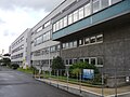 IGN building1.JPG 2,048 × 1,536; 1.52 MB
-
 IGN Stereopolis 1.JPG 1,536 × 2,048; 1,005 KB
-
 IGN Stereopolis 2.JPG 2,048 × 1,536; 1.48 MB
-
 IGN Stereopolis.JPG 4,000 × 3,000; 4.26 MB
-
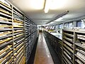
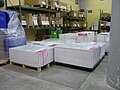 IGN unfolden maps.JPG 2,048 × 1,536; 1.25 MB
-
 KBA Press IGN 1.JPG 640 × 480; 75 KB
-
 KBA Press IGN outset.JPG 1,536 × 2,048; 1.19 MB
-
 KBA Press IGN outset2.JPG 2,048 × 1,536; 1.2 MB
-
 KBA Press IGN outset3.JPG 2,048 × 1,536; 989 KB
-
 KBA Press IGN.JPG 2,048 × 1,536; 1.46 MB
-
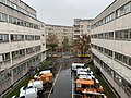
 Site Principal IGN - Saint-Mandé (FR94) - 2020-09-07 - 1.jpg 4,032 × 3,024; 4.22 MB
-
 Véhicules IGN St Mandé 1.jpg 4,032 × 3,024; 4.49 MB
-
 Véhicules IGN St Mandé 2.jpg 4,032 × 3,024; 3.97 MB
-
 Véhicules IGN St Mandé 3.jpg 4,032 × 3,024; 3.99 MB


_-_2021-10-29_-_1.jpg)
_-_2021-10-29_-_2.jpg)
_-_2021-10-29_-_3.jpg)

_-_Saint-Mande_-_Entree.JPG)
_-_Saint-Mande_-_Phototheque.jpg)


_-_2020-09-07_-_1.jpg)


