Category:Skaudvilė in maps
This category includes the images that spot Skaudvilė city in larger geographical area. For maps that specifically represent the city of Skaudvilė more in detail, see Category:Maps of Skaudvilė.
Media in category "Skaudvilė in maps"
The following 5 files are in this category, out of 5 total.
-
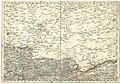 Reymanns Georgenburg.jpg 5,674 × 3,952; 5.21 MB
-
 R200 N34-03sw.jpg 2,244 × 1,517; 4.61 MB
-
 WIG Mapa Operacyjna Polski - 26 Szawle 1938.jpg 8,614 × 7,762; 13.19 MB
-
 USSR map NN 34-3 Siauliai.jpg 5,741 × 4,352; 8.15 MB
-
 LietuvaSkaudvile.png 721 × 556; 28 KB


