Category:Slaughterbridge
village in United Kingdom  | |||||
| Upload media | |||||
| Instance of | |||||
|---|---|---|---|---|---|
| Location | Camelford, Cornwall, South West England, England | ||||
| Elevation above sea level |
| ||||
 | |||||
English: Slaughterbridge, Treague and Camelford Station are three adjoining settlements in north Cornwall, United Kingdom. They straddle the boundary of Forrabury and Minster and Lanteglos by Camelford civil parishes just over a mile (2 km) north-west of the market town of Camelford
Media in category "Slaughterbridge"
The following 14 files are in this category, out of 14 total.
-
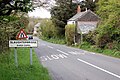 ApproachingSlaughterbridgeFromTheSouthCornwall.jpg 640 × 426; 130 KB
-
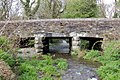 BridgeOverRiverCamelSlaughterbridgeCornwall.jpg 640 × 426; 165 KB
-
 Forrabury and Minster, Worthyvale Manor - geograph.org.uk - 88257.jpg 640 × 431; 146 KB
-
 Hilltop Farm Shop, Slaughterbridge - geograph.org.uk - 3556342.jpg 640 × 480; 71 KB
-
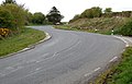 S-bend at Slaughterbridge - geograph.org.uk - 1285157.jpg 640 × 410; 93 KB
-
 Steep hill at Slaughterbridge - geograph.org.uk - 1285150.jpg 640 × 517; 101 KB
-
 Stone cider press st Slaughter Bridge.jpg 3,072 × 2,304; 3.07 MB
-
 TheOldMillAtSlaughterbridgeCornwall.jpg 640 × 426; 110 KB
-

-
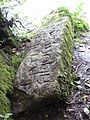 Worthyvale ogham stone closeup.jpg 2,304 × 3,072; 2.75 MB
-
 Worthyvale ogham stone.jpg 3,072 × 2,304; 3.24 MB
-
 Farmland at Higher Trefrew Farm - geograph.org.uk - 557865.jpg 640 × 480; 119 KB
-
 Farmyard at Higher Trefrew Farm - geograph.org.uk - 557856.jpg 640 × 480; 149 KB
-
 Higher Trefrew farmhouse - geograph.org.uk - 558212.jpg 640 × 480; 136 KB


