Category:Sneem
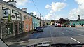
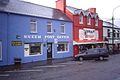
English: Sneem ( Irish: An tSnaidhm) is a town situated on the Iveragh Peninsula (part of the Ring of Kerry) in County Kerry in the southwest of Ireland. It lies on the estuary of the River Sneem. National route N70 runs through the town.
Gaeilge: Baile in Éirinn is ea an tSnaidhm. Tá an baile suite in iardheisceart na tíre i gContae Chiarraí.
village situated on the Iveragh Peninsula, in County Kerry, Ireland  | |||||
| Upload media | |||||
| Instance of | |||||
|---|---|---|---|---|---|
| Location | County Kerry, Munster, Ireland | ||||
 | |||||
Subcategories
This category has the following 2 subcategories, out of 2 total.
S
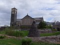
- St Michael's Church, Sneem (2 F)
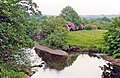
- Sneem River (30 F)
Media in category "Sneem"
The following 131 files are in this category, out of 131 total.
-
 "The Way the Fairies Went" - geograph.org.uk - 4936829.jpg 2,592 × 1,944; 1,011 KB
-
-
 At Parknasilla. Co. Kerry Ireland.jpg 1,074 × 832; 209 KB
-
 Bank House B^B on North Square, Sneem - geograph.org.uk - 4145505.jpg 1,474 × 1,600; 616 KB
-
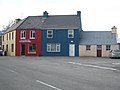
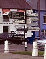
 Blue Bull, Sneem - geograph.org.uk - 889696.jpg 640 × 480; 398 KB
-
 Boats on Sneem estuary - geograph.org.uk - 6217694.jpg 1,024 × 687; 243 KB
-
 Breen's Café ^ Bistro - geograph.org.uk - 4145486.jpg 1,600 × 1,064; 624 KB
-
 Bus, Sneem - geograph.org.uk - 5048673.jpg 640 × 421; 76 KB
-
 Church on Bridge Street, Sneem - geograph.org.uk - 4143434.jpg 1,600 × 1,064; 651 KB
-
-

-
 Country north of Sneem - geograph.org.uk - 4940203.jpg 2,592 × 1,944; 1.09 MB
-
 D O' Shea Bar on North Square, Sneem - geograph.org.uk - 4145518.jpg 1,600 × 1,064; 573 KB
-
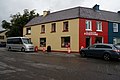 D.J. O' Sullivan Foodstore - geograph.org.uk - 4145567.jpg 1,600 × 1,064; 606 KB
-
 Dan Murphy's Bar, Sneem - geograph.org.uk - 5996352.jpg 1,024 × 681; 134 KB
-
 Entering Sneem, R568 - geograph.org.uk - 5996346.jpg 1,024 × 665; 160 KB
-
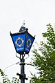 Garda Lamp at Sneem Garda Station - geograph.org.uk - 4143250.jpg 1,064 × 1,600; 305 KB
-
 Gardens at Sneem, Ring of Kerry - geograph.org.uk - 4144932.jpg 1,600 × 1,064; 762 KB
-
 Gift Shop on Bridge Street, Sneem - geograph.org.uk - 4145440.jpg 1,600 × 1,064; 517 KB
-
 Great Southern Hotel, Sneem, Co. Kerry (30504931093).jpg 2,000 × 1,535; 1.77 MB
-
 Hickey's Music - geograph.org.uk - 5996357.jpg 1,024 × 680; 141 KB
-
 Houses in Sneem - geograph.org.uk - 4145850.jpg 1,600 × 1,064; 470 KB
-
 Houses on West End, Sneem - geograph.org.uk - 4143404.jpg 1,600 × 1,064; 622 KB
-
 Kelly's Bakery on Bridge Street, Sneem - geograph.org.uk - 4143417.jpg 1,600 × 1,153; 539 KB
-
 Mace Foodstore, Sneem - geograph.org.uk - 4145758.jpg 1,600 × 1,064; 367 KB
-
 McCarthy's Motors off N70 - geograph.org.uk - 4310670.jpg 640 × 412; 43 KB
-
 N70 passing the Garda Station - geograph.org.uk - 5998832.jpg 1,024 × 1,018; 216 KB
-
 Narrow bridge in Sneem - geograph.org.uk - 5996359.jpg 1,024 × 637; 192 KB
-
 North Square Park, Sneem - geograph.org.uk - 5953471.jpg 2,000 × 1,500; 999 KB
-
 North Street off Bridge Street, Sneem - geograph.org.uk - 4145499.jpg 1,600 × 1,064; 454 KB
-
 O' Sullivan's on Bridge Street, Sneem - geograph.org.uk - 4145296.jpg 1,600 × 1,064; 434 KB
-
 O' Sullivan's on Bridge Street, Sneem - geograph.org.uk - 4145477.jpg 1,600 × 1,064; 495 KB
-
 O' Sullivan's Sacre Coeur Restaurant - geograph.org.uk - 4145587.jpg 1,600 × 1,064; 504 KB
-
 O'Sullivan's Sacre Coeur Restaurant, Sneem - geograph.org.uk - 5953395.jpg 2,000 × 1,325; 657 KB
-
 Old pier near Sneem - geograph.org.uk - 889723.jpg 480 × 640; 352 KB
-

-
 Pharmacy on Killarney Road, Sneem - geograph.org.uk - 4145907.jpg 1,600 × 1,064; 592 KB
-
 Pink and green - geograph.org.uk - 4187615.jpg 4,608 × 3,456; 3.05 MB
-
 Public convenience in Sneem - geograph.org.uk - 2724877.jpg 640 × 480; 66 KB
-
 Quills on the Ring of Kerry, Sneem - geograph.org.uk - 4145456.jpg 1,600 × 1,064; 524 KB
-
 R568 approaching Sneem - geograph.org.uk - 5996344.jpg 1,024 × 681; 220 KB
-
 Ring of Kerry - Sneem - Beehive huts - geograph.org.uk - 1605946.jpg 640 × 427; 111 KB
-

-

-

-
 Ring of Kerry - Sneem - geograph.org.uk - 1569954.jpg 640 × 426; 81 KB
-

-

-

-
 Ring of Kerry Sneem de Gaulle Denkmal Irland@20160602.jpg 2,150 × 2,673; 5.92 MB
-
 Road sign, Ring of Kerry - geograph.org.uk - 5998836.jpg 1,024 × 582; 103 KB
-
 Rough track off N70 south of Sneem - geograph.org.uk - 4310672.jpg 640 × 420; 60 KB
-
 Shops on the Ring of Kerry, Sneem - geograph.org.uk - 4145464.jpg 1,600 × 1,064; 551 KB
-
 Sneem - County Kerry - geograph.org.uk - 661573.jpg 640 × 427; 61 KB
-
 Sneem - County Kerry - geograph.org.uk - 661576.jpg 640 × 429; 66 KB
-
 Sneem - geograph.org.uk - 5996361.jpg 1,024 × 562; 142 KB
-
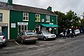
 Sneem - Riney's and Murphy's Bars - geograph.org.uk - 2003069.jpg 640 × 480; 64 KB
-
 Sneem -1880.jpeg 600 × 458; 70 KB
-
 Sneem 01.JPG 4,608 × 2,592; 3.66 MB
-
 Sneem 02.JPG 4,608 × 2,592; 3.04 MB
-
 Sneem 05.JPG 4,608 × 2,592; 4.59 MB
-
 Sneem 06.JPG 4,608 × 2,592; 3.3 MB
-
 Sneem Anglican Church - geograph.org.uk - 5223611.jpg 480 × 640; 59 KB
-
 Sneem Anglican Church - geograph.org.uk - 5953501.jpg 2,000 × 1,500; 941 KB
-
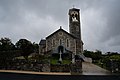
 Sneem Church - geograph.org.uk - 1942765.jpg 1,024 × 768; 152 KB
-
 Sneem Firestation - geograph.org.uk - 3473368.jpg 1,280 × 960; 278 KB
-
 Sneem in the background - geograph.org.uk - 1022351.jpg 640 × 480; 53 KB
-
 Sneem North Square 1987 08 15.jpg 3,163 × 2,109; 8.35 MB
-
 Sneem Post Office and Erin Knitwear, Co Kerry November 1991 - Flickr - sludgegulper.jpg 2,398 × 1,599; 243 KB
-
 Sneem quay - geograph.org.uk - 4486077.jpg 756 × 567; 141 KB
-
 Sneem Ring of Kerry - geograph.org.uk - 1361409.jpg 640 × 457; 276 KB
-
 Sneem Ring of Kerry - geograph.org.uk - 1361414.jpg 640 × 457; 340 KB
-
 Sneem Ring of Kerry - geograph.org.uk - 1361428.jpg 640 × 457; 326 KB
-
 Sneem River - geograph.org.uk - 5811830.jpg 640 × 427; 129 KB
-
 Sneem River estuary at Goldens Cove - geograph.org.uk - 4936834.jpg 2,592 × 1,944; 1.29 MB
-
 Sneem River, Kerry - geograph.org.uk - 889713.jpg 640 × 480; 320 KB
-
 Sneem River, Sneem - geograph.org.uk - 4466618.jpg 1,574 × 2,300; 3.81 MB
-
 Sneem River, Sneem on Ring of Kerry, 1993 - geograph.org.uk - 4467468.jpg 2,328 × 1,572; 3.58 MB
-
 Sneem River, Sneem, Ring of Kerry - geograph.org.uk - 4466625.jpg 2,276 × 1,488; 3.53 MB
-
 Sneem South Square 1987 08 15.jpg 3,172 × 2,115; 7.52 MB
-
 Sneem Tavern - geograph.org.uk - 5953494.jpg 2,000 × 1,475; 880 KB
-
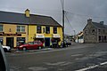
 Sneem village square, County Kerry - geograph.org.uk - 1737888.jpg 1,600 × 1,067; 176 KB
-
 Sneem, Beggar with his goat - geograph.org.uk - 5242076.jpg 3,456 × 2,304; 3.76 MB
-
 Sneem, Church - geograph.org.uk - 5242051.jpg 3,456 × 2,304; 2.73 MB
-
 Sneem, Church - geograph.org.uk - 5242062.jpg 3,456 × 2,304; 2.89 MB
-
 Sneem, Co. Kerry (5743899813).jpg 580 × 441; 67 KB
-
 Sneem, Co. Kerry 1993 - geograph.org.uk - 4466604.jpg 2,439 × 1,565; 3.55 MB
-
 Sneem, Co. Kerry.jpg 2,000 × 1,519; 1.26 MB
-
 Sneem, County Kerry, Ireland.jpg 18,176 × 3,302; 37.36 MB
-
 Sneem, Post Office and Sneem Tavern - geograph.org.uk - 5242043.jpg 3,456 × 2,304; 3.29 MB
-
 Sneem-02-Dan Murphy's Bar-2017-gje.jpg 5,184 × 3,456; 3.86 MB
-
 Sneem-04-Dan Murphy's Bar-2017-gje.jpg 5,012 × 2,781; 2.35 MB
-
 Sneem-06-Tavern-2017-gje.jpg 4,697 × 2,845; 2.55 MB
-
 Sneem-08-Tavern-2017-gje.jpg 5,184 × 3,456; 2.79 MB
-
 Sneem-09-Regenbogen-2017-gje.jpg 5,184 × 3,456; 3 MB
-
 Sneem-10-Kirche-2017-gje.jpg 5,184 × 3,456; 4.06 MB
-
 Sneem-12-Toilette-2017-gje.jpg 3,383 × 4,775; 2.51 MB
-
 Sneem-14-Haeuser-2017-gje.jpg 5,184 × 3,013; 2.6 MB
-
 Sneem-16-de Gaulle-Gedenkstein-2017-gje.jpg 3,923 × 3,009; 2.86 MB
-
 Sneem-18-John Egan-2017-gje.jpg 4,480 × 3,014; 3.09 MB
-
 Sneem-20-John Egan-Gedenktafel-2017-gje.jpg 5,184 × 3,456; 3.07 MB
-
 Sneem-22-Steve Crusher Casey-2017-gje.jpg 3,456 × 4,600; 3.49 MB
-
 Sneem-24-Steve Crusher Casey-Gedenktafel-2017-gje.jpg 4,619 × 2,082; 2.21 MB
-
 Sneem-26-Fahrrad mit Torf-2017-gje.jpg 4,919 × 2,870; 4.27 MB
-
 Sneem-30-Laeden-1989-gje.jpg 2,717 × 1,732; 1.82 MB
-
 Sneem-32-Wegweiser-1989-gje.jpg 1,803 × 2,312; 1.85 MB
-
 Sneem-34-Pferdewagen-1989-gje.jpg 2,597 × 1,594; 1.75 MB
-
 Sneem.jpg 2,990 × 2,242; 1.97 MB
-
 South Square, Sneem - geograph.org.uk - 2003077.jpg 640 × 480; 52 KB
-
 St Michael's Church - geograph.org.uk - 4145745.jpg 1,600 × 1,064; 442 KB
-
 Statue of Steve (Crusher) Cassey, Sneem - geograph.org.uk - 4145876.jpg 1,600 × 1,064; 832 KB
-
 Steve crusher Casey - geograph.org.uk - 1022312.jpg 640 × 480; 88 KB
-
 Stone House Restaurant and B^B - geograph.org.uk - 4145552.jpg 1,600 × 1,064; 498 KB
-
 The Church of the Transfiguration, Sneem - geograph.org.uk - 5817240.jpg 1,024 × 768; 132 KB
-
 The Garda Station, Sneem - geograph.org.uk - 4143234.jpg 1,600 × 1,004; 620 KB
-
 The Garda Station, Sneem - geograph.org.uk - 4143241.jpg 1,600 × 1,064; 564 KB
-
 The Grape Vine B^B - geograph.org.uk - 4145698.jpg 1,600 × 1,064; 579 KB
-
 The original boathouse in Sneem - geograph.org.uk - 1022361.jpg 640 × 480; 60 KB
-
 The Post Office, Sneem - geograph.org.uk - 5953490.jpg 2,000 × 1,350; 644 KB
-
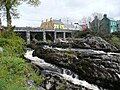 The river bridge, Sneem - geograph.org.uk - 5953484.jpg 2,000 × 1,500; 1.05 MB
-
 The river bridge, Sneem, from upstream - geograph.org.uk - 5953506.jpg 2,000 × 1,500; 1.16 MB
-
 The River Sneem - geograph.org.uk - 4145289.jpg 1,600 × 1,064; 639 KB
-
 The River Sneem - geograph.org.uk - 4145290.jpg 1,600 × 1,009; 618 KB
-
 The Sneem Pyramids and the River Sneem - geograph.org.uk - 4936823.jpg 2,592 × 1,944; 1.8 MB
-
 The Way the Fairies Went - geograph.org.uk - 3309679.jpg 1,400 × 2,088; 878 KB
-
 The Way the Fairies Went - geograph.org.uk - 3309688.jpg 2,074 × 1,415; 1.07 MB
-
 The Way the Fairies Went - geograph.org.uk - 3309694.jpg 2,074 × 1,408; 1.07 MB
-
 The Wrestlers Inn on Bridge Street, Sneem - geograph.org.uk - 4145490.jpg 1,600 × 1,439; 822 KB
-
 View from the bridge - geograph.org.uk - 4187622.jpg 4,608 × 3,456; 4.32 MB
-
 Sneem, Co Kerry, Ireland - geograph.org.uk - 241573.jpg 602 × 400; 55 KB
-
 Village of Sneem, Co. Kerry - geograph.org.uk - 250379.jpg 640 × 480; 55 KB


.jpg)


.jpg)


_Cassey,_Sneem_-_geograph.org.uk_-_4145876.jpg)


