Category:Snow in Greater Manchester
Ceremonial counties of England: Bedfordshire · Berkshire · Buckinghamshire · Cambridgeshire · Cheshire · Cornwall · Cumbria · Derbyshire · Devon · Dorset · Durham · East Riding of Yorkshire · East Sussex · Essex · Gloucestershire · Greater London · Greater Manchester · Hampshire · Herefordshire · Hertfordshire · Isle of Wight · Kent · Lancashire · Leicestershire · Lincolnshire · Merseyside · Norfolk · North Yorkshire · Northamptonshire · Northumberland · Nottinghamshire · Oxfordshire · Rutland · Shropshire · Somerset · South Yorkshire · Staffordshire · Suffolk · Surrey · Tyne and Wear · Warwickshire · West Midlands · West Sussex · West Yorkshire · Wiltshire · Worcestershire
City-counties: Bristol · City of London
Former historic counties:
Other former counties:
City-counties: Bristol · City of London
Former historic counties:
Other former counties:
Subcategories
This category has the following 3 subcategories, out of 3 total.
S
U
Media in category "Snow in Greater Manchester"
The following 200 files are in this category, out of 201 total.
(previous page) (next page)-
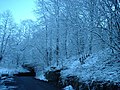
 "View from a bridge in Bolton" (8242351090).jpg 4,640 × 3,104; 2.62 MB
-
 "View from a bridge in Bolton" (8242351708).jpg 3,104 × 4,640; 3.76 MB
-
 "View from a bridge in Bolton" (8242353312).jpg 4,640 × 3,104; 2.66 MB
-
 "View from a bridge" (8241283099).jpg 4,640 × 3,104; 4.09 MB
-
 "View from a bridge" (8241284109).jpg 3,104 × 4,640; 2.62 MB
-
 "View from a bridge" (8242352104).jpg 3,104 × 4,640; 1.67 MB
-
 142052 Castleton East Junction.jpg 1,024 × 768; 423 KB
-
 144014 Castleton East Junction.jpg 1,024 × 826; 654 KB
-
 144015 Castleton East Junction (1).jpg 1,024 × 768; 748 KB
-
 144017 Castleton East Junction.jpg 1,024 × 768; 495 KB
-
 144020 Castleton East Junction.jpg 1,024 × 768; 538 KB
-
 150145 Castleton East Junction (1).jpg 1,024 × 768; 577 KB
-
 150145 Castleton East Junction.jpg 1,024 × 768; 477 KB
-
 153351 and 153358 Castleton East Junction.jpg 1,024 × 768; 518 KB
-
 153358 Castleton East Junction.jpg 1,024 × 768; 448 KB
-
 155344 and 142046 Castleton East Junction.jpg 1,024 × 768; 483 KB
-
 158791 and 142048 Castleton East Junction (1).jpg 1,024 × 768; 575 KB
-
 158861 Castleton East Junction (1).jpg 1,024 × 768; 616 KB
-
 158861 Castleton East Junction.jpg 1,024 × 768; 573 KB
-
 37249 and 37119 pass Deal Street signal box.jpg 1,024 × 768; 331 KB
-
 45146 passes the former Manchester Exchange station.jpg 1,024 × 768; 301 KB
-
 47040 at Manchester Victoria.jpg 1,024 × 768; 264 KB
-
 47528 at Manchester Victoria.jpg 1,024 × 768; 328 KB
-
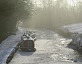 A frozen Peak Forest Canal - geograph.org.uk - 1634760.jpg 640 × 495; 88 KB
-
 A snowy Fourum Centre, Wythenshawe - Tuesday 5th January 2010 - panoramio.jpg 2,048 × 1,536; 1.09 MB
-
 A snowy lane. - geograph.org.uk - 1632005.jpg 640 × 428; 81 KB
-
 A snowy Poundswick Lane, Wythenshawe - panoramio.jpg 2,048 × 1,536; 1.21 MB
-
 A snowy surprise - geograph.org.uk - 1732344.jpg 640 × 444; 91 KB
-
 A step back to the fifties - geograph.org.uk - 1637163.jpg 640 × 480; 82 KB
-
 A tree and a mill - geograph.org.uk - 1624429.jpg 425 × 640; 87 KB
-
 A tree and a street light - geograph.org.uk - 1651102.jpg 480 × 640; 93 KB
-
 Aa snow 2010 01 05 00.jpg 1,600 × 1,200; 438 KB
-
 Abraham Lincoln statue in the snow, 2010.jpg 2,592 × 3,888; 2.48 MB
-
 Acker - geograph.org.uk - 1127451.jpg 640 × 437; 175 KB
-
 After the blizzard January 1978 - geograph.org.uk - 678276.jpg 640 × 480; 53 KB
-
 After the snow - geograph.org.uk - 1746337.jpg 1,600 × 1,200; 609 KB
-
 Alexandra Park, Oldham, Dec '08.jpg 1,600 × 1,200; 432 KB
-
 Apple Street - geograph.org.uk - 4327501.jpg 4,048 × 3,040; 3.58 MB
-
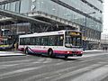
 Arriva bus (3).jpg 4,000 × 3,000; 3.81 MB
-
 "Veiw from a bridge" (8242354124).jpg 4,260 × 2,847; 2.05 MB
-
 Bonsall Street, Hulme.jpg 1,536 × 2,048; 1.1 MB
-
 Booth Hollins Farm, Clegg Moor - geograph.org.uk - 96525.jpg 640 × 480; 119 KB
-
 Bu-Val Buses K149 LGO 2.jpg 2,400 × 1,800; 1.27 MB
-
 Bu-Val Buses W17 BLU and Littleborough Hollingworth Lake 2.jpg 2,400 × 1,800; 1.12 MB
-
 Bu-Val Buses W17 BLU and Littleborough Hollingworth Lake.jpg 2,400 × 1,800; 1.13 MB
-
 Bu-Val Buses W17 BLU rear.jpg 2,400 × 1,800; 1.33 MB
-
 Bu-Val Buses W17 BLU.jpg 2,400 × 1,800; 1.05 MB
-
 Bus in Princess Street, Manchester.jpg 3,072 × 2,304; 1.82 MB
-
 Bus Station, Piccadilly Gardens - geograph.org.uk - 1666638.jpg 640 × 430; 119 KB
-
 Canal Junction.jpg 1,600 × 1,200; 592 KB
-
 Canal lock - geograph.org.uk - 190846.jpg 640 × 425; 99 KB
-
 Cemetery above Tame Valley. - geograph.org.uk - 507746.jpg 640 × 394; 92 KB
-
 Christmas Day at the canal - geograph.org.uk - 1637569.jpg 640 × 538; 98 KB
-
 Compstall Road, Romiley 1906.jpg 660 × 481; 121 KB
-
 Cottages on Hardy Mill Road - geograph.org.uk - 2791577.jpg 3,920 × 2,361; 2.92 MB
-
-
 Delph Road Denshaw January 1978 - geograph.org.uk - 678265.jpg 640 × 480; 52 KB
-
 Departing a snowy Manchester (8448104199).jpg 3,888 × 2,592; 3.98 MB
-
 Departing a snowy Manchester (8449180316).jpg 3,888 × 2,592; 3.74 MB
-
 Dowry Reservoir.jpg 626 × 640; 99 KB
-

-
 Etherow Country Park - geograph.org.uk - 4327690.jpg 2,736 × 3,648; 4.2 MB
-
 Ethihad Campus station (snow).jpg 640 × 480; 137 KB
-
 First bus (14).jpg 4,000 × 3,000; 5 MB
-
 First Manchester bus (60240 W338 JND), 2 February 2009.jpg 1,024 × 768; 493 KB
-
 First Manchester bus 12004 (YN05 GYJ), 2 February 2009.jpg 1,024 × 768; 444 KB
-
 First Manchester bus 34082 (P532 EFL), 2 February 2009.jpg 1,024 × 768; 661 KB
-
 First Manchester bus 37380, 5 January 2010.jpg 1,600 × 1,200; 605 KB
-
 First Manchester bus 37402 (MX58 DXO), 4 February 2012.jpg 1,280 × 960; 808 KB
-
 First Manchester bus 37424 (MX58 DYU), 3 December 2008.jpg 1,600 × 1,200; 613 KB
-
 First Manchester bus 60361 (R571 YNC), 4 February 2012 (1).jpg 1,280 × 960; 878 KB
-
 First Manchester bus 60361 (R571 YNC), 4 February 2012 (2).jpg 1,280 × 960; 750 KB
-
 First Manchester bus 60371 (R581 SBA), 4 February 2012.jpg 1,280 × 960; 783 KB
-
 First Manchester bus 60380 (R625 CVR), 4 February 2012.jpg 1,280 × 960; 803 KB
-
 First Manchester bus 62214 (S673 SVU), 4 February 2012.jpg 1,280 × 960; 778 KB
-
 Frozen canal on Christmas Day - geograph.org.uk - 1634773.jpg 640 × 502; 97 KB
-
 Gateposts in the snow - geograph.org.uk - 4328336.jpg 4,000 × 3,000; 6.43 MB
-
 Glenboro Avenue - geograph.org.uk - 2224157.jpg 640 × 430; 126 KB
-
 Grains Road lookin over Delph (oldham).JPG 1,600 × 1,200; 393 KB
-
 Grains Road lookin towards Denshaw (oldham).JPG 1,600 × 1,200; 397 KB
-
 Great Western Street, Moss Side, Manchester in the snow - panoramio.jpg 1,698 × 2,551; 914 KB
-
 Grooves in the Snow and Ice - geograph.org.uk - 1632455.jpg 640 × 624; 142 KB
-
 Hattersley railway station (geograph 3383959).jpg 1,024 × 732; 169 KB
-
 Hawthorn Lane - geograph.org.uk - 266947.jpg 2,048 × 1,536; 1.38 MB
-
 Heaton Cricket Ground, Lower Pools - geograph.org.uk - 4409603.jpg 640 × 440; 225 KB
-
 Heaton Park Tramway lineup.jpg 4,000 × 3,000; 5.9 MB
-
 Hill above Cox Green Lane - geograph.org.uk - 3013566.jpg 3,008 × 2,000; 961 KB
-
 Hinds Lane - geograph.org.uk - 1671174.jpg 1,024 × 768; 169 KB
-
 Hinds Lane - geograph.org.uk - 1671182.jpg 1,024 × 768; 180 KB
-
 Hinds Lane - geograph.org.uk - 2206285.jpg 800 × 600; 337 KB
-
 Hinds Lane - geograph.org.uk - 2206337.jpg 800 × 600; 376 KB
-
 Hinds lane - geograph.org.uk - 2206342.jpg 800 × 600; 347 KB
-
 Holcombe Hey Fold farm - geograph.org.uk - 136352.jpg 640 × 480; 122 KB
-
 Horses on Mottram Old Road - geograph.org.uk - 1151851.jpg 640 × 487; 137 KB
-
 Huddersfield Narrow Canal - geograph.org.uk - 1160216.jpg 640 × 480; 105 KB
-
 Huddersfield Narrow Canal - geograph.org.uk - 1160220.jpg 640 × 480; 68 KB
-
 In the pound - geograph.org.uk - 1100722.jpg 640 × 426; 47 KB
-
 JPT bus 511 (P821 SGP), 4 February 2012.jpg 1,280 × 960; 704 KB
-
 Kay Gardens in snow - geograph.org.uk - 2222910.jpg 640 × 430; 148 KB
-
 Kingscroft Court, Wigan - geograph.org.uk - 1100878.jpg 640 × 426; 50 KB
-
 Little Lever, Wilby Avenue - geograph.org.uk - 3307039.jpg 640 × 480; 467 KB
-
 Lone Tree - geograph.org.uk - 4867012.jpg 3,648 × 2,736; 4.61 MB
-
 Longsight Methodist Church - geograph.org.uk - 2791611.jpg 3,984 × 2,978; 3.97 MB
-
 Lonsdale St - geograph.org.uk - 2223849.jpg 640 × 430; 152 KB
-
 Looking down "The Hill" in Harwood - geograph.org.uk - 3304004.jpg 1,024 × 682; 552 KB
-
 Looking out at the snow - geograph.org.uk - 1629826.jpg 640 × 480; 55 KB
-
 Lower Pools - geograph.org.uk - 2210287.jpg 800 × 600; 335 KB
-
 Lower Pools - geograph.org.uk - 2454372.jpg 1,280 × 845; 1.53 MB
-
 Magic Bus leaving the depot.jpg 3,072 × 2,304; 1.86 MB
-
 Mail deliveries on Brookfold Lane - geograph.org.uk - 3304047.jpg 1,024 × 682; 682 KB
-
 Manchester bus 192.jpg 1,025 × 661; 284 KB
-
 Media city metrolink station.jpg 2,048 × 1,536; 685 KB
-
 Merseybank snow.jpg 600 × 800; 114 KB
-
 Metrolink Tramway, Radcliffe Station.jpg 800 × 600; 308 KB
-

-
 Mosley Street Metrolink Stop - geograph.org.uk - 1666634.jpg 640 × 430; 145 KB
-
 Mossley snow08.jpg 1,536 × 1,024; 442 KB
-
 Moston station, looking north 1983 - geograph.org.uk - 819881.jpg 640 × 427; 59 KB
-
 Moston station, looking north in 1979 - geograph.org.uk - 811868.jpg 640 × 427; 56 KB
-
 New Year's Day 1997 - geograph.org.uk - 190843.jpg 640 × 468; 121 KB
-
 Northern Rail 142 056 and Bolton Arch.jpg 1,600 × 1,200; 261 KB
-
 Oh So Peaceful - geograph.org.uk - 182336.jpg 640 × 480; 77 KB
-
 Old Hall Farm - geograph.org.uk - 1659595.jpg 640 × 422; 68 KB
-
 Old railway line, Atherton-Hindsford - geograph.org.uk - 89080.jpg 640 × 480; 177 KB
-
 Old railway line, Atherton-Hindsford - geograph.org.uk - 89081.jpg 640 × 480; 179 KB
-
 One Fine Day - geograph.org.uk - 174163.jpg 640 × 480; 166 KB
-
 Panoramic view of Hulme.jpg 3,155 × 758; 480 KB
-
 Paper Mill site - geograph.org.uk - 3313370.jpg 640 × 480; 416 KB
-
 Path at Scotson Fold - geograph.org.uk - 2203289.jpg 600 × 800; 375 KB
-
 Path To Hollybank Street - geograph.org.uk - 2203598.jpg 800 × 600; 388 KB
-
 Path Towards Radcliffe North Junction - geograph.org.uk - 2796686.jpg 480 × 640; 627 KB
-
 Paths through the snow - geograph.org.uk - 4855143.jpg 1,000 × 750; 615 KB
-
 Playing fields in snow - geograph.org.uk - 3747317.jpg 5,808 × 3,873; 6.16 MB
-
 Queens Park Lake - geograph.org.uk - 769773.jpg 640 × 480; 119 KB
-
 Radcliffe Cemetery - geograph.org.uk - 2793732.jpg 640 × 480; 436 KB
-
 Ramsey Grove in the snow - geograph.org.uk - 2224142.jpg 640 × 451; 81 KB
-
 RecycleDavidL.jpg 1,024 × 768; 402 KB
-
 River Irwell, Lower Hinds - geograph.org.uk - 1671149.jpg 1,024 × 768; 236 KB
-
 River Irwell, Mount Sion - geograph.org.uk - 2203548.jpg 800 × 600; 498 KB
-
 River Irwell, Warth Fold - geograph.org.uk - 1671156.jpg 1,024 × 768; 324 KB
-
 River Irwell, Warth Mills - geograph.org.uk - 1671162.jpg 1,024 × 768; 165 KB
-
 River Irwell, Weir at Warth Mills - geograph.org.uk - 1671033.jpg 1,024 × 768; 168 KB
-
 Roman Lakes in the snow - geograph.org.uk - 2221803.jpg 2,560 × 1,920; 2.3 MB
-
 Rooden Reservoir 1.jpg 3,264 × 2,176; 1.3 MB
-
 Scotson Fold - geograph.org.uk - 2203317.jpg 800 × 600; 293 KB
-
 Scout Moor in Winter - geograph.org.uk - 1081405.jpg 640 × 480; 58 KB
-
 Sheaf Field Walk - geograph.org.uk - 2203116.jpg 600 × 800; 394 KB
-
 Sheaf Field Walk - geograph.org.uk - 2203123.jpg 600 × 800; 430 KB
-
 Snow by the Ashton Canal - geograph.org.uk - 4854204.jpg 3,264 × 2,448; 2.04 MB
-
 Snow covered fairway - geograph.org.uk - 3295492.jpg 1,024 × 654; 351 KB
-
 Snow in Millenium Park, Moss Side, Manchester - panoramio.jpg 1,707 × 2,560; 606 KB
-
 Snow on the roads - geograph.org.uk - 1629845.jpg 640 × 480; 55 KB
-
 Snow on Werneth Avenue - geograph.org.uk - 4303369.jpg 1,000 × 1,000; 685 KB
-
 Snow on Werneth Avenue - geograph.org.uk - 4326359.jpg 1,000 × 857; 895 KB
-
 Snow road - geograph.org.uk - 2202538.jpg 640 × 480; 132 KB
-
 Snowstorm in Ramsbottom - geograph.org.uk - 5699346.jpg 6,000 × 4,000; 6.41 MB
-
 Snowy Cameron St - geograph.org.uk - 2223661.jpg 640 × 430; 131 KB
-
 Snowy Lane - geograph.org.uk - 3309358.jpg 1,024 × 682; 499 KB
-
 Snowy road - geograph.org.uk - 3295493.jpg 1,024 × 682; 672 KB
-
 Snowy scene in Harwood - geograph.org.uk - 4328312.jpg 2,668 × 1,998; 3.36 MB
-
 Stalybridge , Buttermere Terrace - geograph.org.uk - 2236248.jpg 3,008 × 2,000; 1.52 MB
-
 Stalybridge , Ennerdale Terrace - geograph.org.uk - 2236247.jpg 3,008 × 2,000; 1.66 MB
-
 Stalybridge , Ennerdale Terrace - geograph.org.uk - 2236250.jpg 2,000 × 3,008; 880 KB
-
 Stott Lane - geograph.org.uk - 2189400.jpg 800 × 600; 308 KB
-
 Stotts Tours bus.jpg 4,000 × 3,000; 5.01 MB
-
 Struggling through the snow - geograph.org.uk - 5835011.jpg 1,280 × 960; 1.3 MB
-

-
 Tea stop - geograph.org.uk - 2202534.jpg 640 × 480; 107 KB
-
 The Aiggin Stone - geograph.org.uk - 469.jpg 640 × 427; 64 KB
-
 The line to Reddish - geograph.org.uk - 2203112.jpg 640 × 457; 100 KB
-
 The Orwell - geograph.org.uk - 1633513.jpg 640 × 426; 91 KB
-
 The Pennine Way at Standedge - geograph.org.uk - 323911.jpg 480 × 640; 97 KB
-
 The remains of Broadley Station (geograph 1698061).jpg 640 × 480; 83 KB
-
 The Road to Tesco - geograph.org.uk - 2232075.jpg 608 × 640; 66 KB
-
 The Trafford Center, Manchester (8449188330).jpg 3,888 × 2,592; 4.32 MB
-
 Tobogganing - geograph.org.uk - 2793698.jpg 640 × 480; 484 KB
-

-
 Track to Bolton Road - geograph.org.uk - 2203196.jpg 800 × 600; 331 KB
-
 Tree Behind Gorsefield School - geograph.org.uk - 2793684.jpg 640 × 480; 531 KB
-
 Trees in their winter garb - geograph.org.uk - 4328348.jpg 4,000 × 3,000; 7.59 MB
-
 Turbine No 2 on Scout Moor - geograph.org.uk - 1074815.jpg 480 × 640; 76 KB
-
 Turbine No 21 on Scout Moor - geograph.org.uk - 1080356.jpg 640 × 480; 39 KB
-
 Unusual log - geograph.org.uk - 752258.jpg 640 × 480; 92 KB
-
 Victorian Terrace, Bank St - geograph.org.uk - 2223210.jpg 640 × 430; 164 KB
-
 WCBS frost.jpg 1,024 × 768; 439 KB
-
 Weaste cemetery - geograph.org.uk - 1746328.jpg 1,024 × 768; 214 KB
-
 Welcome, Beast from the East - geograph.org.uk - 5699004.jpg 640 × 480; 533 KB
-
 Wellhead Close, Hulme - Saturday 2nd January 2010 - panoramio.jpg 3,072 × 2,304; 1.71 MB
-
 White Christmas - geograph.org.uk - 1632443.jpg 640 × 480; 114 KB
-
 White Christmas - geograph.org.uk - 4303669.jpg 1,000 × 773; 933 KB
-
 Winter Hill from Holcombe Hill - geograph.org.uk - 752229.jpg 640 × 480; 93 KB
-
 Winter on Brook's Drive, Davenport Green - geograph.org.uk - 1863630.jpg 3,889 × 2,187; 3.13 MB
-
 Wintry Southern Cemetery in Manchester 4259861363.jpg 2,387 × 1,501; 1.82 MB
-
 Wintry Southern Cemetery in Manchester 4259875557.jpg 2,650 × 1,793; 1.87 MB
-
 Wintry Southern Cemetery in Manchester 4259882687.jpg 2,639 × 1,164; 1.25 MB
-
 Wintry trees above Holcombe Brook - geograph.org.uk - 2792301.jpg 3,872 × 2,592; 2.25 MB
-
 Withins Lane bridge - geograph.org.uk - 2206161.jpg 800 × 600; 298 KB
-
 Woodland Path - geograph.org.uk - 2203553.jpg 800 × 600; 420 KB
-
 Woodlands Road Station - geograph.org.uk - 2221670.jpg 640 × 430; 119 KB
-
 Delph Primary School 1962 - geograph.org.uk - 400925.jpg 640 × 386; 34 KB
.jpg)
.jpg)
.jpg)
.jpg)
.jpg)
.jpg)


.jpg)


.jpg)


.jpg)
.jpg)


.jpg)
.jpg)


.jpg)
.jpg)


.jpg)
.jpg)
,_2_February_2009.jpg)
,_2_February_2009.jpg)
,_2_February_2009.jpg)

,_4_February_2012.jpg)
,_3_December_2008.jpg)
,_4_February_2012_(1).jpg)
,_4_February_2012_(2).jpg)
,_4_February_2012.jpg)
,_4_February_2012.jpg)
,_4_February_2012.jpg)


.JPG)
.JPG)


.jpg)


,_4_February_2012.jpg)


,_near_Littleborough_-_geograph.org.uk_-_96532.jpg)


.jpg)

.jpg)


