Category:Snow in Pakistan in July
Media in category "Snow in Pakistan in July"
The following 56 files are in this category, out of 56 total.
-
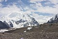 Baltoro Kangri.jpg 4,272 × 2,848; 4.01 MB
-
 Borith Lake, Gilgit–Baltistan, Pakistan.jpg 6,000 × 4,000; 7.49 MB
-
 Chogo Lisa Peak view.jpg 1,024 × 768; 154 KB
-
 Chogolisa (3to4).jpg 908 × 682; 202 KB
-
 Chogolisa from K2.JPG 435 × 302; 45 KB
-
 Chogolisa.jpg 1,229 × 744; 308 KB
-
 Deosai (hunzographer).jpg 4,326 × 3,079; 1.03 MB
-
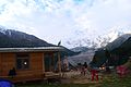 Fairmeadows.jpg 2,048 × 1,368; 253 KB
-
 Fairy meadows view.jpg 4,128 × 2,322; 2.96 MB
-
 Fairy Meadows, the beautiful meadows under the shadow of Nanga Parbat.jpg 5,196 × 3,464; 14.86 MB
-
 Flying flag in front of Nanga Parbat.jpg 2,304 × 1,536; 635 KB
-
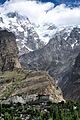
 Ganish,Karimabad, Hunza, GB, Pak.jpg 2,560 × 1,920; 2.67 MB
-
 Gilgit Baltistan1.jpg 2,048 × 1,152; 1.21 MB
-
 Glaciers in Pasu, Hunza.jpg 3,648 × 2,102; 1.78 MB
-
 Glaciers in Pasu.jpg 3,648 × 2,344; 1.52 MB
-
 Gulmit Tower and Ultar Sar from Borith track.jpg 4,128 × 3,096; 2.17 MB
-
 Hunza From Hooper.jpg 5,184 × 3,456; 8.24 MB
-
 Hunza River and Hussaini village (center of image) - view from Karakoram Highway.jpg 2,048 × 1,152; 1.08 MB
-
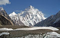 K2 8611.jpg 1,194 × 768; 477 KB
-
 Karakoram highway leads rakaposhi.jpg 3,456 × 2,304; 3.52 MB
-
 KHUDABAD HUNZA.jpg 1,135 × 920; 245 KB
-
 Khurdopin glacier.jpg 1,024 × 768; 180 KB
-
 KKH6.jpg 750 × 601; 88 KB
-
 Laila Peak.jpg 824 × 1,280; 758 KB
-
-
 Nanga Parbat - Rupal Valley Face.jpg 5,312 × 2,340; 2.16 MB
-
 Nanga Parbat - The Killer Mountain .jpg 2,304 × 1,536; 668 KB
-
 Nanga Parbat -- The Killer Mountain.jpg 1,813 × 2,339; 2.24 MB
-
 Nanga Parbat and Karakaram Highway.jpg 6,000 × 4,000; 8.7 MB
-
 Nanga Parbat Diamer face viewed from a tiny desert near KKH.jpg 2,048 × 1,152; 1.84 MB
-
 Nanga Parbat Diamir face.jpg 600 × 450; 73 KB
-
 Nanga Parbat north side.jpg 1,620 × 1,080; 982 KB
-
 Nanga Parbat,Fairy Meadows.jpg 5,890 × 3,927; 8.18 MB
-
 NangaParbat FL.jpg 4,928 × 3,264; 1.29 MB
-
 On my way to Pak-China Border, Khunjrab Pass.jpg 960 × 720; 96 KB
-
 Passu - Hussaini Suspension Bridge.jpg 876 × 594; 193 KB
-
 Photo bomb meh.jpg 5,456 × 3,632; 11.37 MB
-
 Rakhiot Glacier - panoramio (2).jpg 2,816 × 2,120; 1.51 MB
-
 Shadows of Nanga Parbat.jpg 5,196 × 3,464; 12.9 MB
-
 Sheosar Lake with reflection of majestic Nanga Parbat.jpg 5,468 × 3,251; 1.85 MB
-
 Shispare (7611m) (25750586712).jpg 1,500 × 2,250; 2.52 MB
-
 Shispare Ther, Hunza, Gilgit-Baltistan, Pakistan (35220033173).jpg 2,250 × 1,500; 2.79 MB
-
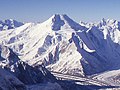
 Shispare, Karakoram Ultra peak.jpg 1,920 × 1,040; 1.26 MB
-
 Tarishing, Nanga Parbat, Morning Glow.jpg 3,640 × 2,560; 5.98 MB
-
 The magnificent Chogolisa karakoram of pakistan Elevation 7665 m.jpg 6,016 × 7,408; 19.31 MB
-
 Ultar peak Karimabad Hunza.jpg 5,184 × 2,912; 2.19 MB
-
 Ultar Sar clouds.jpg 3,648 × 2,048; 1.91 MB
-
 Ultar Sar cloudy.jpg 3,441 × 2,458; 2.41 MB
-
 Ultar Sar FL.jpg 4,928 × 3,264; 1.09 MB
-
 View from K2 of Godwin Austin Glacier.jpg 1,776 × 924; 257 KB
-
 View from the Ultar Glacier trek -Hunza.JPG 4,272 × 2,848; 6.19 MB
-
 View of Baltit Fort & Ultar Peak.jpg 3,072 × 4,608; 7.51 MB
-
 Way to anso lake-01.jpg 5,312 × 2,988; 4.04 MB
-
 Way to ansoo lake 2-01.jpg 5,312 × 2,988; 6.46 MB
-
 Way to ansoo lake-01-01.jpg 5,312 × 2,988; 6.9 MB
-
 Way to Pak-China Border, Khunjrab Pass.jpg 960 × 720; 80 KB


.jpg)


.jpg)


_-_view_from_Karakoram_Highway.jpg)


.jpg)


_(25750586712).jpg)
.jpg)


