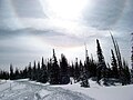
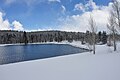
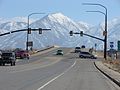
Category:Snow in Utah
States of the United States: Alabama · Alaska · Arizona · Arkansas · California · Colorado · Connecticut · Delaware · Florida · Georgia · Hawaii · Idaho · Illinois · Indiana · Iowa · Kansas · Kentucky · Louisiana · Maine · Maryland · Massachusetts · Michigan · Minnesota · Mississippi · Missouri · Montana · Nebraska · Nevada · New Hampshire · New Jersey · New Mexico · New York · North Carolina · North Dakota · Ohio · Oklahoma · Oregon · Pennsylvania · Rhode Island · South Carolina · South Dakota · Tennessee · Texas · Utah · Vermont · Virginia · Washington · West Virginia · Wisconsin · Wyoming – Washington, D.C.
Subcategories
This category has the following 6 subcategories, out of 6 total.
A
- Snow in Arches National Park (19 F)
S
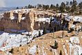
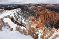
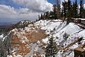
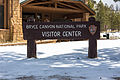
- Snow in Bryce Canyon (33 F)
- Snowy landscapes in Utah (88 F)
- Snowy roads in Utah (25 F)
Media in category "Snow in Utah"
The following 200 files are in this category, out of 424 total.
(previous page) (next page)-
 0312 December 2003 snowstorm.jpg 2,288 × 1,712; 773 KB
-
 1-4 ft. per 100 years Erosion Rate Tree - panoramio.jpg 1,152 × 649; 721 KB
-
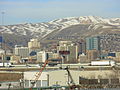 2006 Salt Lake City, Utah mountains.jpg 2,816 × 2,112; 1.19 MB
-
 2007 01 11 lav-slc 132 (354821523).jpg 3,504 × 2,336; 2.58 MB
-

-
-

-

-
 2015.11.10 11.00.49 DSC01773 - Flickr - andrey zharkikh.jpg 4,896 × 3,672; 3.23 MB
-
 2015.12.14 10.34.44 DSC02587 - Flickr - andrey zharkikh.jpg 4,896 × 3,672; 2.44 MB
-
 2017.04.09 08.12.35 DSC06995 - Flickr - andrey zharkikh.jpg 4,896 × 3,672; 2.12 MB
-
 2017.05.17 07.06.35 DSC07047 - Flickr - andrey zharkikh.jpg 3,672 × 4,896; 2.78 MB
-
 80 MPH Speed Limit in Utah.jpg 720 × 540; 49 KB
-
 A Peek Into The Park From The Path - panoramio.jpg 2,448 × 3,264; 3.02 MB
-
 A slushy stream runs through Arches National Park (8420543101).jpg 7,360 × 4,912; 12.98 MB
-

-

-

-
 Abraham Owen Smoot 2-20-06.jpg 588 × 427; 68 KB
-
 After the Snow Landscape, Circleville, UT.jpg 1,600 × 828; 404 KB
-
 After the Storm (8377501505).jpg 5,760 × 2,757; 3.23 MB
-

-
 Aircraft on Provo Municipal Airport taxiway, Jan 16.JPG 2,816 × 2,112; 2.36 MB
-
 Airmen place flags, honor Veterans Day 151110-F-OD616-031.jpg 3,255 × 2,170; 4.12 MB
-
 Airmen place flags, honor Veterans Day 151110-F-OD616-046.jpg 3,185 × 2,123; 2.34 MB
-
 Alone in the snow (Unsplash).jpg 4,000 × 6,000; 2.34 MB
-
 Amelia Earhart Elementary School, Provo, Utah, Jan 16.jpg 2,816 × 2,112; 2.17 MB
-
 American Fork Station passenger platform west end.JPG 2,816 × 2,112; 2.52 MB
-
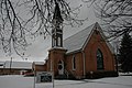 American Fork Utah Presbyterian Church.jpeg 3,008 × 2,000; 1.39 MB
-
 Antelope Island Causeway 2005.JPG 1,280 × 960; 507 KB
-

-

-
 Back Traders Rest station marker, Jan 08.jpg 2,816 × 2,112; 2.68 MB
-
 Backlit by snow (Unsplash).jpg 5,616 × 3,744; 8.56 MB
-
 Baseball Diamond & Pavilions at Lions Park - panoramio.jpg 3,264 × 2,448; 1.97 MB
-
 Baseball Diamond in Snow - panoramio.jpg 3,264 × 2,448; 1.75 MB
-
 Ben Lomond High School.jpg 1,915 × 1,621; 1.74 MB
-
 Bend in Frozen Lower Provo River - panoramio.jpg 3,264 × 2,448; 2.52 MB
-
 Bend in Provo River Trail - panoramio.jpg 3,264 × 2,448; 3.2 MB
-
 Bicycle lockers at Central Pointe, Jan 16.jpg 2,816 × 2,112; 2.75 MB
-
 Bicycle lockers at Layton station, Jan 16.jpg 2,816 × 2,112; 2.49 MB
-
 Bicycle lockers at River Trial, Jan 16.jpg 2,816 × 2,112; 2.68 MB
-
 Big Cottonwood Canyon winter.jpg 8,064 × 6,048; 29.77 MB
-
 Bike repair stand at Orem station, Feb 16.jpg 2,112 × 2,816; 2.08 MB
-
 Bingham Canyon Mine 1942c.jpg 3,847 × 4,969; 8.51 MB
-
 Black Bull, Houses and Mallards - 1 - panoramio.jpg 3,264 × 2,448; 2.64 MB
-
 Black Bull, Houses and Mallards - 2 - panoramio.jpg 3,264 × 2,448; 2.65 MB
-
 Blinded By The Light - panoramio - planetary nebula.jpg 3,264 × 2,448; 2.68 MB
-
 Blinded By The Light - panoramio.jpg 3,264 × 2,448; 3.07 MB
-
 Bridge Mountain - panoramio (1).jpg 1,600 × 614; 172 KB
-
 Brigham City Mercantile.jpeg 3,008 × 2,000; 2.7 MB
-
 Brighton 3-2013 - panoramio (3).jpg 1,493 × 2,109; 1.21 MB
-
 Bryce Canyon (Unsplash).jpg 3,024 × 4,032; 1.99 MB
-
 Bryce Canyon National Park (3447052928).jpg 1,024 × 683; 263 KB
-
 Bryce Canyon National Park, United States (Unsplash).jpg 4,958 × 3,463; 11.85 MB
-
 Bryce Canyon National Park, Utah (3446226863).jpg 1,024 × 683; 229 KB
-
 Bryce Canyon National Park, Utah (3446227239).jpg 1,024 × 682; 237 KB
-
 Bryce Canyon National Park, Utah (3446231199).jpg 1,024 × 683; 261 KB
-
 Bryce Canyon National Park, Utah (3446232349).jpg 1,024 × 683; 175 KB
-
 Bryce Canyon National Park, Utah (3447046594).jpg 1,024 × 683; 281 KB
-
 Bryce Canyon, Wikiexp 10.jpg 4,912 × 3,264; 5.53 MB
-
 Bryce Canyon, Wikiexp 18.jpg 4,912 × 3,264; 4.57 MB
-
 Bus stands at Midvale Center station, Jan 15.jpg 2,816 × 2,112; 2.48 MB
-
 Bus stands, Utah Transit Authority Park and Ride Lot, Stansbury Park, Mar 16.jpg 2,592 × 1,944; 2.32 MB
-
 BYU and Y Mountain (47763549762).jpg 5,152 × 3,864; 4.16 MB
-
 BYU Hinckley Building.JPG 3,072 × 2,304; 1.49 MB
-
 Camper in deer creek reservation (Unsplash).jpg 5,616 × 3,744; 21.41 MB
-
 Canyons sign.JPG 1,500 × 1,000; 562 KB
-
 Cedar Breaks Scenic Road in Winter (81aa6461-1dd8-b71b-0b0f-2a2302b0fefb).JPG 3,072 × 2,304; 4.21 MB
-
 Cemetery at This Is The Place Heritage Park, Mar 17.jpg 2,592 × 1,944; 2.36 MB
-
 Chad's Gap - Candide Thovex.jpg 650 × 430; 64 KB
-
 Chad's Gap - credit Powder Magazine.jpg 950 × 499; 97 KB
-

-
 Children's Playground in Snow - panoramio.jpg 3,264 × 2,448; 3.27 MB
-
 Christmas at This Is The Place Heritage Park, bakery.JPG 2,816 × 2,112; 2.62 MB
-
 Christmas at This Is The Place Heritage Park, claus.JPG 2,816 × 2,112; 2.27 MB
-
 Christmas Eve Snow.jpg 2,612 × 1,469; 465 KB
-
 City of Los Angeles (24031253554).jpg 2,000 × 1,319; 2.14 MB
-
 Coal pile at Golden Spike National Historical Park, Feb 17.jpg 2,592 × 1,944; 2.31 MB
-
 Cold Kolob (26333041).jpeg 2,048 × 1,365; 1.15 MB
-
 Cozy Winter Scene (Unsplash).jpg 5,472 × 3,648; 4.39 MB
-

-
 Dedicated Jogger - panoramio.jpg 3,264 × 2,448; 3.07 MB
-
 Denver & Rio Grande Western No. 223 - January 2002.jpg 783 × 1,139; 184 KB
-
 Dog-eared - panoramio.jpg 4,288 × 2,848; 5.22 MB
-
 Driving to Cedar Breaks National Park (3446059783).jpg 1,024 × 683; 238 KB
-
 Driving to Cedar Breaks National Park (3446060159).jpg 1,024 × 683; 148 KB
-
 Duck Lake, Duck Creek Village, Utah (3446874928).jpg 1,024 × 683; 121 KB
-
 Duck Launches Into Flight - panoramio.jpg 3,264 × 2,448; 2.26 MB
-
 Early Morning After Snowstorm - panoramio.jpg 3,264 × 2,448; 2.17 MB
-
 East across Layton station Park and Ride, Jan 16.jpg 2,816 × 2,112; 2.48 MB
-
 East along SR-178, Feb 16.jpg 2,816 × 2,112; 2.53 MB
-
 East along SR-201 from I-80 interchange, Mar 16.jpg 2,592 × 1,944; 2.41 MB
-
 East at 2700 W Sugar Factory Rd passenger platform, Apr 16.jpg 2,592 × 1,944; 2.44 MB
-
 East at South Salt Lake City station passenger platform, Jan 16.jpg 2,816 × 2,112; 2.38 MB
-
 East on eastbound US-6 in Solder Summit, Utah, Dec 16.jpg 2,592 × 1,944; 2.32 MB
-

-
 East toward I-15 & SR-178 interchange.jpg 2,816 × 2,112; 2.42 MB
-
 East toward I-15 and SR-75 interchange, Feb 16.jpg 2,816 × 2,112; 2.18 MB
-
 East toward junction of SR-178 & SR-198, Feb 16.jpg 2,816 × 2,112; 2.45 MB
-
 East toward junction of US-89 and SR-75, Feb 16.jpg 2,816 × 2,112; 2.26 MB
-
 East toward State Street, Jan 16.jpg 2,816 × 2,112; 2.59 MB
-
 Echo Post Office Echo Utah.jpeg 3,296 × 2,472; 1.86 MB
-
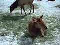 Elk at Hardware Ranch (3), Feb 05.jpg 1,280 × 960; 297 KB
-
 Emerald Lake from the summit of Mount Timpanogos.jpg 4,608 × 3,072; 3.49 MB
-
 End of SE track at Golden Spike National Historical Park, Feb 17.jpg 2,592 × 1,944; 2.35 MB
-
 End of snow removal, Hobble Creek Canyon, Mar 17.jpg 2,592 × 1,944; 2.26 MB
-
 Enterprise CarShare car.JPG 3,296 × 2,472; 1.03 MB
-
 EOD trains to deploy 110322-F-FF603-021.jpg 3,600 × 2,400; 671 KB
-
 Epic Bryce Canyon (16319461865).jpg 7,936 × 2,398; 4.52 MB
-
 Excellent Path Clearing After A Storm - panoramio.jpg 2,448 × 3,264; 2.68 MB
-
 Exotic Flocked Tree - panoramio.jpg 3,264 × 2,448; 1.97 MB
-

-
 Farmington Elementary School (32408726784).jpg 4,163 × 3,864; 3.97 MB
-
 Farmington Jr. High School (32408726184).jpg 4,825 × 2,614; 1.95 MB
-
 Farmington Utah New City Hall.jpeg 4,288 × 3,216; 5.09 MB
-
 Farnsworthsnow.jpg 2,288 × 1,712; 893 KB
-
 First light at Park Avenue. (8291524420).jpg 3,246 × 1,125; 1.41 MB
-
 First Snow, Bryce Canyon - 7-259-Edit-3 (CMYK).jpg 6,899 × 7,004; 28.68 MB
-

-
 Fog Flocked Trees Over Road - panoramio.jpg 3,264 × 2,448; 2.88 MB
-
 FortDouglasMuseum.jpg 3,296 × 2,472; 1,004 KB
-
 Freedom bridge, Utah.jpg 3,264 × 2,448; 1.58 MB
-
 Front Traders Rest station marker, Jan 08.jpg 2,816 × 2,112; 2.67 MB
-
FrontRunner passing Provo Amtrak station, Feb 17.webm 1 min 10 s, 1,280 × 720; 48.95 MB
-
 FrontRunner pulling into Layton station, Jan 16.jpg 2,816 × 2,112; 2.39 MB
-
 Frosted Tree - 1 - panoramio.jpg 2,448 × 3,264; 3.43 MB
-
 Frosted Tree - 2 - panoramio.jpg 2,448 × 3,264; 3.51 MB
-
 Frosted Trees - Jan. 17, 2009 - panoramio.jpg 3,264 × 2,448; 1.92 MB
-
 Frosty Tree Tunnel - panoramio.jpg 2,448 × 3,264; 3.94 MB
-
 Frosty Winter Afternoon - panoramio.jpg 3,264 × 2,448; 3.49 MB
-
 Frosty Winter Morning - panoramio.jpg 3,264 × 2,448; 1.97 MB
-
 Garden of eden at arches national park.jpg 1,280 × 960; 240 KB
-
 Gazebo in Murray City Park on winter morning.jpg 439 × 448; 188 KB
-
 Golden Spike National Historical Park Visitor Center from Golden Spike Drive, Feb 17.jpg 2,592 × 1,944; 2.39 MB
-
 Guys and Geese (15483391520).jpg 2,100 × 1,500; 2.54 MB
-
 Half the temperature, twice the work 130116-F-FF603-002.jpg 3,589 × 2,393; 1.29 MB
-
 Half the temperature, twice the work 130116-F-FF603-019.jpg 4,006 × 2,671; 1.64 MB
-
 Henry-waterfold.jpg 1,024 × 666; 103 KB
-
 Hiding in the Weeds (23131113811).jpg 3,628 × 2,591; 1.31 MB
-
 Hill North of Lions Park - panoramio.jpg 3,264 × 2,448; 1.79 MB
-
 Hillcrest Elementary, Orem, Utah.jpg 2,592 × 1,944; 2.34 MB
-

-
 HistoricSandyTRAXstation.jpg 3,264 × 2,448; 3.1 MB
-
 Holland Centennial Commons on a Snowy Day.jpg 6,016 × 4,016; 9.89 MB
-
 Home at 1697 E Vine Street built in 1937.jpg 1,824 × 1,188; 758 KB
-
 Horse carcass - Moccasin Mountain Dinosaur Tracksite.JPG 4,000 × 3,000; 5.35 MB
-
 Huntington Roller Mill Huntington Utah.jpeg 3,008 × 2,000; 2.29 MB
-
 Hydraulic Device by River - panoramio.jpg 3,264 × 2,448; 2.56 MB
-
 I-70 - panoramio (3).jpg 3,264 × 1,840; 1.46 MB
-
 I-70 - panoramio (4).jpg 3,264 × 1,840; 1.52 MB
-
 Indian Creek Pass Utah February.jpg 6,016 × 4,016; 2.79 MB
-
 ISS008-E-14326 - View of Utah.jpg 3,032 × 2,064; 1.13 MB
-
 Jogger on River Trail - panoramio.jpg 3,264 × 2,448; 3.02 MB
-
 Jogger on Snow Covered River Trail - panoramio.jpg 3,264 × 2,448; 3.1 MB
-
 Johansen House Castle Dale Utah.jpeg 3,008 × 2,000; 2.93 MB
-
 Jordanelle State Park Overlook and Dam View in Winter 2024.jpg 5,272 × 3,948; 11.7 MB
-
 Jordanelle State Park Overlook in Winter 2024.jpg 5,272 × 2,966; 8.08 MB
-
 July Snow in the Uinta Mountains.jpg 4,413 × 3,096; 7.01 MB
-
 Kay's Crossing apartments Layton, Utah, Jan 16.jpg 2,816 × 2,112; 2.65 MB
-
 Khadeeja Islamic Center sign, Jan 16.jpg 2,816 × 2,112; 2.57 MB
-
 Khadeeja Islamic Center, Jan 16.jpg 2,816 × 2,112; 2.44 MB
-
 Kolob Mountain Road, Zion National Park, Utah (68929786).jpg 1,280 × 960; 182 KB
-
 Kolob Mountain Road, Zion National Park, Utah (68929814).jpg 1,280 × 960; 187 KB
-
 Kolob Mountain Road, Zion National Park, Utah (68929837).jpg 1,280 × 960; 201 KB
-
 Kolob Terrace Road (6893472452).jpg 4,000 × 3,000; 4.86 MB
-
 Koosharem Guard Station (11951350556).jpg 4,326 × 2,880; 7.8 MB
-
 Lagoon Roller Coaster winter.jpeg 4,288 × 3,216; 6.84 MB
-
 Larson House Cleveland Utah.jpeg 3,008 × 2,000; 2.86 MB
-
 Layton Depot 1, January 2016.JPG 2,816 × 2,112; 2.21 MB
-
 Layton station clock, Jan 16.jpg 2,816 × 2,112; 2.2 MB
-
 LDS Seminary building at Payson Jr. High School, Feb 16.jpg 2,816 × 2,112; 2.46 MB
-
 Lehi Bank and Hospital Lehi Utah DEMOLISHED.jpeg 3,008 × 2,000; 1.08 MB
-
 Lemmon House Huntington Utah.jpeg 3,008 × 2,000; 2.46 MB
-
 Level crossing at Golden Spike National Historical Park, Feb 17.jpg 2,592 × 1,944; 2.36 MB
-
 Level crossing for W 400 S Orem, Utah, Mar 16.jpg 2,592 × 1,944; 2.22 MB
-
 Liberty Park in the winter, Salt Lake City UT, USA - panoramio.jpg 2,048 × 1,536; 1.03 MB
-
 Lions Park After A Snowstorm 1 - panoramio.jpg 3,264 × 2,448; 1.9 MB
-
 Lions Park After A Snowstorm 2 - panoramio.jpg 3,264 × 2,448; 2.25 MB
-
 Lions Park After A Snowstorm 3 - panoramio.jpg 3,264 × 2,448; 1.9 MB
-
 Lions Park Pavilion - (Not An Alien Spacecraft) - panoramio.jpg 3,264 × 2,448; 2.44 MB
-
 Lions Park Pavilion - Corner View - panoramio.jpg 3,264 × 2,448; 2.37 MB
-
 Lions Park Pavilion - Front View - panoramio.jpg 3,264 × 2,448; 2.26 MB
-
 Little dell reservoir.jpg 3,888 × 2,592; 2.92 MB
-
 Lone Coot - panoramio.jpg 3,264 × 2,448; 2.29 MB
-
 Lone Peak - panoramio.jpg 2,160 × 1,440; 673 KB
-
 Lone Peak Hospital.jpg 5,760 × 3,840; 5.44 MB
-
 Looking north along tracks from River Trail, Jan 16.jpg 2,816 × 2,112; 2.58 MB
-
 Looking south along tracks from River Trail, Jan 16.jpg 2,816 × 2,112; 2.36 MB
-
 Looking south from American Fork Station.JPG 2,816 × 2,112; 2.49 MB
-
 Looking southeast at River Trail, Jan 16.jpg 2,816 × 2,112; 2.49 MB
-
 Looking west at Murray Central.JPG 2,816 × 2,112; 2.39 MB
-
 Looking west at railroad viaduct in Vineyard, Utah.JPG 2,816 × 2,112; 2.31 MB
-
 Low clouds along the Scenic Drive (e2dba3e0-5fe7-4677-bbf5-6ce5d0b961a9).JPG 4,032 × 3,024; 4.22 MB
-
 Lower Emerald Pools (6745618395).jpg 2,336 × 3,504; 1.94 MB
-
 Lunch Breaks at River Trail - panoramio.jpg 3,264 × 2,448; 2.52 MB
-
 Mallard Ducks - panoramio.jpg 3,264 × 2,448; 2.41 MB
-
 Mallards in Winter - panoramio.jpg 3,264 × 2,448; 2.04 MB
-
 Mammoth Creek Rd. - panoramio.jpg 1,600 × 1,200; 433 KB
-
 Memorial art at the South Salt Lake City Station.JPG 3,296 × 2,472; 965 KB


.jpg)


.jpg)


.jpg)


.jpg)


.jpg)


.jpg)
.jpg)
.jpg)
.jpg)
.jpg)
.jpg)
.jpg)
.jpg)
.jpg)


.jpg)

.jpg)

.JPG)


.jpg)


.jpg)

.jpeg)
.jpg)


.jpg)
.jpg)
.jpg)


,_Feb_05.jpg)


.jpg)
.jpg)


.jpg)


.jpg)


.jpg)


.jpg)
.jpg)


.jpg)
.jpg)
.jpg)
.jpg)
.jpg)


_-_panoramio.jpg)


.JPG)
.jpg)


.jpg)
.jpg)
.jpg)