Category:Soil shrink swell maps of Tarn-et-Garonne
Departments of Metropolitan France: Ariège [09] · Aude [11] · Charente [16] · Charente-Maritime [17] · Cher [18] · Corrèze [19] · Creuse [23] · Dordogne [24] · Eure-et-Loir [28] · Gard [30] · Haute-Garonne [31] · Gers [32] · Gironde [33] · Hérault [34] · Indre [36] · Indre-et-Loire [37] · Landes [40] · Loiret [45] · Lot [46] · Lot-et-Garonne [47] · Lozère [48] · Pyrénées-Atlantiques [64] · Hautes-Pyrénées [65] · Pyrénées-Orientales [66] · Deux-Sèvres [79] · Tarn [81] · Tarn-et-Garonne [82] · Vienne [86] · Haute-Vienne [87]
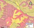
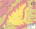
Media in category "Soil shrink swell maps of Tarn-et-Garonne"
The following 15 files are in this category, out of 15 total.
-
 82001-Albefeuille-Lagarde-argile.jpg 3,057 × 2,480; 519 KB
-
 82002-Albias-argile.jpg 3,057 × 2,480; 631 KB
-
 82003-Angeville-argile.jpg 3,057 × 2,480; 509 KB
-
 82004-Asques-argile.jpg 3,057 × 2,480; 606 KB
-
 82005-Aucamville-argile.jpg 3,057 × 2,480; 616 KB
-
 82006-Auterive-argile.jpg 3,057 × 2,480; 311 KB
-
 82007-Auty-argile.jpg 3,057 × 2,480; 464 KB
-
 82008-Auvillar-argile.jpg 3,057 × 2,480; 637 KB
-
 82009-Balignac-argile.jpg 3,057 × 2,480; 471 KB
-
 82010-Bardigues-argile.jpg 3,057 × 2,480; 516 KB
-
 82070-Glatens-argile.jpg 3,057 × 2,480; 343 KB
-
 82076-L'Honor-de-Cos-argile.jpg 3,057 × 2,480; 684 KB
-
 82121-Montauban-argile.jpg 3,057 × 2,480; 1.1 MB
-
 82133-Mouillac-argile.jpg 3,057 × 2,480; 587 KB
-
 82173-Saint-Sardos-argile.jpg 3,057 × 2,480; 646 KB


