Category:Somerleyton, Ashby and Herringfleet
English: Somerleyton, Ashby and Herringfleet is a civil parish in the Waveney district, in the county of Suffolk, England.
civil parish in Suffolk, UK | |||||
| Upload media | |||||
| Instance of | |||||
|---|---|---|---|---|---|
| Named after | |||||
| Location | Waveney, Suffolk, East of England, England | ||||
 | |||||
Subcategories
This category has the following 4 subcategories, out of 4 total.
Media in category "Somerleyton, Ashby and Herringfleet"
The following 200 files are in this category, out of 358 total.
(previous page) (next page)-
 500 Year old Oaks - geograph.org.uk - 1918687.jpg 531 × 800; 249 KB
-

-

-
 Alders beside Waddling Lane - geograph.org.uk - 3888014.jpg 640 × 480; 210 KB
-

-
 Angles Way - geograph.org.uk - 4488316.jpg 768 × 1,024; 251 KB
-
 Angles Way approaching footpath junction - geograph.org.uk - 1956964.jpg 2,304 × 3,072; 2.77 MB
-
 Angles Way approaching Wadding Wood - geograph.org.uk - 1952240.jpg 2,304 × 3,072; 2.82 MB
-
 Angles Way by Wadding Wood - geograph.org.uk - 1952248.jpg 2,304 × 3,072; 2.82 MB
-
 Angles Way by Wadding Wood - geograph.org.uk - 1952260.jpg 2,304 × 3,072; 2.93 MB
-
 Angles Way Byway to Blocka Road - geograph.org.uk - 6007453.jpg 4,608 × 3,456; 3.86 MB
-
 Angles Way Byway to Market Lane - geograph.org.uk - 6006490.jpg 4,000 × 2,353; 2.77 MB
-
 Angles Way Footpath to Market Lane - geograph.org.uk - 6007447.jpg 4,000 × 3,000; 5.03 MB
-
 Angles Way Footpath to Market Lane - geograph.org.uk - 6111057.jpg 4,608 × 3,456; 3.9 MB
-
 Angles Way heading east - geograph.org.uk - 1956912.jpg 2,304 × 3,072; 3.03 MB
-
 Angles Way near to Waveney Grange Farm - geograph.org.uk - 1952238.jpg 2,304 × 3,072; 2.65 MB
-
 Approaching Somerleyton - geograph.org.uk - 4946479.jpg 640 × 480; 65 KB
-
 Ashby Dell Victorian Postbox - geograph.org.uk - 6006609.jpg 2,930 × 3,906; 4.52 MB
-
 Ashby Dell Victorian Postbox - geograph.org.uk - 6007434.jpg 2,982 × 3,976; 4.28 MB
-
 Ashby Dell Victorian Postbox ^ Ashby Village Notice Board - geograph.org.uk - 6006603.jpg 3,000 × 4,000; 3.34 MB
-
 Ashby Dell Victorian Postbox ^ Ashby Village Notice Board - geograph.org.uk - 6007843.jpg 3,000 × 4,000; 3.16 MB
-
 Ashby Dell Victorian Postbox ^ Blocka Road - geograph.org.uk - 6006667.jpg 4,608 × 3,456; 3.93 MB
-
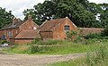 Ashby Hall Farm buildings - geograph.org.uk - 3042718.jpg 3,648 × 2,255; 4.06 MB
-
 Ashby Hall Farm, Suffolk - geograph.org.uk - 2925524.jpg 1,600 × 991; 344 KB
-
 Ashby Hall Workshops - geograph.org.uk - 2004936.jpg 3,000 × 2,400; 4.48 MB
-
 Ashby Hall Workshops sign - geograph.org.uk - 6111162.jpg 4,608 × 3,456; 4.43 MB
-
 Ashby House across the field - geograph.org.uk - 4273167.jpg 640 × 480; 105 KB
-
 At the end of the rainbow - geograph.org.uk - 3972201.jpg 640 × 418; 62 KB
-
 Autumn colours and fallen leaves - geograph.org.uk - 4273140.jpg 640 × 480; 174 KB
-
 B1074 Blundeston Road ^ Somerleyton Road Postbox - geograph.org.uk - 6013529.jpg 4,608 × 3,456; 3.98 MB
-
 B1074 Blundeston Road, Somerleyton - geograph.org.uk - 6013522.jpg 4,608 × 3,456; 3.91 MB
-
 B1074 Blundeston Road, Somerleyton - geograph.org.uk - 6013524.jpg 4,000 × 3,000; 3.93 MB
-
 B1074 Blundeston Road, Somerleyton - geograph.org.uk - 6013526.jpg 4,000 × 3,000; 4.27 MB
-
 B1074 Blundeston Road, Somerleyton - geograph.org.uk - 6013533.jpg 4,000 × 3,000; 4.57 MB
-
 B1074 Herringfleet Road, Herringfleet - geograph.org.uk - 6008903.jpg 4,608 × 3,456; 4.09 MB
-
 B1074 Herringfleet Road, Herringfleet - geograph.org.uk - 6009796.jpg 4,608 × 3,456; 3.97 MB
-
 B1074 Herringfleet Road, St Olaves - geograph.org.uk - 6008306.jpg 4,608 × 3,456; 3.89 MB
-

-
 B1074 St Olaves Road, Herringfleet - geograph.org.uk - 6008908.jpg 4,608 × 3,456; 3.78 MB
-
 B1074 St Olaves Road, Herringfleet - geograph.org.uk - 6009802.jpg 640 × 480; 103 KB
-
 B1074 St Olaves Road, Herringfleet - geograph.org.uk - 6009828.jpg 4,000 × 3,000; 3.33 MB
-
 B1074 St Olaves Road, Herringfleet - geograph.org.uk - 6010203.jpg 4,608 × 3,456; 4.08 MB
-
 B1074 St Olaves Road, Herringfleet - geograph.org.uk - 6011325.jpg 4,608 × 3,456; 3.8 MB
-
 B1074 St Olaves Road, Somerleyton - geograph.org.uk - 6011361.jpg 4,608 × 3,456; 3.9 MB
-
 B1074 St Olaves Road, Somerleyton - geograph.org.uk - 6011366.jpg 4,608 × 3,456; 3.97 MB
-
 B1074 The Street ^ Somerleyton Village sign - geograph.org.uk - 6013309.jpg 4,608 × 3,456; 3.85 MB
-
 B1074 The Street, Somerleyton - geograph.org.uk - 6011674.jpg 4,608 × 3,456; 3.88 MB
-
 B1074 The Street, Somerleyton - geograph.org.uk - 6013500.jpg 4,608 × 3,456; 3.88 MB
-
 Barbed wire fence beside Browston Lane - geograph.org.uk - 3282677.jpg 640 × 544; 291 KB
-
 Bare field north of Blocka Road - geograph.org.uk - 3282606.jpg 640 × 480; 134 KB
-
 Bare field south of Fritton Lake - geograph.org.uk - 3282612.jpg 640 × 480; 174 KB
-
 Barn, Manor House Farm - geograph.org.uk - 4946496.jpg 640 × 480; 68 KB
-
 Beech House, Ashby - geograph.org.uk - 6111094.jpg 4,608 × 3,456; 3.74 MB
-
 Bird of Prey - geograph.org.uk - 1919553.jpg 800 × 531; 106 KB
-
 Blocka Road - geograph.org.uk - 4488405.jpg 768 × 1,024; 349 KB
-
 Blocka Road - geograph.org.uk - 4946516.jpg 640 × 480; 103 KB
-
 Blocka Road - geograph.org.uk - 4946521.jpg 640 × 480; 85 KB
-
 Blocka Road past Herringfleet Hall - geograph.org.uk - 3282620.jpg 640 × 480; 229 KB
-
 Blocka Road, Ashby - geograph.org.uk - 6006317.jpg 4,000 × 3,000; 4.94 MB
-
 Blocka Road, Ashby - geograph.org.uk - 6006511.jpg 4,608 × 3,456; 3.98 MB
-
 Blocka Road, Ashby - geograph.org.uk - 6007457.jpg 4,000 × 3,000; 6.01 MB
-
 Blocka Road, Ashby - geograph.org.uk - 6008087.jpg 4,608 × 3,456; 4.11 MB
-
 Blundeston Road (B1074) - geograph.org.uk - 4946463.jpg 640 × 480; 95 KB
-
 Blundeston Road (B1074) - geograph.org.uk - 4946476.jpg 640 × 480; 64 KB
-
 Border Lane - geograph.org.uk - 4946523.jpg 640 × 480; 70 KB
-
 Border Lane, Ashby - geograph.org.uk - 6110813.jpg 4,608 × 3,456; 3.97 MB
-
 Border Lane, Ashby - geograph.org.uk - 6110824.jpg 4,608 × 3,456; 4.17 MB
-
 Border Lane, Ashby - geograph.org.uk - 6110886.jpg 4,608 × 3,456; 3.97 MB
-
 Bracken growing at Herringfleet Hills - geograph.org.uk - 2420154.jpg 640 × 480; 229 KB
-
 Brick fields - geograph.org.uk - 1919409.jpg 800 × 531; 119 KB
-
 Brick Kiln - geograph.org.uk - 1919118.jpg 800 × 531; 236 KB
-
 Brick Kiln - geograph.org.uk - 1919259.jpg 800 × 531; 188 KB
-
 Browston Lane past Ashby Warren - geograph.org.uk - 3282666.jpg 640 × 480; 235 KB
-
 Browston Lane, Ashby - geograph.org.uk - 6006313.jpg 4,000 × 2,927; 5.81 MB
-
 Browston Lane, Ashby - geograph.org.uk - 6110893.jpg 4,608 × 3,456; 3.98 MB
-
 Byway to Blocka Road - geograph.org.uk - 6111107.jpg 4,608 × 3,456; 3.97 MB
-
 Byway to Blocka Road - geograph.org.uk - 6111118.jpg 4,608 × 3,456; 3.9 MB
-
 Car park at Herringfleet hills - geograph.org.uk - 1918660.jpg 800 × 531; 161 KB
-

-
 Centrifugal Pump - geograph.org.uk - 1918866.jpg 800 × 531; 171 KB
-
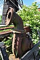 Centrifugal Pump - geograph.org.uk - 1919543.jpg 531 × 800; 172 KB
-
 Church Building at St. Margaret's Church - geograph.org.uk - 6113057.jpg 4,608 × 3,456; 3.86 MB
-

-
 Cows grazing on the marshes - geograph.org.uk - 1956981.jpg 3,072 × 2,304; 2.61 MB
-
 Cows on the Marshes - geograph.org.uk - 1918769.jpg 800 × 531; 78 KB
-
 Crop field off Flixton Road - geograph.org.uk - 4946423.jpg 640 × 480; 80 KB
-
 Crop field off Herringfleet Road - geograph.org.uk - 4946502.jpg 640 × 480; 66 KB
-
 Crop field, Herringfleet - geograph.org.uk - 4946497.jpg 640 × 480; 70 KB
-
 Crop field, The Dell - geograph.org.uk - 4946522.jpg 640 × 480; 57 KB
-
 Curious Cows - geograph.org.uk - 1918757.jpg 800 × 532; 122 KB
-
 Derelict farm building - geograph.org.uk - 4273178.jpg 613 × 480; 189 KB
-

-
 Drain outfall, Suffolk bank, River Waveney - geograph.org.uk - 4633679.jpg 1,024 × 768; 143 KB
-

-
 Drainage Ditch - geograph.org.uk - 4820896.jpg 1,024 × 768; 240 KB
-

-
 Drainage ditch with Swans - geograph.org.uk - 1918785.jpg 800 × 531; 125 KB
-
 Drainage Pond - geograph.org.uk - 1918798.jpg 800 × 531; 80 KB
-
 Drive to Somerleyton Hall - geograph.org.uk - 4946457.jpg 640 × 490; 98 KB
-
 Driveway to Manor House Farm - geograph.org.uk - 1505349.jpg 640 × 503; 94 KB
-
 Electricity poles in sugar beet crop - geograph.org.uk - 1509751.jpg 487 × 640; 90 KB
-
 Entering Herringfleet on the B1074 St Olaves Road - geograph.org.uk - 6011349.jpg 4,608 × 3,456; 3.78 MB
-
 Entering Herringfleet on the B1074 St Olaves Road - geograph.org.uk - 6011359.jpg 4,608 × 3,456; 3.81 MB
-
 Entering Somerleyton on the B1074 St Olaves Road - geograph.org.uk - 6011343.jpg 4,608 × 3,456; 3.91 MB
-
 Entering Somerleyton on the B1074 St Olaves Road - geograph.org.uk - 6011355.jpg 4,608 × 3,456; 3.82 MB
-
 Entering Suffolk on the B1074 Herringfleet Road - geograph.org.uk - 6008900.jpg 4,608 × 3,456; 3.94 MB
-

-
 Entrance to Ashby Hall Workshops - geograph.org.uk - 6111164.jpg 4,608 × 3,456; 4.22 MB
-

-
 Entrance to Somerleyton Farms - geograph.org.uk - 6011354.jpg 4,608 × 3,456; 3.99 MB
-
 Entrance to Somerleyton Hall - geograph.org.uk - 6113873.jpg 4,608 × 3,456; 3.92 MB
-
 Entrance to The Dell - geograph.org.uk - 6007511.jpg 4,608 × 3,456; 4.33 MB
-
 Entrance to the former Station Building - geograph.org.uk - 6114105.jpg 3,000 × 4,000; 5.29 MB
-
 Ex Brick Works Chimney Base - geograph.org.uk - 1919475.jpg 800 × 531; 201 KB
-
 Fallen Wall - geograph.org.uk - 1919278.jpg 800 × 531; 225 KB
-
 Farm entrance - geograph.org.uk - 4273154.jpg 603 × 480; 114 KB
-
 Farm Track through Wadding Wood - geograph.org.uk - 1952244.jpg 2,304 × 3,072; 2.73 MB
-
 Farm Track through Wadding Wood - geograph.org.uk - 1952247.jpg 2,304 × 3,072; 3.01 MB
-
 Farm track through Wadding Wood - geograph.org.uk - 3887990.jpg 640 × 480; 284 KB
-
 Field Entrance off Market Lane - geograph.org.uk - 6111745.jpg 4,608 × 3,456; 3.96 MB
-
 Field side flora - geograph.org.uk - 3042711.jpg 2,311 × 3,081; 2.8 MB
-

-
 Field towards Home Farm - geograph.org.uk - 4946460.jpg 640 × 480; 88 KB
-
 Fieldgate beside Blocka Road - geograph.org.uk - 3282595.jpg 640 × 433; 141 KB
-
 Fields and hedgerow - geograph.org.uk - 4946484.jpg 640 × 480; 77 KB
-
 Flixton Road - geograph.org.uk - 4946427.jpg 640 × 480; 87 KB
-
 Flood Bank - geograph.org.uk - 4820887.jpg 1,024 × 768; 267 KB
-

-

-

-
 Flowers where bricks once baked - geograph.org.uk - 1919380.jpg 800 × 531; 99 KB
-
 Footpath junction in Herringfleet Hills - geograph.org.uk - 2420191.jpg 640 × 480; 302 KB
-

-
 Footpath off Flixton Road - geograph.org.uk - 4946430.jpg 640 × 480; 131 KB
-

-
 Footpath Sign - geograph.org.uk - 4820791.jpg 1,024 × 768; 312 KB
-

-
 Footpath signpost - geograph.org.uk - 6111048.jpg 2,905 × 3,873; 6.96 MB
-
 Footpath signpost off Market Lane - geograph.org.uk - 6111754.jpg 2,899 × 3,866; 5.42 MB
-
 Footpath to Ashby church - geograph.org.uk - 4273165.jpg 640 × 480; 112 KB
-
 Footpath to Blocka Road - geograph.org.uk - 6111011.jpg 4,608 × 3,456; 4.06 MB
-
 Footpath to Blocka Road - geograph.org.uk - 6111177.jpg 4,608 × 3,456; 4.01 MB
-
 Footpath to Market Lane - geograph.org.uk - 6007510.jpg 4,000 × 3,000; 5.57 MB
-
 Footpath to Market Lane - geograph.org.uk - 6110986.jpg 4,608 × 3,456; 4.13 MB
-
 Footpath to Market Lane - geograph.org.uk - 6111763.jpg 4,608 × 3,456; 3.88 MB
-
 Footpath to Slugs Lane - geograph.org.uk - 6113890.jpg 3,000 × 4,000; 4.76 MB
-
 Footpath to Station Road - geograph.org.uk - 6115884.jpg 4,608 × 3,456; 4.13 MB
-
 Former fuel Station off The Street - geograph.org.uk - 6011678.jpg 4,608 × 3,456; 3.92 MB
-
 Former fuel Station off The Street - geograph.org.uk - 6012115.jpg 4,000 × 3,000; 3.09 MB
-
 Furze Clump - geograph.org.uk - 4488303.jpg 1,024 × 768; 266 KB
-
 Gardens, Somerleyton Hall - geograph.org.uk - 5536284.jpg 3,411 × 2,270; 1.83 MB
-

-
 Gate into pasture beside Waddling Lane - geograph.org.uk - 3888012.jpg 640 × 480; 227 KB
-
 Gated farm track off Border Lane - geograph.org.uk - 4946524.jpg 640 × 480; 87 KB
-
 Golden bracken and leafless oak trees - geograph.org.uk - 4273195.jpg 640 × 480; 172 KB
-
 Grazing near Somerleyton Park - geograph.org.uk - 4946474.jpg 640 × 480; 98 KB
-
 Grazing off Green Lane - geograph.org.uk - 4946446.jpg 640 × 480; 93 KB
-
 Green Lane - geograph.org.uk - 4946442.jpg 640 × 480; 95 KB
-
 Green Lane - geograph.org.uk - 4946448.jpg 640 × 480; 114 KB
-
 Green Lane - geograph.org.uk - 4946455.jpg 640 × 480; 116 KB
-
 Hardstanding at Ashby Hall Farm - geograph.org.uk - 6110928.jpg 4,608 × 3,456; 3.81 MB
-
 Heading east on Border Lane - geograph.org.uk - 4946525.jpg 640 × 480; 83 KB
-
 Heading south on Market Lane - geograph.org.uk - 4946494.jpg 640 × 480; 77 KB
-
 Heathland at Herringfleet Hills - geograph.org.uk - 2420139.jpg 640 × 480; 276 KB
-
 Heavy Horses - geograph.org.uk - 3102768.jpg 640 × 395; 101 KB
-
 Hedgerow and crop field - geograph.org.uk - 4946421.jpg 640 × 480; 77 KB
-
 Heron on Herringfleet Marsh - geograph.org.uk - 1919513.jpg 800 × 531; 146 KB
-
 Herringfleet Road (B1074) - geograph.org.uk - 4946503.jpg 640 × 480; 77 KB
-
 Herringfleet Road (B1074) - geograph.org.uk - 4946507.jpg 640 × 480; 68 KB
-
 Herringfleet Smock Mill - geograph.org.uk - 1918723.jpg 800 × 531; 126 KB
-
 Herringfleet Village Name sign - geograph.org.uk - 6011352.jpg 4,608 × 3,456; 4.08 MB
-
 Junction of Angles Way and footpath - geograph.org.uk - 1956927.jpg 3,072 × 2,304; 2.75 MB
-
 Junction of tracks in Wadding Wood - geograph.org.uk - 1952241.jpg 3,072 × 2,304; 2.74 MB
-
 Kayan Stage - geograph.org.uk - 3102727.jpg 640 × 396; 79 KB
-
 Level Crossing No 58 - geograph.org.uk - 1951016.jpg 3,072 × 2,304; 2.33 MB
-
 Level Crossing No 59 - geograph.org.uk - 1952245.jpg 3,072 × 2,304; 2.71 MB
-
 Level Crossing No 62 - geograph.org.uk - 1957000.jpg 3,072 × 2,304; 2.44 MB
-

-
 Looking east on Blocka Road - geograph.org.uk - 4946519.jpg 640 × 480; 112 KB
-
 Looking towards the Arena Stage - geograph.org.uk - 3102730.jpg 640 × 396; 61 KB
-
 Looking up Snake's Lane - a track from Ashby to Lound - geograph.org.uk - 3124362.jpg 3,264 × 2,448; 2.51 MB
-
 Manor House Farm - the farmhouse - geograph.org.uk - 1505350.jpg 600 × 585; 78 KB
-
 Marker Post at Ashby Hall Farm - geograph.org.uk - 6111111.jpg 2,917 × 3,890; 6.71 MB
-
 Marker Post on the Angles Way - geograph.org.uk - 2069506.jpg 768 × 1,024; 1.23 MB
-
 Market Lane - geograph.org.uk - 4946491.jpg 640 × 480; 58 KB
-
 Market Lane, Ashby - geograph.org.uk - 6111170.jpg 4,608 × 3,456; 3.87 MB
-
 Market Lane, Ashby - geograph.org.uk - 6111734.jpg 4,608 × 3,456; 4.44 MB
-
 Market Lane, Ashby - geograph.org.uk - 6111742.jpg 4,608 × 3,456; 4.01 MB
-
 Market Lane, Ashby - geograph.org.uk - 6111746.jpg 4,608 × 3,456; 4 MB
-
 Market Lane, Ashby - geograph.org.uk - 6111749.jpg 4,608 × 3,456; 3.83 MB
-
 Market Lane, Ashby - geograph.org.uk - 6111753.jpg 4,608 × 3,456; 3.9 MB
-
 Market Lane, Somerleyton - geograph.org.uk - 6113414.jpg 4,608 × 3,456; 3.87 MB
-
 Market Lane, Somerleyton - geograph.org.uk - 6113415.jpg 4,608 × 3,456; 3.83 MB
-
 Market Lane, Somerleyton - geograph.org.uk - 6113878.jpg 4,608 × 3,456; 4 MB
-
 Marsh gate below Herringfleet Hills - geograph.org.uk - 2420205.jpg 640 × 480; 233 KB
-
 Marsh Lane sign - geograph.org.uk - 6116658.jpg 4,000 × 3,000; 7.04 MB
-
 Marsh Lane sign ^ roadsign - geograph.org.uk - 6115883.jpg 4,608 × 3,456; 4.21 MB
-
 Marsh Lane, Somerleyton - geograph.org.uk - 6115881.jpg 4,608 × 3,456; 3.78 MB
-
 Marshland Scenery - geograph.org.uk - 1918848.jpg 800 × 531; 106 KB
-
 Marshland View - geograph.org.uk - 1918945.jpg 800 × 531; 71 KB


_-_geograph.org.uk_-_4946463.jpg)
_-_geograph.org.uk_-_4946476.jpg)


_-_geograph.org.uk_-_4946503.jpg)
_-_geograph.org.uk_-_4946507.jpg)


