Category:Somerton, Oxfordshire
village and civil parish in Cherwell district, Oxfordshire, England  | |||||
| Upload media | |||||
| Instance of | |||||
|---|---|---|---|---|---|
| Location | Cherwell, Oxfordshire, South East England, England | ||||
| Population |
| ||||
| Area |
| ||||
| Said to be the same as | Somerton (Wikimedia duplicated page, civil parish) | ||||
| official website | |||||
 | |||||
English: Somerton is a village and civil parish in Oxfordshire, England, in the Cherwell valley about northwest of Bicester.
Subcategories
This category has the following 3 subcategories, out of 3 total.
Media in category "Somerton, Oxfordshire"
The following 85 files are in this category, out of 85 total.
-
 A new Village Hall at Somerton - geograph.org.uk - 1876308.jpg 3,648 × 2,736; 2.04 MB
-
 Back of Somerton Deep Lock - geograph.org.uk - 3373638.jpg 3,412 × 2,542; 4.13 MB
-
 Bridge 194, Oxford Canal - geograph.org.uk - 3475433.jpg 4,000 × 3,000; 4.85 MB
-
 Bridge 194, Somerton Deep Lock Bridge - geograph.org.uk - 4517800.jpg 1,024 × 877; 362 KB
-
 Bridge 194, Somerton Deep Lock Bridge - geograph.org.uk - 4517806.jpg 1,024 × 710; 345 KB
-
 Bridge 195, Meadlands Bridge - geograph.org.uk - 4517815.jpg 1,024 × 772; 238 KB
-
 Bridge 195, Oxford Canal - geograph.org.uk - 3475460.jpg 4,000 × 3,000; 4.53 MB
-
 Bridge 196, Somerton Bridge - geograph.org.uk - 4518768.jpg 1,024 × 756; 270 KB
-
 Bridge 198, Deep Cutting Bridge - geograph.org.uk - 4518834.jpg 1,024 × 718; 223 KB
-
 Bridge 198, Oxford Canal - geograph.org.uk - 799807.jpg 640 × 480; 102 KB
-
 Bridge 199, Oxford Canal - geograph.org.uk - 799822.jpg 640 × 480; 107 KB
-
 Bridge 199, Somerton Mill Bridge - geograph.org.uk - 4518924.jpg 1,024 × 735; 329 KB
-
 Bridge over a farm track at Somerton - geograph.org.uk - 1324962.jpg 640 × 427; 84 KB
-
 Bridge over the main road at Somerton - geograph.org.uk - 1324967.jpg 640 × 427; 106 KB
-

-
 Buttercup meadow next to the Oxford Canal - geograph.org.uk - 4518883.jpg 909 × 1,024; 405 KB
-
 Buttercups along the towpath - geograph.org.uk - 4517811.jpg 1,024 × 768; 343 KB
-
 Canalside Homes - geograph.org.uk - 799801.jpg 640 × 480; 89 KB
-
 Chiswell's Farm Crossing - geograph.org.uk - 1324980.jpg 640 × 427; 83 KB
-
 Country road - geograph.org.uk - 4353958.jpg 640 × 480; 41 KB
-
 Country road - geograph.org.uk - 4354030.jpg 640 × 480; 57 KB
-
 Country road - geograph.org.uk - 4354083.jpg 640 × 468; 82 KB
-
 Crossroads - geograph.org.uk - 4354042.jpg 640 × 480; 102 KB
-
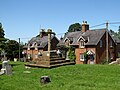
 Deep Lock Cottage along the Oxford Canal - geograph.org.uk - 4517803.jpg 1,024 × 722; 241 KB
-
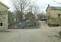
 Entrance to Somerton - geograph.org.uk - 4353966.jpg 640 × 480; 108 KB
-
 Entrance to Somerton - geograph.org.uk - 4353997.jpg 640 × 480; 95 KB
-
 Farmland - geograph.org.uk - 4354064.jpg 640 × 480; 64 KB
-
 Farmland and bales next to the Oxford Canal - geograph.org.uk - 4518906.jpg 1,024 × 668; 262 KB
-
 Farmland in the Cherwell valley - geograph.org.uk - 4518858.jpg 1,024 × 817; 369 KB
-
 Footpath south of Troy Farm - geograph.org.uk - 4354038.jpg 640 × 480; 113 KB
-
 Former RAF Upper Heyford from the air - geograph.org.uk - 2355956.jpg 640 × 480; 169 KB
-
 Former RAF Upper Heyford from the air - geograph.org.uk - 4604425.jpg 640 × 480; 125 KB
-
 Fritwell & Somerton station site geograph-3538883-by-Ben-Brooksbank.jpg 2,383 × 1,605; 3.7 MB
-
 Fritwell Railway - geograph.org.uk - 6194393.jpg 1,600 × 1,200; 812 KB
-
 Grain Silos at Somerton - geograph.org.uk - 1876284.jpg 3,648 × 2,736; 2.14 MB
-
 Lock 34, Oxford Canal - Somerton Deep Lock - geograph.org.uk - 3475425.jpg 4,000 × 3,000; 4.99 MB
-
 Long curve at Somerton - geograph.org.uk - 1324974.jpg 640 × 427; 70 KB
-

-
 Near Somerton - geograph.org.uk - 782564.jpg 480 × 640; 119 KB
-
 North Oxfordshire countryside - geograph.org.uk - 1588937.jpg 640 × 480; 67 KB
-
-
 Oxford Canal Walk - geograph.org.uk - 5192214.jpg 640 × 480; 80 KB
-
 Oxford Canal Walk - geograph.org.uk - 5192224.jpg 640 × 480; 82 KB
-
 Oxford Canal Walk - geograph.org.uk - 5192233.jpg 640 × 480; 71 KB
-
 Oxford Canal Walk - geograph.org.uk - 5192241.jpg 640 × 480; 80 KB
-
 Raghouse Lane - geograph.org.uk - 4354048.jpg 640 × 480; 85 KB
-
 Railway - geograph.org.uk - 4354044.jpg 640 × 480; 69 KB
-
 Railway bridge at Somerton - geograph.org.uk - 1588943.jpg 640 × 442; 74 KB
-
 Railway parallels the Oxford Canal - geograph.org.uk - 2565292.jpg 640 × 480; 84 KB
-
 Recycling Bins at Somerton - geograph.org.uk - 1040929.jpg 640 × 480; 76 KB
-
 Road junction - geograph.org.uk - 4353953.jpg 640 × 480; 64 KB
-
 Road junction - geograph.org.uk - 4354073.jpg 640 × 480; 89 KB
-
 Roadside Field near Upper Heyford - geograph.org.uk - 1040928.jpg 640 × 480; 64 KB
-
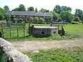 Canalside Pillbox - geograph.org.uk - 799905.jpg 640 × 480; 116 KB
-
 Dredging Operation - geograph.org.uk - 799796.jpg 640 × 480; 79 KB
-
 Somerton and the Oxford Canal - geograph.org.uk - 114135.jpg 640 × 481; 44 KB
-

-
 Somerton Crossing - geograph.org.uk - 1324954.jpg 640 × 418; 90 KB
-
 Somerton Crossing - geograph.org.uk - 799829.jpg 640 × 480; 117 KB
-
 Somerton Crossing heading south - geograph.org.uk - 1345641.jpg 640 × 427; 97 KB
-
 Somerton Deep Lock No 34 - geograph.org.uk - 4517513.jpg 897 × 1,024; 390 KB
-
 Somerton Deep Lock Oxford Canal - geograph.org.uk - 3292608.jpg 2,081 × 1,415; 906 KB
-

-
 Somerton Road junction with Ardley Road - geograph.org.uk - 3399301.jpg 3,556 × 2,448; 1.55 MB
-
 Somerton Road west of Midginwell Farm - geograph.org.uk - 3399295.jpg 3,460 × 2,588; 1.86 MB
-
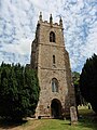 Somerton, St James the Apostle - geograph.org.uk - 5476524.jpg 3,456 × 4,608; 3.75 MB
-
 Somerton-Church Street - geograph.org.uk - 6194380.jpg 1,600 × 1,200; 592 KB
-
 Southward on Oxford Canal at Somerton, 1992 - geograph.org.uk - 4144358.jpg 2,416 × 1,453; 3.63 MB
-
 Steps at Somerton Deep Lock No 34 - geograph.org.uk - 4517808.jpg 1,024 × 665; 251 KB
-
 The Cherwell Valley in early summer - geograph.org.uk - 839476.jpg 640 × 480; 101 KB
-
 The Oxford Canal at Somerton - geograph.org.uk - 1588945.jpg 640 × 480; 49 KB
-
 The Oxford Canal near Somerton - geograph.org.uk - 4518816.jpg 1,024 × 744; 296 KB
-
 The Oxford Canal south of Somerton - geograph.org.uk - 2565296.jpg 640 × 480; 76 KB
-
 The Oxford Canal south of Water Street bridge - geograph.org.uk - 3399312.jpg 3,648 × 2,736; 1.56 MB
-
 The Oxford Canal west of Somerton - geograph.org.uk - 4518865.jpg 1,024 × 768; 311 KB
-
 Towpath along the Oxford Canal - geograph.org.uk - 4518915.jpg 1,024 × 768; 292 KB
-
 Tractor next to the Oxford Canal - geograph.org.uk - 4518824.jpg 1,024 × 804; 254 KB
-
 Troy Cottages - geograph.org.uk - 4354031.jpg 640 × 480; 78 KB
-
 Troy Farm - geograph.org.uk - 4354037.jpg 640 × 480; 92 KB
-
 View from Somerton Deep lock South Oxford Canal - geograph.org.uk - 3354256.jpg 3,648 × 2,736; 4.39 MB
-
 Village Farm in the distance - geograph.org.uk - 4354021.jpg 640 × 480; 54 KB
-
 Village Farm turning - geograph.org.uk - 4354011.jpg 640 × 480; 81 KB
-
 Bridleway to Upper Heyford - geograph.org.uk - 398539.jpg 640 × 480; 102 KB
-
 Mudginwell Farm - geograph.org.uk - 398550.jpg 640 × 480; 72 KB
-
 Overlooking the Cherwell Valley - geograph.org.uk - 398544.jpg 640 × 480; 53 KB


_(FindID_477932).jpg)


