Category:Sound of Jura
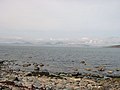
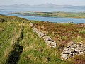
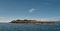
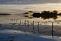
The Sound of Jura is the waters between the Isle of Jura, in the Inner Hebrides, and the Kintyre Peninsula extending from mainland Scotland. At its southern end, the Sound of Jura and the Sound of Islay merge.
strait in Argyll and Bute, Scotland, UK, between the Kintyre peninsula, and Jura and Islay  | |||||
| Upload media | |||||
| Instance of | |||||
|---|---|---|---|---|---|
| Location | Argyll and Bute, Scotland | ||||
| Located in or next to body of water | |||||
 | |||||
Subcategories
This category has the following 4 subcategories, out of 4 total.
E
- Eilean Dubh, Sound of Jura (2 F)
G
- Glas Eilean, Sound of Jura (4 F)
S
- Sgeir Cùl an Rubha (1 F)
- Skervuile Lighthouse (11 F)
Media in category "Sound of Jura"
The following 78 files are in this category, out of 78 total.
-
 Across Sound of Jura - geograph.org.uk - 1298175.jpg 640 × 480; 61 KB
-
 Across to Islay - geograph.org.uk - 1298073.jpg 640 × 480; 55 KB
-
 Admiralty Chart No 2338 Loch Coalisport to Loch Crinan, Published 1967.jpg 11,208 × 19,597; 34.35 MB
-

-
 Admiralty Chart No 2478 Scotland - west coast - Lochs Swen, Killisport &c., Published 1856.jpg 8,342 × 11,025; 19.61 MB
-
 Admiralty Chart No 2724 Approaches to the Firth of Clyde, Published 1970.jpg 11,280 × 16,334; 22.32 MB
-
 Anchorage, Eilean Mor - geograph.org.uk - 1970549.jpg 640 × 427; 59 KB
-
 Barnhill. - geograph.org.uk - 1114298.jpg 640 × 480; 65 KB
-
 Boundary wall above Castle Sween - geograph.org.uk - 825941.jpg 640 × 480; 96 KB
-

-
 Channel between Eilean nan Coinean and Eilean Fraoich - geograph.org.uk - 4650092.jpg 1,600 × 1,200; 407 KB
-

-

-
 Cruach Fearna - geograph.org.uk - 1328074.jpg 640 × 480; 97 KB
-
 Cruach na Seilcheig - geograph.org.uk - 764776.jpg 640 × 480; 95 KB
-
 Cruach Na Seilcheig - geograph.org.uk - 764933.jpg 640 × 480; 87 KB
-
 Dead bracken at Ardpatrick Point - geograph.org.uk - 1599469.jpg 640 × 241; 92 KB
-

-
 Dubh Sgeir The sound of Jura.jpg 640 × 480; 114 KB
-
 Dubh Sgeir, Sound of Jura - geograph.org.uk - 2266207.jpg 3,200 × 2,200; 769 KB
-
 Dun Rostan - geograph.org.uk - 825987.jpg 640 × 480; 95 KB
-
 Eilean na h-Eairne - geograph.org.uk - 6159754.jpg 1,024 × 768; 179 KB
-
 Eilean nan Leac - geograph.org.uk - 1976895.jpg 640 × 330; 153 KB
-
 Entering the Dorus Mor - geograph.org.uk - 4541255.jpg 800 × 600; 85 KB
-
-

-
 Fringes of kelp - geograph.org.uk - 834874.jpg 640 × 480; 96 KB
-
 Gulf of Corryvreckan - geograph.org.uk - 22292.jpg 640 × 480; 58 KB
-
 Island Carraig an Daimh - geograph.org.uk - 1896347.jpg 1,600 × 1,200; 360 KB
-
 Jura and Scarba.jpg 3,504 × 2,336; 7.53 MB
-
 Jura Express - geograph.org.uk - 1899708.jpg 1,536 × 1,152; 1 MB
-
 Jura from near Kilmroy - geograph.org.uk - 86538.jpg 600 × 450; 80 KB
-
 Keills Chapel, Tayvallich, Argyll - geograph.org.uk - 61959.jpg 640 × 480; 72 KB
-
 Kinuachdrachd Harbour - geograph.org.uk - 66963.jpg 640 × 464; 38 KB
-
 Landscape view of Sailean na h'-Aide - geograph.org.uk - 2433113.jpg 3,008 × 2,000; 2.33 MB
-
 Leth Sgeir - geograph.org.uk - 343292.jpg 640 × 480; 62 KB
-

-
 Loch Sween from Castle Sween - geograph.org.uk - 1512129.jpg 640 × 480; 101 KB
-

-
 Looking north from Eileann Mhor - geograph.org.uk - 3435053.jpg 800 × 600; 79 KB
-
 Moorland on Cnoc Stighseir - geograph.org.uk - 824179.jpg 640 × 480; 97 KB
-
 Ordnance Survey One-Inch Sheet 60 North Jura and Firth of Lorne, Published 1925.jpg 8,823 × 14,239; 11.94 MB
-
 Ordnance Survey One-Inch Sheet 70 Sound of Jura, Published 1926.jpg 8,762 × 13,998; 12.83 MB
-
 Port a'Bhuailteir - geograph.org.uk - 834866.jpg 640 × 480; 97 KB
-
 Port Bealach nan Gail - geograph.org.uk - 1228538.jpg 640 × 460; 100 KB
-
 Rocky shoreline - geograph.org.uk - 834878.jpg 640 × 480; 98 KB
-
-
 Ruadh Sgeir - geograph.org.uk - 6158686.jpg 1,024 × 768; 191 KB
-
 Rubha na h-Earba - geograph.org.uk - 2670540.jpg 800 × 534; 192 KB
-
 Rèisa an t-Struith - geograph.org.uk - 4594390.jpg 4,608 × 3,456; 3.53 MB
-
 Sailean Mor - geograph.org.uk - 2671053.jpg 800 × 533; 189 KB
-
 Scarba and The Strait of Coryvreckan - geograph.org.uk - 20844.jpg 640 × 422; 49 KB
-
 Sgeir na Maoile - geograph.org.uk - 4162528.jpg 640 × 480; 372 KB
-
 Sgeir na Maoile - geograph.org.uk - 4162531.jpg 640 × 480; 427 KB
-
 Sgeir na Maoile - geograph.org.uk - 4162537.jpg 640 × 480; 449 KB
-
 Sound of Jura - geograph.org.uk - 1328055.jpg 640 × 360; 70 KB
-
 Sound of Jura - geograph.org.uk - 2508783.jpg 1,632 × 1,232; 460 KB
-

-
 The Corryvreckan from Scarba - geograph.org.uk - 39713.jpg 1,324 × 453; 406 KB
-
 The end of Rubha na Cille - geograph.org.uk - 6658347.jpg 800 × 600; 125 KB
-
 The End of the Road - geograph.org.uk - 1274505.jpg 640 × 427; 217 KB
-
-
 The Old Schoolhouse - geograph.org.uk - 1329712.jpg 640 × 480; 86 KB
-

-
 The Sound of Islay - geograph.org.uk - 865604.jpg 640 × 480; 70 KB
-
 The Sound Of Jura - geograph.org.uk - 3044203.jpg 4,592 × 3,448; 2.52 MB
-
 The Sound of Jura - geograph.org.uk - 4042570.jpg 3,264 × 2,448; 3.31 MB
-

-
 View over Shuna to the Sound of Jura - geograph.org.uk - 483110.jpg 640 × 480; 111 KB
-
 Views from the A846 - geograph.org.uk - 449280.jpg 640 × 480; 82 KB
-
 Water tank above Castle Sween - geograph.org.uk - 825937.jpg 640 × 480; 96 KB
-
 White boat and the Sound of Jura - geograph.org.uk - 245265.jpg 640 × 480; 97 KB
-
 Derelict jetty at Keills - geograph.org.uk - 543255.jpg 640 × 480; 102 KB
-
 Double rainbow over the Sound of Jura - geograph.org.uk - 292119.jpg 640 × 480; 64 KB
-
 Eas Daltot - geograph.org.uk - 733357.jpg 640 × 480; 95 KB
-
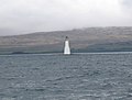 Skervuile Lighthouse, Sound of Jura - geograph.org.uk - 173119.jpg 640 × 488; 57 KB
-
 Skervuile Rocks, Sound of Jura - geograph.org.uk - 41371.jpg 640 × 480; 74 KB
-
 Sound of Jura from A846 - geograph.org.uk - 448854.jpg 640 × 480; 104 KB


