Category:South Cadbury
Deutsch: South Cadbury ist ein Ort in der englischen Grafschaft Somerset, etwa zwölf Kilometer nordöstlich von Yeovil. Man vermutet, dass in der Gegend die Schlacht von Camlann stattgefunden hat (wie auch bei Camelford in Cornwall). Zudem könnte das nahegelegene Cadbury Castle das sagenhafte Camelot sein, der Herrschaftssitz von König Artus.
English: South Cadbury is a village in the civil parish of South Cadbury and Sutton Montis in the South Somerset council area of the English county of Somerset.
Nederlands: South Cadbury is een plaats in het bestuurlijke gebied South Somerset, in het Engelse graafschap Somerset. De plaats telt 264 inwoners.
village in Somerset, UK  | |||||
| Upload media | |||||
| Instance of | |||||
|---|---|---|---|---|---|
| Location | South Cadbury and Sutton Montis, South Somerset, Somerset, South West England, England | ||||
 | |||||
Subcategories
This category has only the following subcategory.
S
Media in category "South Cadbury"
The following 31 files are in this category, out of 31 total.
-
 A303 looking east - geograph.org.uk - 486259.jpg 640 × 477; 88 KB
-
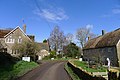 Church Road entering South Cadbury - geograph.org.uk - 3884986.jpg 3,776 × 2,520; 4.11 MB
-
 CNP 3242 (7026987329).jpg 1,024 × 685; 568 KB
-
 Collection of the Museum of Somerset, Taunton 07.jpg 5,152 × 3,864; 4.3 MB
-
 No parking - geograph.org.uk - 486286.jpg 640 × 477; 95 KB
-
 South Cadbury - geograph.org.uk - 2009030.jpg 4,416 × 3,312; 2.81 MB
-
 South Cadbury, towards Cadbury Castle - geograph.org.uk - 2968250.jpg 640 × 427; 387 KB
-
 South Cadbury, towards Parrock Hill - geograph.org.uk - 2968256.jpg 640 × 427; 336 KB
-
-

-

-
 Wonders of Spring! CNP 3296 (6880894904).jpg 1,024 × 685; 327 KB
-
 A reflective walk - geograph.org.uk - 486282.jpg 640 × 477; 124 KB
-
 Approaching South Cadbury - geograph.org.uk - 486266.jpg 640 × 477; 73 KB
-

-
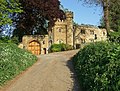
 Castle gateway - geograph.org.uk - 486327.jpg 640 × 477; 127 KB
-
 Descent from Cadbury Castle - geograph.org.uk - 486294.jpg 640 × 477; 130 KB
-
 Ford near Eastcombe Farm - geograph.org.uk - 428840.jpg 640 × 477; 119 KB
-
 Local destinations - geograph.org.uk - 486243.jpg 640 × 477; 65 KB
-
 Maidenhair tree - detail - geograph.org.uk - 195161.jpg 640 × 480; 92 KB
-
 Maidenhair tree, South Cadbury - geograph.org.uk - 195168.jpg 480 × 640; 114 KB
-
 Penhill farm - geograph.org.uk - 560883.jpg 640 × 425; 80 KB
-
 Ploughed field hillside - geograph.org.uk - 560876.jpg 640 × 425; 81 KB
-
 Road approaching Five Acres - geograph.org.uk - 560873.jpg 640 × 425; 96 KB
-
 Road junction south of Cadbury Castle - geograph.org.uk - 486334.jpg 640 × 477; 135 KB
-
 The Camelot, South Cadbury - geograph.org.uk - 476502.jpg 640 × 480; 78 KB
-
 The Camelot, South Cadbury - geograph.org.uk - 486269.jpg 640 × 477; 75 KB
-
 The Crescent, Compton Pauncefoot - geograph.org.uk - 476484.jpg 640 × 480; 114 KB
-
 The Old Crossroads at Chapel Cross - geograph.org.uk - 424330.jpg 640 × 480; 171 KB
-
 The Old Rectory, Compton Pauncefoot - geograph.org.uk - 476467.jpg 640 × 480; 123 KB
-


.jpg)


_-_geograph.org.uk_-_420934.jpg)


.jpg)


