Category:South Petherton

village and civil parish in South Somerset, England  | |||||
| Upload media | |||||
| Instance of | |||||
|---|---|---|---|---|---|
| Location | South Somerset, Somerset, South West England, England | ||||
| Population |
| ||||
| Said to be the same as | South Petherton (Wikimedia duplicated page, civil parish) | ||||
| official website | |||||
 | |||||
English: South Petherton is a village and civil parish on the River Parrett in the South Somerset district of Somerset, England. It is from East Lambrook, Martock and Lopen.
فارسی: رده:روستاهای سامرست
Suomi: South Petherton on suuri kylä Lounais-Englannissa. Siellä asuu noin 3 200 ihmistä.
Français : South Petherton est une ville et une paroisse civile du Somerset, en Angleterre. Elle est située sur le fleuve Parrett, à huit kilomètres à l'est de la ville d'Ilminster. Administrativement, elle relève du district de South Somerset. Au moment du recensement de 2011, elle comptait .
Latina: South Petherton est oppidum Somersetensis comitatus in Anglia occidentali situm. Ibi nundinae tenebantur ab anno 1044, mercatus autem ab anno 1213.
Nederlands: South Petherton is een plaats en civil parish in het bestuurlijke gebied South Somerset, in het Engelse graafschap Somerset met 3222 inwoners.
Polski: South Petherton – miasto w Anglii, w hrabstwie Somerset, w dystrykcie South Somerset. Leży 59 km na południe od centrum Bristol i 197 km na zachód od Londynu. W 2002 miasto liczyło 3222 mieszkańców.
Português: South Petherton é uma vila no sudoeste do Reino Unido. Sua população é de 3 200 habitantes.
Simple English: South Petherton is a small town in Somerset, a county in England. Over 4, 000 people live there.
Svenska: South Petherton är en by och en civil parish i South Somerset i Somerset i England. Orten har 3 367 invånare (2011). Byn nämndes i Domedagsboken (Domesday Book) år 1086, och kallades då Sudperet/Sutpedret/Sutperret/Sutpetret/Sudperetone/Sutperettona.
Subcategories
This category has the following 7 subcategories, out of 7 total.
Media in category "South Petherton"
The following 200 files are in this category, out of 379 total.
(previous page) (next page)-
 'Under Sheriff's Office' South Petherton - geograph.org.uk - 5486037.jpg 2,425 × 1,914; 1.86 MB
-
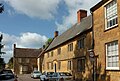
 12, St. James's Street, South Petherton (geograph 5713072).jpg 1,024 × 768; 149 KB
-
 12-14 Roundwell Street.jpg 4,288 × 2,848; 7.64 MB
-
 40-44 St James' Street, South Petherton - geograph.org.uk - 5462236.jpg 2,484 × 1,865; 1.92 MB
-
 A cool path near South Petherton - geograph.org.uk - 4532033.jpg 3,456 × 2,304; 1.19 MB
-
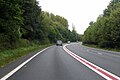
 A303 - geograph.org.uk - 5305175.jpg 640 × 426; 68 KB
-

-
 A303 bridge at Moor - geograph.org.uk - 3785614.jpg 1,024 × 743; 215 KB
-
 A303 crossing River Parrett - geograph.org.uk - 4122082.jpg 1,600 × 1,200; 1.3 MB
-
 A303 east of South Petherton - geograph.org.uk - 3022646.jpg 640 × 430; 68 KB
-
 A303 eastbound descending to River Parrett - geograph.org.uk - 4122077.jpg 1,600 × 1,200; 1.35 MB
-
 A303 heading east - geograph.org.uk - 3022636.jpg 640 × 430; 47 KB
-
 A303 heading west - geograph.org.uk - 6261534.jpg 1,024 × 684; 212 KB
-
 A303 heading west - geograph.org.uk - 6261563.jpg 1,024 × 684; 208 KB
-
 A303 heading west - geograph.org.uk - 6261575.jpg 1,024 × 684; 194 KB
-
 A303 heading west - geograph.org.uk - 6261704.jpg 1,024 × 684; 225 KB
-
 A303 in a cutting, near Watergore - geograph.org.uk - 4122036.jpg 1,600 × 1,200; 1.17 MB
-
 A303 in fog - geograph.org.uk - 4753528.jpg 640 × 399; 19 KB
-
 A303 in fog, South Petherton - geograph.org.uk - 4754679.jpg 640 × 527; 24 KB
-

-
 A303 oncoming dual carriageway - geograph.org.uk - 3726726.jpg 1,935 × 1,257; 1.13 MB
-
 A303 passing West Lodge - geograph.org.uk - 5305166.jpg 640 × 426; 79 KB
-
 A303, eastbound - geograph.org.uk - 4770260.jpg 640 × 426; 62 KB
-
 A303, South Petherton - geograph.org.uk - 4770254.jpg 640 × 319; 38 KB
-
 A303, westbound - geograph.org.uk - 5305186.jpg 640 × 476; 64 KB
-
 A303, westbound in fog - geograph.org.uk - 4753529.jpg 640 × 398; 21 KB
-
 Above Carey's Hollow - geograph.org.uk - 2477896.jpg 640 × 359; 97 KB
-
 Alley, South Petherton - geograph.org.uk - 6137215.jpg 2,848 × 4,288; 1.6 MB
-
 Allotments, Whitfield Lane, South Petherton - geograph.org.uk - 6137727.jpg 3,718 × 2,216; 1.02 MB
-
 Allotments, Whitfield Lane, South Petherton - geograph.org.uk - 6137739.jpg 4,254 × 2,585; 1.98 MB
-
 Allotments, Whitfield Lane, South Petherton - geograph.org.uk - 6137743.jpg 4,260 × 2,479; 1.27 MB
-
 Amber snail - geograph.org.uk - 450514.jpg 480 × 640; 59 KB
-
 AONB, Allotments, Whitfield Lane, South Petherton - geograph.org.uk - 6137748.jpg 4,288 × 2,848; 1.97 MB
-
 Approaching Carey's Hollow - geograph.org.uk - 6137952.jpg 4,288 × 2,848; 2.53 MB
-

-
 Arable field, South Petherton - geograph.org.uk - 6138379.jpg 4,288 × 2,848; 2.13 MB
-
 Arable field, South Petherton - geograph.org.uk - 6139856.jpg 4,288 × 2,848; 1.82 MB
-
 Autumn sown crop near Wigborough - geograph.org.uk - 5545476.jpg 1,024 × 768; 140 KB
-
 Bakery, South Petherton, Somerset - geograph.org.uk - 2005748.jpg 800 × 538; 125 KB
-
 Barn at Joylers Mill - geograph.org.uk - 5231638.jpg 1,024 × 715; 146 KB
-
 Bean field near Middle Lambrook - geograph.org.uk - 4532036.jpg 3,456 × 2,304; 1.4 MB
-
 Beaufort Gardens - geograph.org.uk - 5231204.jpg 1,024 × 734; 125 KB
-
 Ben Cross - geograph.org.uk - 5231160.jpg 1,024 × 768; 216 KB
-
 Benchmark on Blake Hall, South Petherton - geograph.org.uk - 4496238.jpg 640 × 480; 132 KB
-

-
 Benchmark on Pound Cottage, Pound - geograph.org.uk - 4496276.jpg 640 × 480; 119 KB
-

-

-

-
 Bend on the A303 - geograph.org.uk - 3022644.jpg 640 × 392; 38 KB
-
 Blake Hall, South Petherton - geograph.org.uk - 4532011.jpg 3,456 × 2,304; 766 KB
-
 Blake Hall, South Petherton - geograph.org.uk - 5486011.jpg 2,356 × 1,990; 706 KB
-
 Blake Hall, South Petherton - geograph.org.uk - 6137299.jpg 3,137 × 2,118; 704 KB
-
 Brewer's Arms - geograph.org.uk - 2478506.jpg 640 × 480; 95 KB
-
 Brewers Arms, South Petherton.jpg 4,160 × 2,773; 5.94 MB
-
 Bridge Farm - geograph.org.uk - 5232794.jpg 1,024 × 768; 166 KB
-
 Bridge Farm Drayton - geograph.org.uk - 4831493.jpg 640 × 428; 61 KB
-
 Bridge over the A303 - geograph.org.uk - 4753533.jpg 640 × 376; 26 KB
-
 Bridge over the A303 - geograph.org.uk - 4770245.jpg 640 × 395; 52 KB
-
 Bridge over the A303 - geograph.org.uk - 5305177.jpg 640 × 426; 76 KB
-

-
 Bridge parapet, A303, Frogmary Green - geograph.org.uk - 4122027.jpg 1,201 × 1,600; 1.21 MB
-
 Bridge Road south of the A303 - geograph.org.uk - 619780.jpg 640 × 480; 141 KB
-
 Bridge Way - geograph.org.uk - 6139835.jpg 4,003 × 2,679; 1.77 MB
-
 Bridgeway Cottages - geograph.org.uk - 6139860.jpg 4,279 × 2,713; 1.61 MB
-
 Bridleway to West Street - geograph.org.uk - 5231163.jpg 1,024 × 768; 251 KB
-

-
 Buildings at Joylers Mill - geograph.org.uk - 5255010.jpg 640 × 427; 96 KB
-
 Buildings on Market Square, South Petherton - geograph.org.uk - 6139447.jpg 2,663 × 3,537; 1.49 MB
-
 Buildings on Palmer Street, South Petherton - geograph.org.uk - 6137651.jpg 3,638 × 2,161; 786 KB
-
 Buildings on St James's Street, South Petherton - geograph.org.uk - 6137360.jpg 3,947 × 2,703; 1.13 MB
-
 Buildings, South Petherton - geograph.org.uk - 6137711.jpg 3,368 × 2,216; 992 KB
-
 Carey's Hollow - geograph.org.uk - 6137981.jpg 2,848 × 4,288; 2.45 MB
-
 Carey's Hollow - geograph.org.uk - 6137986.jpg 2,842 × 4,079; 1.61 MB
-
 Carey's Hollow - geograph.org.uk - 6137990.jpg 4,288 × 2,848; 2.72 MB
-
 Carey's Hollow - geograph.org.uk - 6137999.jpg 2,848 × 4,288; 2.69 MB
-

-
 Cherry Tree at Stoodham - geograph.org.uk - 808830.jpg 640 × 480; 100 KB
-
 Church House, South Petherton - geograph.org.uk - 4532012.jpg 3,456 × 2,304; 4.69 MB
-
 Church of St Peter and St Paul, South Petherton - geograph.org.uk - 6139339.jpg 2,842 × 4,142; 1.73 MB
-
 Church of St Peter and St Paul, South Petherton - geograph.org.uk - 6300913.jpg 2,848 × 4,288; 1.83 MB
-
 Church Parade, South Petherton (geograph 6137195).jpg 3,682 × 2,473; 916 KB
-
 Churchyard and Church Rooms, South Petherton (geograph 5713061).jpg 1,024 × 768; 125 KB
-
 Churchyard and The Surgery, South Petherton (geograph 6137277).jpg 4,288 × 2,848; 1.42 MB
-
 Churchyard, South Petherton - geograph.org.uk - 6137135.jpg 4,288 × 2,639; 1.88 MB
-
 Churchyard, South Petherton - geograph.org.uk - 6139328.jpg 4,288 × 2,848; 2.21 MB
-
 Churchyard, South Petherton - geograph.org.uk - 6139350.jpg 4,288 × 2,848; 2.28 MB
-
 Coke House, South Petherton - geograph.org.uk - 5486006.jpg 2,531 × 1,975; 2.31 MB
-
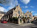
 Coke Memorial Methodist Church, South Petherton - geograph.org.uk - 5462246.jpg 2,311 × 1,973; 1.55 MB
-
 Coke Memorial Methodist Church, South Petherton - geograph.org.uk - 6139098.jpg 2,484 × 3,823; 844 KB
-
 Coke Memorial Methodist Church, South Petherton - geograph.org.uk - 6301051.jpg 2,675 × 3,569; 1.02 MB
-
 Combine Harvester - geograph.org.uk - 252804.jpg 640 × 480; 84 KB
-
 Compton Durville, Impressive Tree Line - geograph.org.uk - 4782243.jpg 1,200 × 729; 1.09 MB
-
 Compton Road, South Petherton - geograph.org.uk - 6137704.jpg 4,288 × 2,848; 1.59 MB
-
 Compton Road, South Petherton - geograph.org.uk - 6138110.jpg 4,288 × 2,500; 999 KB
-
 Compton Street - geograph.org.uk - 2478493.jpg 640 × 480; 87 KB
-
 Corner of Market Square, South Petherton (geograph 6137325).jpg 3,911 × 2,601; 1,018 KB
-
 Cottages at Compton Durville - geograph.org.uk - 3264787.jpg 640 × 480; 59 KB
-
 Cottages in Watergore - geograph.org.uk - 4191050.jpg 1,600 × 1,200; 1.26 MB
-
 Country Lane near Wigborough - geograph.org.uk - 5166979.jpg 640 × 428; 90 KB
-
 Creedy Bridge - geograph.org.uk - 1503736.jpg 640 × 480; 87 KB
-
 Cultivated field near Fouts Cross - geograph.org.uk - 2477886.jpg 640 × 359; 94 KB
-
 Daubeney tomb, St Peter and St Paul Church - geograph.org.uk - 5461170.jpg 2,523 × 1,825; 2.07 MB
-
 David Hall, South Petherton - geograph.org.uk - 1157085.jpg 640 × 480; 108 KB
-
 David Hall, South Petherton - geograph.org.uk - 5485987.jpg 2,676 × 1,894; 2.09 MB
-
 David Hall, South Petherton.jpg 4,492 × 3,369; 8.08 MB
-
 Diamond Jubilee fountain, South Petherton - geograph.org.uk - 4532013.jpg 2,304 × 3,456; 1.02 MB
-

-

-

-
 Direction Sign - Signpost in Over Stratton - geograph.org.uk - 6094555.jpg 1,128 × 1,641; 119 KB
-
 Direction Sign – Signpost - geograph.org.uk - 6591408.jpg 1,024 × 694; 230 KB
-
 Dumping ground, South Petherton - geograph.org.uk - 6138531.jpg 4,288 × 2,848; 2.6 MB
-
 Dutchies Orchard, South Petherton - geograph.org.uk - 4532014.jpg 3,456 × 2,304; 1.42 MB
-
 East Lambrook Bridge and Water Street - geograph.org.uk - 4532038.jpg 3,456 × 2,304; 1.31 MB
-

-

-
 Esso service station, South Petherton - geograph.org.uk - 5171389.jpg 1,024 × 868; 161 KB
-
 Farm track, west of Shapway - geograph.org.uk - 5231179.jpg 1,024 × 795; 226 KB
-
 Field and hedge near South Petherton - geograph.org.uk - 6137150.jpg 4,288 × 2,848; 2.21 MB
-
 Field by the Parrett - geograph.org.uk - 1503768.jpg 640 × 480; 90 KB
-
 Field by Whitfield Lane, South Petherton - geograph.org.uk - 6137722.jpg 4,288 × 2,848; 2.35 MB
-
 Field by Whitfield Lane, South Petherton - geograph.org.uk - 6137725.jpg 4,288 × 2,848; 1.79 MB
-
 Field Lane - geograph.org.uk - 5122442.jpg 1,024 × 768; 324 KB
-
 Field near Broadmead - geograph.org.uk - 6137733.jpg 4,288 × 2,848; 1.86 MB
-
 Field Side Brook - geograph.org.uk - 4839902.jpg 640 × 428; 118 KB
-

-

-
 Fives Wall in South Petherton.jpg 4,288 × 2,848; 6.46 MB
-
 Flaxdrayton Farm - geograph.org.uk - 5166964.jpg 640 × 428; 72 KB
-
 Flaxdrayton Farm - geograph.org.uk - 5232759.jpg 1,024 × 768; 164 KB
-
 Flaxdrayton Farmhouse - geograph.org.uk - 5232783.jpg 1,024 × 785; 232 KB
-
 Footbridge Over Lambrook Brook - geograph.org.uk - 921470.jpg 640 × 480; 125 KB
-
 Footpath near Manor at South Petherton - geograph.org.uk - 4532025.jpg 3,456 × 2,304; 1.41 MB
-
 Footpath signpost, Compton Road, South Petherton - geograph.org.uk - 6138141.jpg 4,288 × 2,848; 1.18 MB
-
 Footpath, South Petherton - geograph.org.uk - 6138360.jpg 4,288 × 2,848; 2.78 MB
-
 Footpath, South Petherton - geograph.org.uk - 6138387.jpg 4,288 × 2,848; 2.19 MB
-
 Footpath, South Petherton - geograph.org.uk - 6138535.jpg 2,831 × 4,094; 1.67 MB
-
 Footpath, South Petherton - geograph.org.uk - 6138543.jpg 4,288 × 2,848; 1.6 MB
-
 Footpath, South Petherton - geograph.org.uk - 6138601.jpg 4,288 × 2,848; 2.68 MB
-
 Footpath, South Petherton - geograph.org.uk - 6138610.jpg 4,288 × 2,848; 1.6 MB
-
 Former Crown Hotel, South Petherton - geograph.org.uk - 6139432.jpg 2,225 × 3,540; 1.13 MB
-
 Former National Westminster Bank, South Petherton - geograph.org.uk - 5462983.jpg 3,008 × 2,000; 2.63 MB
-

-
 Fosse Way - geograph.org.uk - 4831472.jpg 640 × 428; 128 KB
-
 Freshly Tilled Field - geograph.org.uk - 3447787.jpg 640 × 480; 89 KB
-
 Grass field, South Petherton - geograph.org.uk - 6138406.jpg 4,288 × 2,848; 2.21 MB
-
 Grass field, South Petherton - geograph.org.uk - 6138576.jpg 4,288 × 2,632; 1.33 MB
-
 Grass field, South Petherton - geograph.org.uk - 6138595.jpg 4,288 × 2,848; 1.4 MB
-
 Grass field, South Petherton - geograph.org.uk - 6138604.jpg 3,992 × 2,508; 2.53 MB
-
 Harding monument, South Petherton (geograph 6139260).jpg 4,288 × 2,848; 2.74 MB
-
 Harding's Court, South Petherton - geograph.org.uk - 6137668.jpg 4,288 × 2,848; 2.73 MB
-
 Hayes End Manor.jpg 6,000 × 3,429; 12.4 MB
-
 Hayes End, South Petherton - geograph.org.uk - 6137171.jpg 4,288 × 2,848; 1.72 MB
-
 Hele Lane - geograph.org.uk - 2478497.jpg 480 × 640; 98 KB
-
 Hidden vehicle, South Petherton footpath - geograph.org.uk - 6138525.jpg 4,288 × 2,848; 2.83 MB
-
 Holbrook House - geograph.org.uk - 1206479.jpg 640 × 480; 79 KB
-

-
 House on Compton Road, South Petherton - geograph.org.uk - 6138092.jpg 2,848 × 4,288; 1.43 MB
-
 House on Lopen Lane - geograph.org.uk - 5122435.jpg 1,024 × 831; 226 KB
-
 House on North Street, South Petherton - geograph.org.uk - 6138676.jpg 4,288 × 2,848; 1.6 MB
-
 House on North Street, South Petherton - geograph.org.uk - 6138958.jpg 3,754 × 2,519; 1.68 MB
-
 House on North Street, South Petherton - geograph.org.uk - 6139041.jpg 3,554 × 2,444; 899 KB
-
 Houses at Compton Durville - geograph.org.uk - 5231187.jpg 1,024 × 817; 156 KB
-
 Houses in Over Stratton - geograph.org.uk - 4830629.jpg 640 × 428; 67 KB
-
 Houses on Compton Rd - geograph.org.uk - 3447796.jpg 640 × 480; 80 KB
-
 Houses on Drayton Lane - geograph.org.uk - 5232800.jpg 1,024 × 768; 199 KB
-
 Houses on Harp Road, Watergore, Somerset - geograph.org.uk - 3402778.jpg 1,600 × 1,013; 340 KB
-
 Houses on North Street - geograph.org.uk - 5231153.jpg 1,024 × 768; 141 KB
-
 Houses on North Street, South Petherton - geograph.org.uk - 6139067.jpg 3,061 × 2,245; 750 KB
-
 Houses, Whitfield Lane, South Petherton - geograph.org.uk - 6137724.jpg 4,288 × 2,848; 1.4 MB
-

-
 Joyler's Mill, South Petherton - geograph.org.uk - 902947.jpg 640 × 480; 81 KB
-
 Joylers Mill - geograph.org.uk - 5231512.jpg 1,024 × 813; 181 KB
-
 Joylers Mill HDR (18188250708).jpg 3,165 × 2,551; 5.02 MB
-
 Joylers Mill.jpg 4,288 × 2,848; 7.89 MB
-
 Jubilee fountain, South Petherton - geograph.org.uk - 5463010.jpg 1,993 × 2,060; 1.93 MB
-
 Junction on North Street, South Petherton - geograph.org.uk - 6138839.jpg 4,288 × 2,848; 1.37 MB
-
 K6 phone box in South Petherton.jpg 4,236 × 2,824; 6.84 MB
-
 Knapp House, South Petherton - geograph.org.uk - 5463367.jpg 2,641 × 1,958; 2.47 MB
-
 Lamb Cottage, a listed building South Petherton, Somerset.jpg 4,288 × 2,848; 7.35 MB
-
 Lamb Cottage, South Petherton - geograph.org.uk - 6137674.jpg 4,187 × 2,316; 1.33 MB
-
 Lane through Drayton - geograph.org.uk - 5232769.jpg 1,024 × 831; 252 KB
-
 Lay-by for eastbound A303, South Petherton - geograph.org.uk - 4122062.jpg 1,600 × 1,200; 1.13 MB
-
 Listed buildings, South Petherton (geograph 6137698).jpg 3,612 × 2,385; 1.02 MB
-
 Listed buildings, South Petherton (geograph 6139113).jpg 3,604 × 2,302; 1.11 MB
-
 Little Lopen Lane - geograph.org.uk - 5460441.jpg 1,024 × 795; 272 KB
-
 Little Lopen Lane - geograph.org.uk - 5460445.jpg 1,024 × 768; 312 KB
-
 Little Lopen Lane - geograph.org.uk - 5913157.jpg 1,024 × 768; 171 KB
-
 Little Lopen Lane - geograph.org.uk - 5913166.jpg 1,024 × 735; 219 KB
-

-
 Maize near Drayton - geograph.org.uk - 1503723.jpg 640 × 446; 76 KB
-
 Market Square, South Petherton - geograph.org.uk - 5650967.jpg 1,024 × 683; 305 KB
-
 Market Square, South Petherton - geograph.org.uk - 6139140.jpg 2,068 × 2,712; 504 KB
-
 Market Square, South Petherton - geograph.org.uk - 6139168.jpg 3,539 × 2,425; 991 KB
-
 Market Square, South Petherton - geograph.org.uk - 6139414.jpg 2,324 × 3,513; 711 KB
-
 Meadow by Whitfield Lane - geograph.org.uk - 6137726.jpg 2,848 × 4,288; 1.99 MB
-
 Memorial Methodist Church, South Petherton - geograph.org.uk - 5231135.jpg 1,024 × 768; 155 KB
-
 Methodist church, South Petherton - geograph.org.uk - 6137455.jpg 3,551 × 2,184; 965 KB
-
 Minor road crossing A303 at Watergore - geograph.org.uk - 4122050.jpg 1,600 × 1,198; 1.17 MB

.jpg)


.jpg)
.jpg)
.jpg)


.jpg)


.jpg)


.jpg)


.jpg)
.jpg)


