Category:South Willesborough and Newtown
English: South Willesborough and Newtown is a civil parish in the Ashford district, in the county of Kent, England.
civil parish in Ashford, Kent, England | |||||
| Upload media | |||||
| Instance of | |||||
|---|---|---|---|---|---|
| Location | Ashford, Kent, South East England, England | ||||
 | |||||
Subcategories
This category has the following 6 subcategories, out of 6 total.
Media in category "South Willesborough and Newtown"
The following 99 files are in this category, out of 99 total.
-
 Ashford Business Park - geograph.org.uk - 4028675.jpg 640 × 382; 50 KB
-
 Ashford Designer Outlet - geograph.org.uk - 5775452.jpg 640 × 426; 46 KB
-
 Ashford Designer Outlet - geograph.org.uk - 5805528.jpg 640 × 426; 39 KB
-

-
 Ashford sidings - geograph.org.uk - 5805531.jpg 640 × 426; 65 KB
-
 Ashford sidings - geograph.org.uk - 5805532.jpg 640 × 426; 54 KB
-

-
 Bad Munstereifel Road Bridge - geograph.org.uk - 4028680.jpg 640 × 430; 70 KB
-
 Bath Road - geograph.org.uk - 4266599.jpg 640 × 480; 47 KB
-
 Big field - geograph.org.uk - 5226059.jpg 640 × 426; 40 KB
-
 Boys Hall Ancient Monument Information Board - geograph.org.uk - 1889711.jpg 3,072 × 2,304; 1.74 MB
-
 Boys Hall Moat - geograph.org.uk - 1889727.jpg 3,072 × 2,304; 2.01 MB
-
 Boys Hall Road bridge - geograph.org.uk - 4028671.jpg 640 × 460; 63 KB
-
 Bridge to The Albion - geograph.org.uk - 2957924.jpg 640 × 430; 40 KB
-
 Bridleway to Fairview Drive - geograph.org.uk - 1898290.jpg 3,072 × 2,304; 2.96 MB
-
 Car park by the railway - geograph.org.uk - 3272017.jpg 640 × 337; 65 KB
-
 Carpet warehouse on Crowbridge Road, Sevington - geograph.org.uk - 4907619.jpg 2,048 × 1,536; 1.49 MB
-
 Churchill public house, for sale - geograph.org.uk - 2752326.jpg 640 × 480; 84 KB
-
 Churchill sign - geograph.org.uk - 2436666.jpg 480 × 640; 86 KB
-

-
 Cudworth Road, Sevington - geograph.org.uk - 2752349.jpg 640 × 480; 71 KB
-
 D ^ D Autos - geograph.org.uk - 2957931.jpg 640 × 430; 37 KB
-
 D ^ D Autos - geograph.org.uk - 2957933.jpg 640 × 430; 37 KB
-
 Departing Ashford - geograph.org.uk - 2074192.jpg 1,559 × 937; 792 KB
-
 Dover Bound - geograph.org.uk - 2074196.jpg 1,578 × 1,038; 942 KB
-
 Elevated HS1 - geograph.org.uk - 4028667.jpg 640 × 430; 82 KB
-
 Elevated HS1 - geograph.org.uk - 4028668.jpg 640 × 430; 77 KB
-
 Elevated HS1 - geograph.org.uk - 4188876.jpg 640 × 430; 94 KB
-
 Elevated HS1 - geograph.org.uk - 4265126.jpg 640 × 430; 76 KB
-
 Ellson Close - geograph.org.uk - 5023626.jpg 3,264 × 2,448; 3.88 MB
-
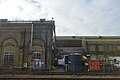
 Engine Shed, Ashford - geograph.org.uk - 5775456.jpg 640 × 426; 57 KB
-
 Engine Shed, Ashford - geograph.org.uk - 5775457.jpg 640 × 426; 60 KB
-
 Engine Shed, Ashford - geograph.org.uk - 5775458.jpg 640 × 426; 66 KB
-
 Engine shed, Ashford - geograph.org.uk - 5775705.jpg 640 × 425; 50 KB
-
 Engine Shed, Ashford - geograph.org.uk - 5805536.jpg 640 × 426; 60 KB
-
 Engine Shed, Ashford - geograph.org.uk - 5805537.jpg 640 × 425; 67 KB
-
 Engine Shed, Ashford - geograph.org.uk - 5805540.jpg 640 × 425; 64 KB
-
 Engine sheds, Ashford - geograph.org.uk - 5805534.jpg 640 × 426; 53 KB
-

-
 Erection of residential buildings, Newtown Road - geograph.org.uk - 4299405.jpg 1,132 × 822; 183 KB
-
 Fairview Drive - geograph.org.uk - 2435972.jpg 7,781 × 2,719; 6.24 MB
-
 Flying geese feature - geograph.org.uk - 4568051.jpg 3,264 × 2,448; 3.74 MB
-
 Footbridge over HS1 - geograph.org.uk - 4028672.jpg 640 × 430; 71 KB
-
 Footbridges over the railway - geograph.org.uk - 1889739.jpg 3,072 × 2,304; 1.4 MB
-
 Footpath in Orbital Business Park - geograph.org.uk - 1889701.jpg 3,072 × 2,304; 1.92 MB
-
 Former Railway Works, Ashford - geograph.org.uk - 5867933.jpg 1,024 × 768; 206 KB
-

-
 GSE Design and Build Headquarters - geograph.org.uk - 1889697.jpg 3,072 × 2,304; 1.39 MB
-
 Harold Way - geograph.org.uk - 5025025.jpg 3,264 × 2,448; 2.08 MB
-
 Herbert Road, , Ashford - geograph.org.uk - 2752359.jpg 640 × 480; 53 KB
-
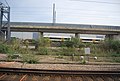
 High Speed 1 - geograph.org.uk - 3442236.jpg 640 × 430; 52 KB
-
 High Speed 1 - geograph.org.uk - 3442240.jpg 640 × 430; 60 KB
-
 High Speed 1 - geograph.org.uk - 4028634.jpg 640 × 430; 78 KB
-
 High Speed 1 - geograph.org.uk - 4028635.jpg 640 × 430; 80 KB
-
 High Speed 1 - geograph.org.uk - 4028670.jpg 640 × 310; 45 KB
-

-
 Hoarding along Newtown Road - geograph.org.uk - 3826591.jpg 1,207 × 905; 181 KB
-
 Hoarding along Newtown Road - geograph.org.uk - 3826597.jpg 1,104 × 836; 187 KB
-
 HS 1 - geograph.org.uk - 4840400.jpg 640 × 426; 85 KB
-
 HS1 near Ashford Station - geograph.org.uk - 4188872.jpg 640 × 430; 86 KB
-
 HS1, Ashford - geograph.org.uk - 5158091.jpg 640 × 360; 54 KB
-
 HS1, Ashford - geograph.org.uk - 5158105.jpg 640 × 404; 66 KB
-
 HS1, Ashford - geograph.org.uk - 5158108.jpg 640 × 356; 48 KB
-
 HS1, Ashford - geograph.org.uk - 5158260.jpg 640 × 426; 62 KB
-

-
 Kirtley Way - geograph.org.uk - 5023584.jpg 3,264 × 2,448; 1.64 MB
-
 Kissing Gate near Boys Hall Ancient Monument - geograph.org.uk - 1889707.jpg 3,072 × 2,304; 1.55 MB
-
 Land by the railway line - geograph.org.uk - 2703877.jpg 640 × 430; 48 KB
-
 Luggage To The Fore - geograph.org.uk - 2074209.jpg 1,578 × 1,038; 1,014 KB
-
 Maintenance train, Ashford - geograph.org.uk - 4265130.jpg 640 × 430; 50 KB
-
 Maintenance train, Ashford - geograph.org.uk - 5775454.jpg 640 × 426; 61 KB
-
 Meggitt Defence Systems, Sevington - geograph.org.uk - 4903408.jpg 2,048 × 1,536; 1.49 MB
-
 Network Rail, Ashford - geograph.org.uk - 5775455.jpg 640 × 426; 37 KB
-
 New estate on Newtown Road, Willesborough - geograph.org.uk - 4907620.jpg 1,970 × 1,426; 674 KB
-
 New industrial units by the railway - geograph.org.uk - 2703879.jpg 640 × 430; 50 KB
-
 New Town - geograph.org.uk - 5226060.jpg 640 × 426; 55 KB
-
 New Town Green, Ashford - geograph.org.uk - 2927575.jpg 816 × 612; 177 KB
-
 Newtown Road, Ashford - geograph.org.uk - 2929011.jpg 792 × 586; 125 KB
-
 PC World, Ashford Business Park - geograph.org.uk - 4028677.jpg 640 × 430; 58 KB
-
 Railway and Train to Ashford - geograph.org.uk - 1889776.jpg 3,072 × 2,304; 1.74 MB
-
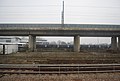
 Railway lines at Ashford International - geograph.org.uk - 3667385.jpg 1,408 × 994; 293 KB
-
 Railways from Ashford to Folkestone - geograph.org.uk - 1889753.jpg 3,072 × 2,304; 1.7 MB
-
 Railways to Ashford - geograph.org.uk - 1889763.jpg 3,072 × 2,304; 1.92 MB
-
 Samuel Peto Way - geograph.org.uk - 5023600.jpg 3,264 × 2,448; 1.7 MB
-
 Samuel Peto Way - geograph.org.uk - 5025036.jpg 3,264 × 2,448; 1.71 MB
-
 Samuel Peto Way - geograph.org.uk - 5025052.jpg 3,264 × 2,448; 1.6 MB
-
 Site of former Klondyke Workshops - geograph.org.uk - 2927611.jpg 792 × 582; 150 KB
-
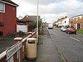
 South Willesborough - geograph.org.uk - 3226430.jpg 640 × 262; 63 KB
-
 South Willesborough - geograph.org.uk - 3272015.jpg 640 × 375; 51 KB
-
 South Willesborough - geograph.org.uk - 5226295.jpg 640 × 371; 40 KB
-
 South Willesborough - geograph.org.uk - 5867026.jpg 1,024 × 681; 135 KB
-
 Surtees Close, Sevington - geograph.org.uk - 2752323.jpg 640 × 480; 84 KB
-
 The Boulevard - geograph.org.uk - 2435980.jpg 640 × 305; 65 KB
-
 The Long Barrow - geograph.org.uk - 1898350.jpg 3,072 × 2,304; 1.57 MB
-
 The railway by Newtown Road, Willesborough - geograph.org.uk - 4904279.jpg 2,048 × 1,536; 968 KB
-
 Town houses on East Stour Way - geograph.org.uk - 1898311.jpg 3,072 × 2,304; 1.79 MB
-
 Turning for Orbital Park, Ashford - geograph.org.uk - 5659683.jpg 1,024 × 665; 85 KB
-
 View from Sevington Loop - geograph.org.uk - 2027333.jpg 1,024 × 768; 185 KB
-
 Wasteland by the railway line - geograph.org.uk - 2957946.jpg 640 × 430; 33 KB


_-_geograph.org.uk_-_4016670.jpg)


