Category:Southern Downs Region
local government area of Queensland, Australia | |||||
| Upload media | |||||
| Instance of | |||||
|---|---|---|---|---|---|
| Location | Queensland, AUS | ||||
| Capital | |||||
| Legislative body |
| ||||
| Inception |
| ||||
| Population |
| ||||
| Area |
| ||||
| Elevation above sea level |
| ||||
| official website | |||||
 | |||||
English: Southern Downs Region is a local government area on the Darling Downs, Queensland, Australia
Subcategories
This category has the following 63 subcategories, out of 63 total.
A
C
- Campbells Plains, Queensland (2 F)
- Cherry Gully, Queensland (1 F)
- Clintonvale, Queensland (1 F)
- Cottonvale, Queensland (1 F)
- Cunningham, Queensland (11 F)
D
- Danderoo, Queensland (3 F)
E
- Emu Vale, Queensland (3 F)
F
- Fleurbaix, Queensland (3 F)
G
- Glen Alpin, Queensland (1 F)
- Glen Niven, Queensland (1 F)
- Glenlyon, Queensland (2 F)
J
- Junabee, Queensland (1 F)
K
- Karara, Queensland (5 F)
- Kyoomba, Queensland (2 F)
L
- Lyra, Queensland (2 F)
M
- Mount Colliery, Queensland (5 F)
- Mount Marshall, Queensland (1 F)
N
- North Branch, Queensland (1 F)
P
- Pratten, Queensland (1 F)
Q
- Queen Mary Falls (16 F)
S
- Severnlea, Queensland (1 F)
- Somme, Queensland (2 F)
- Shire of Stanthorpe (4 F)
T
- The Head, Queensland (3 F)
U
V
- Victoria Hill, Queensland (1 F)
W
- Willowvale, Queensland (1 F)
Y
Media in category "Southern Downs Region"
The following 5 files are in this category, out of 5 total.
-
 Grosvenor's Chair Lookout, Spicers Gap Road Conservation Park.JPG 4,928 × 3,264; 6.9 MB
-
 Off For A Walk (137820113).jpeg 2,048 × 1,366; 1.63 MB
-

-
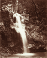
 Queensland State Archives 3990 Emu Vale Waterfalls 404 ft 7 May 1894.png 579 × 720; 893 KB
-

.jpeg)


