Category:Southwell, Nottinghamshire

town in the English country of Nottinghamshire  | |||||
| Upload media | |||||
| Instance of | |||||
|---|---|---|---|---|---|
| Location | Newark and Sherwood, Nottinghamshire, East Midlands, England | ||||
| Population |
| ||||
| Said to be the same as | Southwell (Wikimedia duplicated page, civil parish) | ||||
| official website | |||||
 | |||||
English: Southwell is a small town in Nottinghamshire, England. It is best known as the site of Southwell Minster, the seat of the Church of England diocese that covers Nottinghamshire. Its population is approx. 6,900.
Română: Southwell este un oraş în comitatul Nottinghamshire, regiunea East Midlands, Anglia. Oraşul se află în districtul Newark and Sherwood.
Subcategories
This category has the following 10 subcategories, out of 10 total.
Media in category "Southwell, Nottinghamshire"
The following 200 files are in this category, out of 776 total.
(previous page) (next page)-
 6 Market Place - geograph.org.uk - 6119528.jpg 1,024 × 683; 247 KB
-
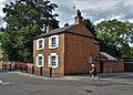 A corner house in Southwell - geograph.org.uk - 5864789.jpg 5,184 × 3,696; 5.09 MB
-
 A glimpse of Southwell Minster - geograph.org.uk - 4318560.jpg 800 × 533; 98 KB
-
 A recently ploughed field near Southwell - geograph.org.uk - 4321603.jpg 4,000 × 2,248; 5.29 MB
-
 A reflective window in Southwell - geograph.org.uk - 5864808.jpg 4,961 × 3,708; 3.27 MB
-
 A612 Nottingham Road south of Southwell - geograph.org.uk - 4147216.jpg 1,024 × 768; 114 KB
-

-
 Across the valley - geograph.org.uk - 2768271.jpg 640 × 427; 85 KB
-
 Across the valley - geograph.org.uk - 2768282.jpg 640 × 427; 79 KB
-
 Allenby Road towards the B6386 - geograph.org.uk - 2657221.jpg 1,600 × 1,200; 502 KB
-
 Allotments off Crink Lane, Southwell (1) - geograph.org.uk - 5817360.jpg 800 × 533; 134 KB
-
 Allotments off Crink Lane, Southwell - geograph.org.uk - 5817362.jpg 800 × 533; 107 KB
-
 An extremely muddy Robin Hood Way - geograph.org.uk - 4318556.jpg 800 × 533; 140 KB
-
 Archbishop's Palace - geograph.org.uk - 5122660.jpg 1,600 × 1,064; 325 KB
-
 Asian food outlets, King Street, Southwell - geograph.org.uk - 5864792.jpg 4,259 × 3,666; 3.24 MB
-
 At the 4 Furlong mark - geograph.org.uk - 4735505.jpg 3,072 × 1,728; 1.42 MB
-

-
 Autumn sown wheat nearly ready for harvesting - geograph.org.uk - 5464976.jpg 1,024 × 768; 238 KB
-
 B6386 Southwell Road - geograph.org.uk - 4808847.jpg 3,696 × 2,448; 2.26 MB
-
 B6386 towards Oxton - geograph.org.uk - 2657228.jpg 1,600 × 1,200; 314 KB
-
 B6386 towards Oxton - geograph.org.uk - 2657232.jpg 1,600 × 1,200; 445 KB
-
 Bamboo canes growing beside River Greet - geograph.org.uk - 4318796.jpg 4,000 × 2,248; 5.77 MB
-
-
 Bamboos and teasels beside the River Greet - geograph.org.uk - 4318817.jpg 3,361 × 2,247; 6.06 MB
-
 Becher's Walk - geograph.org.uk - 851795.jpg 640 × 426; 95 KB
-
 Beck Dyke dives below Fiskerton Road - geograph.org.uk - 4735496.jpg 3,072 × 1,728; 2.27 MB
-
 Beck Dyke, north west of Morton - geograph.org.uk - 3974666.jpg 1,024 × 768; 315 KB
-
 Bench Mark, Normanton crossroads - geograph.org.uk - 3429595.jpg 1,280 × 960; 407 KB
-
 Bench Mark, Potwell Dyke bridge - geograph.org.uk - 3429134.jpg 1,280 × 960; 393 KB
-
 Bench mark, Southwell Drill Hall - geograph.org.uk - 3427035.jpg 1,280 × 960; 248 KB
-
 Bishops Manor - geograph.org.uk - 4318564.jpg 800 × 533; 105 KB
-
 Bittersweet (Solanum dulcamara) - geograph.org.uk - 851557.jpg 640 × 426; 42 KB
-
 Boundary Wall, Easthorpe House, Southwell.jpg 1,280 × 960; 458 KB
-
 Brackenhurst Campus (1) - geograph.org.uk - 4147221.jpg 1,024 × 768; 184 KB
-
 Brackenhurst Campus (2) - geograph.org.uk - 4147225.jpg 1,024 × 768; 138 KB
-
 Brackenhurst Campus library - geograph.org.uk - 4318547.jpg 800 × 533; 71 KB
-

-
 Brackenhurst footpaths - geograph.org.uk - 839683.jpg 640 × 426; 89 KB
-
 Brackenhurst Hall (Nottingham Trent University Campus) - geograph.org.uk - 6267759.jpg 3,211 × 2,778; 2.34 MB
-
 Brackenhurst Hall (Nottingham Trent University Campus) - geograph.org.uk - 6267779.jpg 3,219 × 2,254; 1.29 MB
-
 Brackenhurst Hall (Nottingham Trent University Campus) - geograph.org.uk - 6267786.jpg 3,494 × 2,321; 2.08 MB
-
 Brackenhurst Hall (Nottingham Trent University Campus) - geograph.org.uk - 6268437.jpg 4,032 × 3,024; 3.65 MB
-
 Brackenhurst Hall (Nottingham Trent University Campus) - geograph.org.uk - 6268450.jpg 2,855 × 3,595; 3.8 MB
-
 Brackenhurst Hall (Nottingham Trent University Campus) - geograph.org.uk - 6268457.jpg 2,771 × 2,865; 1.94 MB
-
 Brackenhurst Hall (Nottingham Trent University Campus) - geograph.org.uk - 6268466.jpg 3,573 × 2,419; 2.31 MB
-
 Brackenhurst Hall (Nottingham Trent University Campus) - geograph.org.uk - 6269196.jpg 3,204 × 2,314; 1.67 MB
-
 Brackenhurst Hall (Nottingham Trent University Campus) - geograph.org.uk - 6269209.jpg 3,927 × 2,945; 4.86 MB
-
 Brackenhurst Hall (Nottingham Trent University Campus) - geograph.org.uk - 6270224.jpg 3,895 × 2,921; 3.85 MB
-
 Brackenhurst Hall (Nottingham Trent University Campus) - geograph.org.uk - 6270241.jpg 3,790 × 2,842; 3.91 MB
-
 Brackenhurst Hall (Nottingham Trent University Campus) - geograph.org.uk - 6270257.jpg 2,998 × 3,625; 2.89 MB
-
 Brackenhurst Hall (Nottingham Trent University Campus) - geograph.org.uk - 6270269.jpg 2,965 × 3,953; 3.23 MB
-
 Brackenhurst Hall (Nottingham Trent University Campus). - geograph.org.uk - 6267810.jpg 3,711 × 2,334; 2.26 MB
-
 Brackenhurst Lane - geograph.org.uk - 5471015.jpg 1,024 × 768; 158 KB
-
 Brick barn on Oxton Road - geograph.org.uk - 4811041.jpg 3,036 × 1,860; 2.63 MB
-
 Brickley Cottage - geograph.org.uk - 3061857.jpg 640 × 427; 86 KB
-
 Bridge across Beck Dyke, north west of Morton - geograph.org.uk - 3974670.jpg 1,024 × 768; 265 KB
-

-
 Bridleway Back to Southwell - geograph.org.uk - 140441.jpg 640 × 480; 90 KB
-
 Bridleway north of Halloughton Wood (1) - geograph.org.uk - 4826647.jpg 1,024 × 768; 171 KB
-
 Bridleway north of Halloughton Wood (2) - geograph.org.uk - 4826666.jpg 1,024 × 768; 163 KB
-
 Bridleway past Brinkley Hall Farm - geograph.org.uk - 4705575.jpg 640 × 427; 85 KB
-
 Bridleway to Dale Farm - geograph.org.uk - 1843417.jpg 640 × 480; 101 KB
-
 Brink Dance Company in rehearsal at The HopBarn .jpg 720 × 960; 51 KB
-
 Brinkley farmland - geograph.org.uk - 3061841.jpg 640 × 427; 81 KB
-
 Brinkley Hill - geograph.org.uk - 3061851.jpg 640 × 427; 95 KB
-
 Brinkley Hill towards Southwell - geograph.org.uk - 2657186.jpg 1,600 × 1,200; 584 KB
-
 Broken Gateway - geograph.org.uk - 2148445.jpg 1,024 × 768; 302 KB
-
 Burgage Green Vicinity, Southwell, Notts. - geograph.org.uk - 6224556.jpg 3,311 × 2,634; 2.02 MB
-
 Burgage Green Vicinity, Southwell, Notts. - geograph.org.uk - 6224601.jpg 4,004 × 3,003; 2.57 MB
-
 Burgage Green, Southwell, Notts. - geograph.org.uk - 6224544.jpg 3,843 × 2,881; 2.06 MB
-
 Burgage Green, Southwell, Notts. - geograph.org.uk - 6224608.jpg 3,266 × 2,805; 3.1 MB
-
 Burgage lane - geograph.org.uk - 851799.jpg 640 × 426; 96 KB
-
 Burgage Manor, Southwell - geograph.org.uk - 5864803.jpg 4,815 × 3,670; 2.6 MB
-
 Burgage Park, Southwell (1) - geograph.org.uk - 3475441.jpg 1,024 × 768; 213 KB
-
 Burgage Park, Southwell (2) - geograph.org.uk - 3475443.jpg 1,024 × 768; 198 KB
-
 Bus stop at Brackenhurst - geograph.org.uk - 839815.jpg 640 × 426; 119 KB
-
 Bus terminus, Norwood Gardens - geograph.org.uk - 838476.jpg 640 × 426; 106 KB
-
 Bus turning circle, Norwood Gardens, Southwell - geograph.org.uk - 3722633.jpg 1,024 × 768; 164 KB
-
 By Cotmoor Plantation - geograph.org.uk - 2150254.jpg 1,024 × 768; 153 KB
-

-
 Car park entrance, Hollybeck Garden Centre - geograph.org.uk - 5140932.jpg 1,024 × 768; 133 KB
-
 Caudwell House from Normanton Road - geograph.org.uk - 838601.jpg 640 × 426; 114 KB
-
 Church Street, Southwell next to the Minster - geograph.org.uk - 1425784.jpg 1,600 × 1,200; 428 KB
-
 Clock off Kings Street, Southwell - geograph.org.uk - 3574768.jpg 1,024 × 680; 195 KB
-
 Coghill Court, Southwell - geograph.org.uk - 4147175.jpg 1,024 × 768; 179 KB
-
 Comfort me with apples... - geograph.org.uk - 3823531.jpg 2,448 × 3,264; 1.59 MB
-
 Converted barn, Westhorpe (geograph 6226035).jpg 1,024 × 768; 187 KB
-
 Converted outbuildings, Westhorpe Hall - geograph.org.uk - 6226039.jpg 1,024 × 768; 186 KB
-
 Corkhill Lane - geograph.org.uk - 4817400.jpg 1,600 × 1,084; 400 KB
-
 Corkhill Lane towards Kirklington - geograph.org.uk - 2657342.jpg 1,600 × 1,200; 476 KB
-
 Corkhill Road, Normanton - geograph.org.uk - 3429640.jpg 1,280 × 960; 211 KB
-
 Cottage on the corner of The Holme and Westhorpe - geograph.org.uk - 6226045.jpg 1,024 × 768; 277 KB
-
 Cottages, King Street, Southwell (geograph 7045279).jpg 1,024 × 768; 173 KB
-
 Cranfield House, Southwell - geograph.org.uk - 6169173.jpg 5,042 × 3,786; 5.22 MB
-
 Crew Lane - geograph.org.uk - 2764763.jpg 1,024 × 768; 263 KB
-
 Cricket at Brackenhurst College - geograph.org.uk - 5817351.jpg 800 × 533; 87 KB
-
 Crink Lane near Park Hill (1) - geograph.org.uk - 4004211.jpg 1,024 × 768; 91 KB
-
 Crink Lane near Park Hill (2) - geograph.org.uk - 4004212.jpg 1,024 × 768; 109 KB
-
 Crink Lane towards Park Hill - geograph.org.uk - 2657194.jpg 1,600 × 1,200; 293 KB
-
 Crossing the Potwell Dyke - geograph.org.uk - 838795.jpg 640 × 426; 130 KB
-

-
 Crossing wires - geograph.org.uk - 2764719.jpg 1,024 × 768; 145 KB
-
 Crown Hotel Southwell 3 February 2013.JPG 4,000 × 3,000; 4.65 MB
-
 Cul-de-sac off Easthorpe - geograph.org.uk - 838770.jpg 640 × 426; 93 KB
-
 Cundy Hill - geograph.org.uk - 800014.jpg 640 × 480; 110 KB
-
 Cundy Hill, south west of Southwell - geograph.org.uk - 4826706.jpg 1,024 × 768; 99 KB
-
 Cundy Hill, Southwell - geograph.org.uk - 4966587.jpg 1,600 × 1,093; 617 KB
-
 Cut Mark, Southwell Minster - geograph.org.uk - 2717163.jpg 640 × 480; 93 KB
-
 Detail - Southwell Minster - geograph.org.uk - 5638613.jpg 960 × 1,280; 220 KB
-
 Detail of 2 Westgate, Southwell - geograph.org.uk - 4152421.jpg 640 × 381; 134 KB
-
 Dogrose (pink) - geograph.org.uk - 842560.jpg 640 × 427; 58 KB
-
 Dogrose (white) - geograph.org.uk - 842579.jpg 640 × 426; 86 KB
-
 Drive to Hopyard Farm, east of Southwell - geograph.org.uk - 5817422.jpg 800 × 533; 103 KB
-

-
 East end of Stubbins Lane, south of Southwell - geograph.org.uk - 4147210.jpg 1,024 × 768; 149 KB
-
 Edge of Oilseed Rape Field - geograph.org.uk - 815752.jpg 640 × 480; 86 KB
-

-
 Electricity pylon west of Radley Lane - geograph.org.uk - 5141017.jpg 1,024 × 768; 307 KB
-
 Empty fruit cages at Norwood Park - geograph.org.uk - 4318309.jpg 800 × 519; 168 KB
-
 Entering Southwell - geograph.org.uk - 4811633.jpg 3,696 × 2,448; 5.73 MB
-
 Entrance to Hill House, Southwell.jpg 1,280 × 960; 535 KB
-
 Entrance to Potwell Close - geograph.org.uk - 838777.jpg 640 × 426; 111 KB
-
 Entrance to Southwell Racecourse - geograph.org.uk - 4318300.jpg 4,000 × 2,248; 4.96 MB
-
 Entrance to Springfield House, Nottingham Road - geograph.org.uk - 6225964.jpg 1,024 × 768; 202 KB
-
 Entrance to the waterfowl sanctuary - geograph.org.uk - 2731032.jpg 3,648 × 2,736; 3.03 MB
-
 Entrance to the Women's Institute - geograph.org.uk - 851881.jpg 640 × 426; 100 KB
-
 Entrance, Brackenhurst Hall.jpg 1,280 × 960; 457 KB
-
-
 Fallen willow - geograph.org.uk - 6225951.jpg 1,024 × 768; 261 KB
-
 Farm track crossing the Southwell Trail - geograph.org.uk - 4679582.jpg 1,024 × 768; 255 KB
-
 Farm track near Old Radley Farm - geograph.org.uk - 2150232.jpg 1,024 × 768; 231 KB
-
 Farm track to Old Radley Farm - geograph.org.uk - 2150214.jpg 1,024 × 768; 144 KB
-
 Farmland near Cotmoor Plantation - geograph.org.uk - 1760088.jpg 640 × 480; 73 KB
-
 Farmland near Stubbins Farm - geograph.org.uk - 1760053.jpg 640 × 480; 103 KB
-
 Farmland near Westhorpe - geograph.org.uk - 852196.jpg 640 × 426; 64 KB
-
 Farmland off Fiskerton Road - geograph.org.uk - 2657187.jpg 1,600 × 1,200; 347 KB
-
 Farmland off Hockerton Road - geograph.org.uk - 2657343.jpg 1,600 × 1,200; 316 KB
-
 Farmland off Normanton Road - geograph.org.uk - 2657347.jpg 1,600 × 1,200; 397 KB
-
 Farmland off Oxton Road (B6386) - geograph.org.uk - 2657235.jpg 1,600 × 1,200; 641 KB
-
 Farmland off Saversick Lane - geograph.org.uk - 2768296.jpg 640 × 427; 81 KB
-
 Farmland off the B6386 - geograph.org.uk - 2657226.jpg 1,600 × 1,200; 549 KB
-
 Farmland off the B6386 - geograph.org.uk - 2657229.jpg 1,600 × 1,200; 594 KB
-
 Farmland, Westhorpe Dumble - geograph.org.uk - 1760067.jpg 640 × 480; 87 KB
-
 Farthingate - geograph.org.uk - 838912.jpg 640 × 426; 98 KB
-

-
 Field access of Radley Lane - geograph.org.uk - 5141014.jpg 1,024 × 768; 339 KB
-
 Field boundary - geograph.org.uk - 811795.jpg 640 × 480; 91 KB
-
 Field edge and power lines - geograph.org.uk - 5466309.jpg 1,024 × 768; 299 KB
-
 Field near Durdham Farm - geograph.org.uk - 4004200.jpg 1,024 × 768; 141 KB
-
 Field near Park Hill - geograph.org.uk - 839631.jpg 640 × 426; 66 KB
-
 Field north of Oxton Road, south west of Halam - geograph.org.uk - 5141002.jpg 1,024 × 768; 177 KB
-
 Field of beans, Cundy Hill - geograph.org.uk - 6225950.jpg 1,024 × 768; 224 KB
-

-
 Fields and power lines at Brinkley - geograph.org.uk - 5817386.jpg 800 × 533; 105 KB
-

-
 Fields north of Brinkley - geograph.org.uk - 5817382.jpg 800 × 533; 115 KB
-
 Fields of oilseed rape near Normanton - geograph.org.uk - 5466331.jpg 1,024 × 768; 113 KB
-
 Fingerpost, Burgage, Southwell - geograph.org.uk - 4024762.jpg 903 × 1,280; 267 KB
-

-
 Fire Station, Newark Road, Southwell - geograph.org.uk - 5817403.jpg 800 × 533; 128 KB
-
 Fiskerton Road south east of Southwell (1) - geograph.org.uk - 4672942.jpg 1,024 × 768; 118 KB
-
 Fiskerton Road south east of Southwell (2) - geograph.org.uk - 4672944.jpg 1,024 × 768; 258 KB
-
 Fiskerton Road towards Southwell - geograph.org.uk - 2657188.jpg 1,600 × 1,200; 508 KB
-
 Footbridge across the Potwell Dyke - geograph.org.uk - 6225968.jpg 1,024 × 768; 294 KB
-
 Footbridge at Westhorpe - geograph.org.uk - 852222.jpg 426 × 640; 114 KB
-
 Footbridge over the Potwell Dyke - geograph.org.uk - 838785.jpg 428 × 640; 132 KB
-
 Footbridge over the River Greet - geograph.org.uk - 2762617.jpg 1,024 × 768; 230 KB
-
 Footpath across field south of Southwell - geograph.org.uk - 4004205.jpg 1,024 × 768; 95 KB
-
 Footpath along the dumble - geograph.org.uk - 852243.jpg 640 × 426; 105 KB
-
 Footpath along the dumble - geograph.org.uk - 852246.jpg 640 × 426; 90 KB
-
 Footpath along the rape field - geograph.org.uk - 852187.jpg 640 × 426; 105 KB
-
 Footpath along the ridge - geograph.org.uk - 852154.jpg 426 × 640; 112 KB
-
 Footpath and miscanthus - geograph.org.uk - 6225947.jpg 1,024 × 768; 176 KB
-
 Footpath at the back of Halloughton Road - geograph.org.uk - 852259.jpg 640 × 426; 104 KB
-
 Footpath crossing - geograph.org.uk - 838507.jpg 426 × 640; 115 KB
-

-
 Footpath from Oxton Road to Westhorpe - geograph.org.uk - 852207.jpg 426 × 640; 103 KB
-
 Footpath from Westgate - geograph.org.uk - 839251.jpg 640 × 426; 89 KB
-
 Footpath from Westhorpe - geograph.org.uk - 852217.jpg 426 × 640; 128 KB
-
 Footpath from Westhorpe - geograph.org.uk - 852263.jpg 640 × 426; 73 KB
-
 Footpath in Easthorpe - geograph.org.uk - 838765.jpg 426 × 640; 104 KB
-
 Footpath in the Greet Valley - geograph.org.uk - 838505.jpg 640 × 426; 96 KB
-
 Footpath junction - geograph.org.uk - 851599.jpg 640 × 426; 114 KB
-
 Footpath link to Beaumont Avenue - geograph.org.uk - 852163.jpg 426 × 640; 97 KB
-
 Footpath near Brinkley - geograph.org.uk - 1016109.jpg 640 × 480; 109 KB
-
 Footpath near Crew Lane - geograph.org.uk - 838737.jpg 640 × 426; 121 KB
-
 Footpath near Easthorpe - geograph.org.uk - 838744.jpg 640 × 426; 80 KB
-
 Footpath near Westhorpe - geograph.org.uk - 852223.jpg 640 × 426; 121 KB
-
 Footpath off Crink Lane - geograph.org.uk - 5471008.jpg 1,024 × 768; 190 KB
-
 Footpath off Kirklington Road - geograph.org.uk - 838485.jpg 640 × 426; 138 KB
-
 Footpath on Cundy Hill - geograph.org.uk - 6225945.jpg 1,024 × 768; 212 KB
-
 Footpath over fields - geograph.org.uk - 2657192.jpg 1,600 × 1,200; 564 KB
-
 Footpath past Lowes Wong School - geograph.org.uk - 852127.jpg 640 × 426; 125 KB
-
 Footpath past the chapel - geograph.org.uk - 851951.jpg 426 × 640; 71 KB
-
 Footpath through the rape - geograph.org.uk - 839608.jpg 426 × 640; 149 KB
-
 Footpath to Corkhill Lane - geograph.org.uk - 5464985.jpg 1,024 × 768; 281 KB
-
 Footpath to Corkhill Lane - geograph.org.uk - 5464993.jpg 1,024 × 768; 289 KB
-
 Footpath to Easthorpe - geograph.org.uk - 838782.jpg 426 × 640; 113 KB
-
 Footpath to Halam Road - geograph.org.uk - 852180.jpg 640 × 426; 117 KB
-
 Footpath to Maythorne - geograph.org.uk - 5466307.jpg 1,024 × 768; 247 KB


_-_geograph.org.uk_-_5817360.jpg)


_-_geograph.org.uk_-_851557.jpg)

_-_geograph.org.uk_-_4147221.jpg)
_-_geograph.org.uk_-_4147225.jpg)


_-_geograph.org.uk_-_6267759.jpg)
_-_geograph.org.uk_-_6267779.jpg)
_-_geograph.org.uk_-_6267786.jpg)
_-_geograph.org.uk_-_6268437.jpg)
_-_geograph.org.uk_-_6268450.jpg)
_-_geograph.org.uk_-_6268457.jpg)
_-_geograph.org.uk_-_6268466.jpg)
_-_geograph.org.uk_-_6269196.jpg)
_-_geograph.org.uk_-_6269209.jpg)
_-_geograph.org.uk_-_6270224.jpg)
_-_geograph.org.uk_-_6270241.jpg)
_-_geograph.org.uk_-_6270257.jpg)
_-_geograph.org.uk_-_6270269.jpg)
._-_geograph.org.uk_-_6267810.jpg)


_-_geograph.org.uk_-_4826647.jpg)
_-_geograph.org.uk_-_4826666.jpg)


_-_geograph.org.uk_-_3475441.jpg)
_-_geograph.org.uk_-_3475443.jpg)


.jpg)


.jpg)


_-_geograph.org.uk_-_4004211.jpg)
_-_geograph.org.uk_-_4004212.jpg)


_-_geograph.org.uk_-_842560.jpg)
_-_geograph.org.uk_-_842579.jpg)


_-_geograph.org.uk_-_2657235.jpg)


_-_geograph.org.uk_-_4672942.jpg)
_-_geograph.org.uk_-_4672944.jpg)


