Category:Southwick, Northamptonshire
English: Southwick (pronounced "Suth-ick") is a small village in Northamptonshire, England. It is approximately 3 miles north of the town of Oundle and is set in a valley of the river Nene.
village and civil parish in Northamptonshire, United Kingdom  | |||||
| Upload media | |||||
| Instance of | |||||
|---|---|---|---|---|---|
| Location | North Northamptonshire, Northamptonshire, East Midlands, England | ||||
| Population |
| ||||
 | |||||
Subcategories
This category has the following 2 subcategories, out of 2 total.
S
- St Mary, Southwick (6 F)
Media in category "Southwick, Northamptonshire"
The following 174 files are in this category, out of 174 total.
-
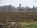 A distant Fotheringhay church - geograph.org.uk - 2883413.jpg 640 × 480; 89 KB
-
 Abandoned cottage - geograph.org.uk - 6323908.jpg 1,024 × 768; 188 KB
-
 Abandoned cottage - geograph.org.uk - 6323913.jpg 1,024 × 768; 155 KB
-
 Access to the Nene floodplain - geograph.org.uk - 3698241.jpg 800 × 450; 244 KB
-
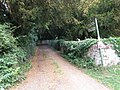 Access track to the woods - geograph.org.uk - 2477714.jpg 640 × 480; 126 KB
-
 Across to Short Wood - geograph.org.uk - 3180612.jpg 2,560 × 1,920; 1,007 KB
-
 Approaching Briary Wood - geograph.org.uk - 6326143.jpg 1,024 × 768; 246 KB
-
 Approaching Holey Brookes - geograph.org.uk - 6323821.jpg 1,024 × 768; 226 KB
-
 Approaching Southwick Coppice - geograph.org.uk - 6332420.jpg 1,024 × 768; 287 KB
-
 Arable and grazing land near Provost Lodge - geograph.org.uk - 3180615.jpg 2,560 × 1,920; 968 KB
-
 Barley field and Holey Brookes - geograph.org.uk - 6323782.jpg 1,024 × 768; 188 KB
-
 Barley field and the edge of Holey Brookes - geograph.org.uk - 6323816.jpg 1,024 × 768; 230 KB
-
 Barley field, Morehay Lawn - geograph.org.uk - 6323776.jpg 1,024 × 768; 185 KB
-
 Beans and a distant shooting platform - geograph.org.uk - 6324990.jpg 1,024 × 768; 227 KB
-
 Beef on the hoof - geograph.org.uk - 3180602.jpg 2,560 × 1,920; 978 KB
-
 Bench Mark on field cottage - geograph.org.uk - 1858450.jpg 3,648 × 2,736; 2.28 MB
-
 Bendy lane by Perio Barn Farm - geograph.org.uk - 3698240.jpg 800 × 450; 274 KB
-
 Blackmore Thick Farm - geograph.org.uk - 3292247.jpg 4,000 × 3,000; 2.96 MB
-
 Boar's Head Farm - geograph.org.uk - 4827421.jpg 640 × 480; 42 KB
-
 Boot scraper and a half - geograph.org.uk - 2477711.jpg 640 × 480; 132 KB
-
 Boundary between two fields of barley - geograph.org.uk - 6323899.jpg 1,024 × 768; 182 KB
-
 Briary Wood and uncultivated field margin - geograph.org.uk - 6326137.jpg 1,024 × 768; 169 KB
-
 Bridge near Crossway Hand farm entrance - geograph.org.uk - 1285941.jpg 640 × 480; 115 KB
-
 Bridleway alongside a field of barley - geograph.org.uk - 6323901.jpg 1,024 × 768; 178 KB
-
 Bridleway and Crossway Hand Cottages - geograph.org.uk - 6332120.jpg 1,024 × 768; 314 KB
-
 Bridleway and Crossway Hand Farm - geograph.org.uk - 6332128.jpg 1,024 × 768; 153 KB
-
 Bridleway and distant plantation - geograph.org.uk - 6334988.jpg 1,024 × 768; 139 KB
-
 Bridleway and the edge of Holey Brookes - geograph.org.uk - 6323803.jpg 1,024 × 768; 261 KB
-

-

-

-

-

-
 Bridleway through the barley - geograph.org.uk - 6226963.jpg 1,024 × 768; 194 KB
-
 Bridleway to Apethorpe - geograph.org.uk - 6332147.jpg 1,024 × 768; 198 KB
-
 Bridleway to Apethorpe, Morehay Lawn - geograph.org.uk - 6324987.jpg 1,024 × 768; 209 KB
-
 Bridleway to Crossway Hand Cottages - geograph.org.uk - 269345.jpg 640 × 480; 81 KB
-
 Bridleway to Holey Brookes - geograph.org.uk - 4827399.jpg 480 × 640; 68 KB
-
 Bridleway to Holey Brookes - geograph.org.uk - 4827402.jpg 480 × 640; 91 KB
-
 Bridleway to Holey Brookes - geograph.org.uk - 4827410.jpg 480 × 640; 63 KB
-
 Bridleway to Holey Brookes - geograph.org.uk - 4827414.jpg 480 × 640; 69 KB
-
 Bridleway to Holey Brookes - geograph.org.uk - 4827428.jpg 480 × 640; 51 KB
-
 Bridleway to Holey Brookes - geograph.org.uk - 4827430.jpg 480 × 640; 116 KB
-
 Bridleway to Tottenhoe Lodge - geograph.org.uk - 6332580.jpg 1,024 × 768; 224 KB
-
 Bridleway view - geograph.org.uk - 4827406.jpg 480 × 640; 47 KB
-
 Bridleway, Morehay Lawn - geograph.org.uk - 6324992.jpg 1,024 × 768; 170 KB
-
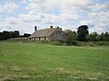
 Cottage in pasture land - geograph.org.uk - 1858421.jpg 3,648 × 2,736; 1.95 MB
-
 Crew yard - geograph.org.uk - 3180607.jpg 2,560 × 1,920; 971 KB
-
 Crossway Hand Farm - geograph.org.uk - 1285950.jpg 640 × 480; 74 KB
-
 Cube house, Southwick - geograph.org.uk - 1285795.jpg 640 × 480; 109 KB
-
 Farm buildings at Tottenhoe Lodge - geograph.org.uk - 3180585.jpg 2,560 × 1,920; 990 KB
-
 Farm track near Spa Farm - geograph.org.uk - 6325870.jpg 1,024 × 768; 166 KB
-
 Farm track, Morehay Lawn - geograph.org.uk - 6324984.jpg 1,024 × 768; 210 KB
-
 Farming machinery near Southwick Grange - geograph.org.uk - 4613459.jpg 4,320 × 3,240; 5.99 MB
-
 Farmland and tree near Perio Mill - geograph.org.uk - 4487924.jpg 4,320 × 3,240; 6.08 MB
-
 Field boundary - geograph.org.uk - 3180589.jpg 2,560 × 1,920; 977 KB
-
 Field boundary and Rough Close - geograph.org.uk - 6332138.jpg 1,024 × 768; 200 KB
-
 Field of stubble and cover crop - geograph.org.uk - 6693833.jpg 2,656 × 1,768; 2.72 MB
-

-
 Flush Bracket Bench Mark - geograph.org.uk - 1858433.jpg 2,736 × 3,648; 2.24 MB
-
 Footbridge into Holey Brookes - geograph.org.uk - 6226968.jpg 1,024 × 768; 311 KB
-
 Footpath from Perio Mill - geograph.org.uk - 3698236.jpg 800 × 450; 227 KB
-
 Footpath to Apethorpe - geograph.org.uk - 6332392.jpg 1,024 × 768; 243 KB
-
 Footpath to Apethorpe - geograph.org.uk - 6332414.jpg 1,024 × 768; 286 KB
-
 Footpath to Glapthorn - geograph.org.uk - 6332107.jpg 1,024 × 768; 189 KB
-
 Footpath to King's Cliffe - geograph.org.uk - 6325430.jpg 1,024 × 768; 283 KB
-
 Footpath to Southwick - geograph.org.uk - 6332416.jpg 1,024 × 768; 204 KB
-
 Footpath to Southwick on Shire Hill - geograph.org.uk - 6332180.jpg 1,024 × 768; 167 KB
-
 Footpath to The Spa - geograph.org.uk - 6226941.jpg 1,024 × 768; 193 KB
-
 Footpath to The Spa - geograph.org.uk - 6325857.jpg 1,024 × 768; 241 KB
-
 Footpath to Woodnewton - geograph.org.uk - 6332376.jpg 1,024 × 768; 360 KB
-
 Footpath uphill from The Spa - geograph.org.uk - 6325827.jpg 1,024 × 768; 180 KB
-
 Former railway guard's van - geograph.org.uk - 6332408.jpg 1,024 × 768; 406 KB
-
 Frere Hill Wood - geograph.org.uk - 3180590.jpg 2,560 × 1,920; 1,006 KB
-
 Gap between Tomlin Wood and a small plantation - geograph.org.uk - 6325390.jpg 1,024 × 768; 167 KB
-
 Gate and temporary fence - geograph.org.uk - 6323904.jpg 1,024 × 768; 361 KB
-
 Gates and abandoned cottage - geograph.org.uk - 6226961.jpg 1,024 × 768; 176 KB
-
 Gentle rolling hills - geograph.org.uk - 3180605.jpg 2,560 × 1,920; 986 KB
-
 Glimpse of a harvested cereal field - geograph.org.uk - 3698218.jpg 800 × 450; 267 KB
-
 Guards van in Southwick Wood - geograph.org.uk - 2475396.jpg 640 × 480; 145 KB
-
 Hillside near Vicarage Farm - geograph.org.uk - 6332747.jpg 1,024 × 768; 223 KB
-
 Isolated trees and Southwick Coppice - geograph.org.uk - 6332170.jpg 1,024 × 766; 205 KB
-
 Junction of tracks at the corner of Tomlin Wood - geograph.org.uk - 6325381.jpg 1,024 × 768; 196 KB
-

-
 Modern shooting lodge, Morehay Lawn - geograph.org.uk - 6323772.jpg 1,024 × 768; 171 KB
-
 Muddy bridleway - geograph.org.uk - 6332568.jpg 1,024 × 768; 304 KB
-
 Oak ghost at the entrance to Spa Farm Cottages - geograph.org.uk - 6695237.jpg 2,656 × 1,768; 1.18 MB
-
 Open gate into Holey Brookes - geograph.org.uk - 6323797.jpg 1,024 × 768; 387 KB
-
 Ordnance Survey Trig Pillar S6789 - geograph.org.uk - 3293219.jpg 4,000 × 3,000; 3.09 MB
-
 Ordnance Survey Trig Pillar S6790 - geograph.org.uk - 3293253.jpg 640 × 480; 126 KB
-
 Pasture land near Lower Benefield - geograph.org.uk - 3180581.jpg 2,560 × 1,920; 977 KB
-
 Path under a threatening sky - geograph.org.uk - 6325404.jpg 1,024 × 768; 131 KB
-
 Perio Barn Farm north of Cotterstock - geograph.org.uk - 4487812.jpg 4,320 × 3,240; 5.68 MB
-
 Ploughed field and Southwick Coppice - geograph.org.uk - 6332422.jpg 1,024 × 768; 263 KB
-
 Pond at Boar's Head Farm - geograph.org.uk - 4827423.jpg 640 × 480; 94 KB
-
 Red Kite overhead - geograph.org.uk - 4827431.jpg 480 × 640; 52 KB
-
 Ride in Great Colsters - geograph.org.uk - 6332385.jpg 1,024 × 768; 315 KB
-
 Ride in Great Colsters - geograph.org.uk - 6332388.jpg 1,024 × 768; 313 KB
-
 River of the River Nene from a canoe - geograph.org.uk - 4553603.jpg 480 × 640; 65 KB
-
 River of the River Nene from a canoe - geograph.org.uk - 4553604.jpg 480 × 640; 64 KB
-
 River of the River Nene from a canoe - geograph.org.uk - 4553609.jpg 480 × 640; 54 KB
-
 River up the River Nene from a canoe - geograph.org.uk - 4553598.jpg 480 × 640; 55 KB
-
 Road by Perio Mill - geograph.org.uk - 3698238.jpg 800 × 450; 192 KB
-
 Road junction with a dead tree - geograph.org.uk - 6325413.jpg 1,024 × 768; 110 KB
-

-
 Roadway to Blackmore Thick Farm - geograph.org.uk - 6332134.jpg 1,024 × 768; 272 KB
-
 Small plantation near Blackmore Thick Farm - geograph.org.uk - 6332476.jpg 1,024 × 768; 159 KB
-
 Small reservoir near Spa Farm - geograph.org.uk - 6325958.jpg 1,024 × 768; 152 KB
-
 Sooee ^^ - geograph.org.uk - 1285902.jpg 640 × 480; 80 KB
-
 Southwick bridge - geograph.org.uk - 1285842.jpg 640 × 480; 105 KB
-
 Southwick Grange - geograph.org.uk - 187431.jpg 640 × 480; 77 KB
-
 Southwick Grange - geograph.org.uk - 3698221.jpg 800 × 450; 235 KB
-
 Southwick street scene - geograph.org.uk - 2477724.jpg 640 × 480; 61 KB
-
 Southwick water tower - geograph.org.uk - 2887639.jpg 640 × 480; 82 KB
-
 SouthwickPub.JPG 2,085 × 2,477; 3.85 MB
-
 Spa Farm - geograph.org.uk - 6226945.jpg 1,024 × 768; 183 KB
-
 Spa Farm - geograph.org.uk - 6693854.jpg 2,656 × 1,768; 2.88 MB
-
 Spa Farm Cottages - geograph.org.uk - 6325417.jpg 1,024 × 768; 166 KB
-
 Spring lambs, Southwick - geograph.org.uk - 2887698.jpg 640 × 480; 131 KB
-
 St Mary the Virgin church, Southwick - geograph.org.uk - 5786525.jpg 1,944 × 2,446; 939 KB
-
 St Mary's church, Southwick - geograph.org.uk - 6545571.jpg 4,320 × 3,240; 2.94 MB
-
-

-
 St. Mary's, Southwick - geograph.org.uk - 6332163.jpg 1,024 × 768; 171 KB
-
 Straw stack and footpath through a field of oats - geograph.org.uk - 6326117.jpg 1,024 × 768; 175 KB
-
 Straw stack near Spa Farm - geograph.org.uk - 6326108.jpg 1,024 × 768; 213 KB
-
 Stream at Southwick - geograph.org.uk - 6332423.jpg 1,024 × 768; 264 KB
-
 Stream by the road to Bulwick - geograph.org.uk - 6332474.jpg 1,024 × 768; 297 KB
-
 Stretching credulity a little - geograph.org.uk - 2477705.jpg 640 × 480; 92 KB
-
 Stubble and maize - geograph.org.uk - 6325850.jpg 1,024 × 768; 174 KB
-
 Thatched house, Southwick - geograph.org.uk - 269319.jpg 640 × 480; 85 KB
-
 The beginning of a bridleway to Apethorpe - geograph.org.uk - 6332479.jpg 1,024 × 768; 442 KB
-
 The edge of Southwick Coppice - geograph.org.uk - 6332418.jpg 1,024 × 768; 261 KB
-
 The path runs out - geograph.org.uk - 6325864.jpg 1,024 × 768; 211 KB
-
 The remains of King's Cliffe Spa - geograph.org.uk - 6325819.jpg 1,024 × 768; 322 KB
-
 The road into Southwick - geograph.org.uk - 6332100.jpg 1,024 × 768; 222 KB
-
 The road through Wych Spinney - geograph.org.uk - 2887680.jpg 640 × 480; 123 KB
-
 The road to Southwick near Vicarage Farm - geograph.org.uk - 6332113.jpg 1,024 × 768; 315 KB
-
 This way - geograph.org.uk - 6323808.jpg 1,024 × 768; 287 KB
-
 Towards Frere Hill Wood - geograph.org.uk - 4827444.jpg 480 × 640; 64 KB
-
 Towards Tottenhoe Lodge - geograph.org.uk - 3180582.jpg 2,560 × 1,920; 1,005 KB
-
 Track along the edge of Howe Wood - geograph.org.uk - 6332410.jpg 1,024 × 768; 337 KB
-
 Track along the south side of Tomlin Wood - geograph.org.uk - 6695242.jpg 2,656 × 1,768; 2.88 MB
-
 Track alongside Tomlin Wood - geograph.org.uk - 6325383.jpg 1,024 × 768; 232 KB
-
 Track between fields below Morehay Lawn - geograph.org.uk - 6226972.jpg 1,024 × 768; 151 KB
-
 Track in Great Colsters - geograph.org.uk - 6332382.jpg 1,024 × 768; 244 KB
-
 Track in Great Colsters - geograph.org.uk - 6332413.jpg 1,024 × 768; 323 KB
-
 Track in Holey Brookes - geograph.org.uk - 6323813.jpg 1,024 × 768; 314 KB
-
 Track into Tomlin Wood - geograph.org.uk - 6325386.jpg 1,024 × 768; 383 KB
-
 Track to Southwick Hall - geograph.org.uk - 6332372.jpg 1,024 × 768; 250 KB
-
 Track towards Wymond Hill - geograph.org.uk - 2364834.jpg 640 × 469; 72 KB
-
 Triangulation Pillar near Blackmore Thick Farm - geograph.org.uk - 1858406.jpg 3,648 × 2,736; 2.28 MB
-
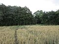
 Trig point and footpath across a field of oats - geograph.org.uk - 6326114.jpg 1,024 × 768; 211 KB
-

-
 Uphill heading towards Tottenhoe Lodge - geograph.org.uk - 3180583.jpg 2,560 × 1,920; 979 KB
-
 Vicarage Farm - geograph.org.uk - 1285972.jpg 640 × 480; 107 KB
-
 Vicarage Farm beyond the hedge - geograph.org.uk - 6332752.jpg 1,024 × 768; 350 KB
-
 Vicarage farm near Southwick - geograph.org.uk - 3180598.jpg 2,560 × 1,920; 971 KB
-
 View downhill to The Spa - geograph.org.uk - 6325837.jpg 1,024 × 768; 193 KB
-
 View from bridleway to Holey Brookes - geograph.org.uk - 4827419.jpg 640 × 480; 40 KB
-
 View from Crossway Hand Farm - geograph.org.uk - 4827435.jpg 640 × 480; 60 KB
-
 View of the River Nene from a canoe - geograph.org.uk - 4553611.jpg 640 × 480; 82 KB
-
 View of the River Nene from a canoe - geograph.org.uk - 4553613.jpg 480 × 640; 67 KB
-
 View towards Crossway Hand Farm - geograph.org.uk - 6332571.jpg 1,024 × 768; 262 KB
-
 View towards Fotheringhay - geograph.org.uk - 6332249.jpg 1,024 × 768; 143 KB
-
 Water course, Southwick - geograph.org.uk - 1285827.jpg 640 × 480; 123 KB
-
 Water in the Trees - geograph.org.uk - 187422.jpg 480 × 640; 72 KB
-
 Water tower between Glapthorn and Southwick - geograph.org.uk - 6332801.jpg 1,024 × 768; 252 KB
-
 Water tower, Southwick - geograph.org.uk - 4560732.jpg 4,320 × 3,240; 4.5 MB
-
 Waterlogged field near Crossway Hand Farm - geograph.org.uk - 6332566.jpg 1,024 × 768; 249 KB
-
 Wind pump - geograph.org.uk - 3180593.jpg 2,560 × 1,920; 1.04 MB
-
 Footpath at Southwick near Oundle - geograph.org.uk - 93825.jpg 640 × 480; 142 KB
-
 Older oak, near Shire Hill Lodge - geograph.org.uk - 269274.jpg 480 × 640; 161 KB
-
 Shire Hill Lodge - geograph.org.uk - 269299.jpg 640 × 480; 87 KB


