Category:Soutpan Spruit
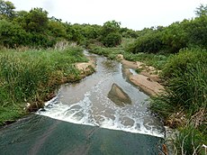
English: The Soutpan Spruit in northern Gauteng is also known downstream as the Ngopedimatlhaja and Kutswana, before it joins the Moretele / Pienaars River just upstream of Klipvoor dam.
| Object location | | View all coordinates using: OpenStreetMap |
|---|
stream in North West, South Africa | |||||
| Upload media | |||||
| Instance of | |||||
|---|---|---|---|---|---|
| Location | North West, Transvaal region | ||||
 | |||||
Media in category "Soutpan Spruit"
The following 3 files are in this category, out of 3 total.
-
Soutpanspruit by laagwaterbrug, a, Zoutpan.jpg 4,000 × 3,000; 3.94 MB
-
Soutpanspruit by laagwaterbrug, b, Zoutpan.jpg 4,000 × 3,000; 3.99 MB
-
Soutpanspruit by laagwaterbrug, c, Zoutpan.jpg 4,000 × 3,000; 3.79 MB


