Category:Sparrendaal (Driebergen-Rijsenburg)
| Object location | | View all coordinates using: OpenStreetMap |
|---|
building in Utrechtse Heuvelrug, Netherlands  | |||||
| Upload media | |||||
| Instance of | |||||
|---|---|---|---|---|---|
| Part of | |||||
| Location | Driebergen-Rijsenburg, Utrecht, Netherlands | ||||
| Street address |
| ||||
| Located on street | |||||
| Architectural style | |||||
| Owned by | |||||
| Heritage designation |
| ||||
 | |||||
Nederlands: Sparrendaal (Driebergen)
|
This is a category about rijksmonumentcomplex number 519720
|
Hoofdgebouw:
|
This is a category about rijksmonument number 519722
|
Historische tuin- en parkaanleg:
|
This is a category about rijksmonument number 519725
|
Bouwhuizen:
|
This is a category about rijksmonument number 519727
|
Entreehek:
|
This is a category about rijksmonument number 519731
|
Brug:
|
This is a category about rijksmonument number 519732
|
Slingermuur:
|
This is a category about rijksmonument number 519734
|
| Address |
|
Subcategories
This category has the following 6 subcategories, out of 6 total.
I
- Interior of Sparrendaal (36 F)
Media in category "Sparrendaal (Driebergen-Rijsenburg)"
The following 26 files are in this category, out of 26 total.
-
 "Sparrendaal", voorgevel - Driebergen-Rijsenburg - 20063849 - RCE.jpg 1,200 × 971; 302 KB
-
 Driebergen-Rijsenburg - Sparrendaal Brug RM519732.JPG 4,608 × 2,610; 1.4 MB
-
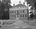
 Exterieur OVERZICHT VOORGEVEL - Driebergen-Rijsenburg - 20311965 - RCE.jpg 1,200 × 947; 355 KB
-
 Exterieur VOORGEVEL - Driebergen-Rijsenburg - 20311966 - RCE.jpg 1,200 × 943; 316 KB
-

-

-

-

-
 Overzicht van de achtergevel - Driebergen-Rijsenburg - 20428473 - RCE.jpg 802 × 1,200; 289 KB
-
 Overzicht van de achtergevel - Driebergen-Rijsenburg - 20428475 - RCE.jpg 1,200 × 802; 232 KB
-

-
 Overzicht van de zijgevel - Driebergen-Rijsenburg - 20428477 - RCE.jpg 802 × 1,200; 359 KB
-
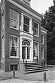
 Overzicht voorgevel - Driebergen-Rijsenburg - 20063865 - RCE.jpg 1,200 × 894; 360 KB
-
 Overzicht voorzijde - Driebergen-Rijsenburg - 20063853 - RCE.jpg 1,200 × 960; 314 KB
-
 RM519731 Entreehek van Sparrendaal.JPG 4,320 × 3,240; 2.14 MB
-
 Sparrendaal (Driebergen-Rijsenburg). Corbel.jpg 2,432 × 4,320; 5.66 MB
-
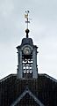 Sparrendaal (Driebergen-Rijsenburg). Klokkenstoel.jpg 2,052 × 3,773; 3.02 MB
-
 Sparrendaal (Driebergen-Rijsenburg). Zicht door het venster.jpg 2,432 × 4,320; 4.79 MB
-
 Sparrendaal (Driebergen-Rijsenburg). Zicht op het huis.jpg 2,432 × 4,320; 5.85 MB
-
 Sparrendaal Driebergen.jpg 1,503 × 1,011; 412 KB
-
 Sparrendaal in Driebergen-Rijsenburg.jpg 300 × 400; 116 KB
-
 Sparrendaal-Driebergen (39).JPG 3,008 × 2,000; 1.4 MB
-
 SparrendaalZeist.jpg 791 × 605; 192 KB
-
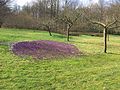 Tuin Buitenplaats Sparrendaal.jpg 2,016 × 1,512; 1.52 MB
-
 West zijgevel naar het zuid-oosten - Driebergen-Rijsenburg - 20063856 - RCE.jpg 944 × 1,200; 375 KB
-
 WittekerstbijSparrendaal2009.jpg 3,072 × 2,304; 3.58 MB


._Corbel.jpg)
._Klokkenstoel.jpg)
._Zicht_door_het_venster.jpg)
._Zicht_op_het_huis.jpg)


.JPG)


