Category:Sperrstelle Heiligenschwendi
| Object location | | View all coordinates using: OpenStreetMap |
|---|
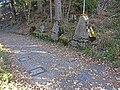
former border fortification of the Swiss Army in Heiligenschwendi in the canton of Bern, Switzerland  | |||||
| Upload media | |||||
| Instance of |
| ||||
|---|---|---|---|---|---|
| Part of | |||||
| Location | Heiligenschwendi, Thun administrative district, Oberland administrative region, Bern, Switzerland | ||||
| Street address |
| ||||
| Heritage designation |
| ||||
| Inception |
| ||||
 | |||||
Media in category "Sperrstelle Heiligenschwendi"
The following 13 files are in this category, out of 13 total.
-
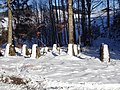 Betonhöcker In der Gasse T 1151 Heiligenschwendi.jpg 4,896 × 3,672; 6.78 MB
-
 Feldkanonenschild Mehlbaumen II A 1907.jpg 4,896 × 3,672; 7.27 MB
-
 Heiligenschwendi In der Gasse E T 1151 015.jpg 4,896 × 3,672; 1.46 MB
-
 Heiligenschwendi In der Gasse E T 1151 017.jpg 4,896 × 3,672; 1.68 MB
-
 Heiligenschwendi In der Gasse W Sperre Wald T 1151b 019.jpg 4,896 × 3,672; 1.83 MB
-
 Heiligenschwendi Tankmauer Aspiwald T 1156 038.jpg 4,896 × 3,672; 1.43 MB
-
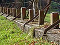 Heiligenschwendi Tankmauer Trachtenwege T 1155 042.jpg 4,896 × 3,672; 1.78 MB
-
 Heiligenschwendi Trachtenwege A 1921 048.jpg 4,896 × 3,672; 870 KB
-
 Heiligenschwendi Trachtenwege A 1921 049.jpg 4,896 × 3,672; 1.6 MB
-
 Heiligenschwendi Trachtenwege E A 1921 047.jpg 4,896 × 3,672; 1.54 MB
-
 Heiligenschwendi Trachtenwege W A 1922 045.jpg 4,896 × 3,672; 1.71 MB
-
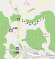 Sperre In der Gasse.png 489 × 521; 166 KB
-
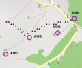 Sperre Multenegg.png 499 × 413; 105 KB


