Category:Spreyton
English: For Spreyton in Australia see Spreyton.
village just north of Dartmoor in Devon, England  | |||||
| Upload media | |||||
| Instance of | |||||
|---|---|---|---|---|---|
| Location | West Devon, Devon, South West England, England | ||||
| Population |
| ||||
 | |||||
Subcategories
This category has the following 3 subcategories, out of 3 total.
Media in category "Spreyton"
The following 170 files are in this category, out of 170 total.
-
 A lovely view from the lane to Week Farm - geograph.org.uk - 3437132.jpg 640 × 480; 144 KB
-
 A30 north of Narraway - geograph.org.uk - 3225469.jpg 3,269 × 1,928; 859 KB
-
 Approach to Spreyton - geograph.org.uk - 1727287.jpg 640 × 480; 96 KB
-
-
 At North Beer Cross, looking north-east - geograph.org.uk - 4243719.jpg 1,600 × 1,200; 1.14 MB
-
 Bare tree with Cosdon Hill behind - geograph.org.uk - 4243796.jpg 1,600 × 1,598; 1.64 MB
-
 Beech trees in Broadapark Plantation - geograph.org.uk - 4243782.jpg 1,200 × 1,600; 1.34 MB
-
 Blackdown Copse - geograph.org.uk - 3300684.jpg 1,024 × 768; 509 KB
-
 Bowbeer Cross - geograph.org.uk - 1895828.jpg 640 × 480; 93 KB
-
 Brandis Corner - geograph.org.uk - 2238593.jpg 640 × 464; 92 KB
-
 Brandis Cross - geograph.org.uk - 4243801.jpg 1,600 × 964; 898 KB
-
 Bridge near Spreyton Wood - geograph.org.uk - 3298459.jpg 1,024 × 768; 765 KB
-
 Bridge over River Troney - geograph.org.uk - 3298455.jpg 1,024 × 768; 754 KB
-
 Bridge over the River Yeo - geograph.org.uk - 27566.jpg 640 × 427; 85 KB
-
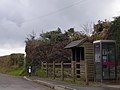 Bus shelter and phone box at Spreyton - geograph.org.uk - 4243751.jpg 1,600 × 1,202; 1.15 MB
-
 Caution pheasants - geograph.org.uk - 1619483.jpg 640 × 480; 138 KB
-
 Collapsed roof, Nethercott - geograph.org.uk - 1619576.jpg 640 × 434; 89 KB
-
 Combe Moor Lane - geograph.org.uk - 2239967.jpg 640 × 470; 105 KB
-
 Combe Moor Lane crossing the River Yeo at Thorn Bridge - geograph.org.uk - 5345187.jpg 6,000 × 4,000; 5.38 MB
-
 Combe Moor Lane crossing the River Yeo at Thorn Bridge - geograph.org.uk - 5345192.jpg 6,000 × 4,000; 5.39 MB
-

-
 Coxmoor Ford - geograph.org.uk - 4189006.jpg 3,872 × 2,592; 5.02 MB
-
 Coxmoor Ford and footbridge - geograph.org.uk - 2239847.jpg 640 × 480; 118 KB
-
 Coxmoor Lane - geograph.org.uk - 2239804.jpg 640 × 480; 129 KB
-
 Croft Lane at St Cherries - geograph.org.uk - 4243776.jpg 1,200 × 1,600; 1.34 MB
-
 Crossroads at Spreyton - geograph.org.uk - 4243746.jpg 1,600 × 1,199; 1.09 MB
-
 Cullaford Bridge - geograph.org.uk - 1890827.jpg 640 × 480; 132 KB
-
 Cullaford Bridge - geograph.org.uk - 1896544.jpg 640 × 480; 153 KB
-
 Cullaford Bridge on the River Yeo - geograph.org.uk - 5345250.jpg 6,000 × 4,000; 4.72 MB
-
 Cullaford Bridge on the River Yeo - geograph.org.uk - 5345255.jpg 6,000 × 4,000; 5.48 MB
-
 Cullaford Cross - geograph.org.uk - 1896557.jpg 640 × 480; 100 KB
-

-

-
 Entrance to Spreyton - geograph.org.uk - 5373974.jpg 640 × 480; 86 KB
-
 Farm access track, Hollycombe - geograph.org.uk - 1553122.jpg 640 × 480; 93 KB
-
 Farm buildings at Combe Moor - geograph.org.uk - 4243717.jpg 1,600 × 1,200; 1.39 MB
-
 Field and trees at Brandis Corner - geograph.org.uk - 4243707.jpg 1,600 × 1,200; 1.17 MB
-
 Field boundary junction near Spreyton - geograph.org.uk - 1624795.jpg 640 × 480; 129 KB
-
 Field by Itton Moor Lane - geograph.org.uk - 2238648.jpg 640 × 480; 78 KB
-
 Field near Coxmoor Ford - geograph.org.uk - 2239835.jpg 640 × 480; 123 KB
-
 Field near Coxmoor Ford - geograph.org.uk - 2239841.jpg 640 × 445; 105 KB
-
 Fields near Highfield - geograph.org.uk - 1895979.jpg 640 × 480; 112 KB
-
 Fingerpost at Spreyton Wood Cross - geograph.org.uk - 1723124.jpg 640 × 480; 262 KB
-
 Flat landscape at the junction for Falkedon - geograph.org.uk - 4243778.jpg 1,600 × 1,064; 1,024 KB
-
 Footpath and forest track through Spreyton Wood - geograph.org.uk - 3299132.jpg 1,024 × 768; 853 KB
-
 Ford at Hillerton - geograph.org.uk - 4188964.jpg 3,872 × 2,592; 5.59 MB
-
 Ford at Hillerton - geograph.org.uk - 4188979.jpg 3,872 × 2,592; 5.31 MB
-
 Ford at Nethercott - geograph.org.uk - 5924451.jpg 3,662 × 2,744; 3.36 MB
-
 Ford, Nethercott, Nr. Spreyton, Devon - geograph.org.uk - 448453.jpg 640 × 480; 127 KB
-
 Former chapel, Heath Cross - geograph.org.uk - 1895966.jpg 640 × 449; 74 KB
-
 Fuidge Manor seen from near Fursham Cross - geograph.org.uk - 3298325.jpg 1,024 × 768; 596 KB
-
 Gate and path, line of Roman road - geograph.org.uk - 2239356.jpg 640 × 480; 123 KB
-
 Gate into Spreyton Wood - geograph.org.uk - 3299129.jpg 768 × 1,024; 771 KB
-
 Gate on line of Roman road - geograph.org.uk - 2239385.jpg 640 × 480; 121 KB
-
 Gateway near Powlesland - geograph.org.uk - 1619533.jpg 640 × 431; 69 KB
-
 Ham Farm access road - geograph.org.uk - 4243692.jpg 1,600 × 1,200; 1.47 MB
-
 Heath Cross near Spreyton - geograph.org.uk - 4243744.jpg 1,600 × 1,200; 1.01 MB
-
 Heath farmhouse - geograph.org.uk - 1896348.jpg 640 × 405; 79 KB
-
 Heath Road - geograph.org.uk - 1895989.jpg 640 × 480; 102 KB
-
 Heath Road - geograph.org.uk - 1896417.jpg 640 × 480; 116 KB
-
 Highermoor Plantation - geograph.org.uk - 1553116.jpg 640 × 480; 113 KB
-
 Highermoor Plantation - geograph.org.uk - 4243787.jpg 1,600 × 1,119; 383 KB
-
 Hillside above the Yeo - geograph.org.uk - 1624675.jpg 640 × 480; 106 KB
-
 Hollycombe Cross aka Brandis Cross - geograph.org.uk - 1727294.jpg 640 × 480; 50 KB
-
 Itton Moor Lane - geograph.org.uk - 2239058.jpg 640 × 436; 78 KB
-
 Lane and buildings at Great Begbeer Farm - geograph.org.uk - 3437122.jpg 640 × 480; 101 KB
-
 Lane approaching Thorn Bridge - geograph.org.uk - 2238423.jpg 640 × 462; 152 KB
-
 Lane at Bowbeer Cross - geograph.org.uk - 1895822.jpg 640 × 480; 118 KB
-
 Lane at No Man's Land - geograph.org.uk - 1895924.jpg 640 × 480; 96 KB
-
 Lane at Spreyton Wood - geograph.org.uk - 1552834.jpg 640 × 472; 92 KB
-
 Lane from Spreyton - geograph.org.uk - 5700024.jpg 4,288 × 2,848; 2.17 MB
-
 Lane near West Cullaford - geograph.org.uk - 3437163.jpg 640 × 480; 178 KB
-
 Lane to Downhayes - geograph.org.uk - 3437118.jpg 640 × 480; 154 KB
-
 Lane to Spreyton - geograph.org.uk - 1552788.jpg 640 × 469; 96 KB
-
 Lane to Spreyton - geograph.org.uk - 1552813.jpg 640 × 480; 127 KB
-
 Lane to Spreyton - geograph.org.uk - 1552820.jpg 640 × 480; 131 KB
-
 Lane to Spreyton - geograph.org.uk - 5700020.jpg 4,288 × 2,848; 2.71 MB
-
 Lane to Spreyton - geograph.org.uk - 5702266.jpg 3,534 × 2,366; 1.77 MB
-
 Lane to Weeke - Week Farm - geograph.org.uk - 3437140.jpg 640 × 480; 214 KB
-
 Line of Roman Road - geograph.org.uk - 2239228.jpg 640 × 480; 153 KB
-
 Looking down the River Yeo from Cullaford Bridge - geograph.org.uk - 5345267.jpg 6,000 × 4,000; 5.83 MB
-
 Looking down the River Yeo from Thorn Bridge - geograph.org.uk - 5345199.jpg 6,000 × 4,000; 5.46 MB
-
 Looking up the River Yeo from Cullaford Bridge - geograph.org.uk - 5345270.jpg 6,000 × 4,000; 4.72 MB
-
 Looking up the River Yeo from Thorn Bridge - geograph.org.uk - 5345202.jpg 5,908 × 3,861; 4.86 MB
-
 Meadow by Highermoor Plantation - geograph.org.uk - 1553115.jpg 640 × 480; 124 KB
-
 Minor road from Spreyton to Whiddon Down - geograph.org.uk - 4442047.jpg 800 × 600; 179 KB
-
 Modern house next to the River Yeo - geograph.org.uk - 3437149.jpg 640 × 480; 184 KB
-
 Nethercott Lane - geograph.org.uk - 1624707.jpg 640 × 480; 122 KB
-
 Nethercott Lane - geograph.org.uk - 1624781.jpg 640 × 480; 103 KB
-
 Nethercott, Near Spreyton, Devon - geograph.org.uk - 448448.jpg 640 × 480; 106 KB
-
 North Beer Farm - geograph.org.uk - 2238145.jpg 640 × 410; 105 KB
-
 Northbeer Lane - geograph.org.uk - 2238403.jpg 640 × 447; 98 KB
-
 Ordnance Survey Cut Mark - geograph.org.uk - 4935507.jpg 595 × 640; 147 KB
-
 Path by line of Roman road - geograph.org.uk - 2239335.jpg 506 × 640; 141 KB
-
 Path by line of Roman road, Itton - geograph.org.uk - 2239178.jpg 480 × 640; 132 KB
-
 Path by line of Roman road, Itton - geograph.org.uk - 2239201.jpg 640 × 480; 133 KB
-
 Path from Coxmoor Ford - geograph.org.uk - 2239589.jpg 640 × 480; 141 KB
-
 Primary School, Spreyton, Devon - geograph.org.uk - 448440.jpg 640 × 480; 75 KB
-
 River Troney in spate - geograph.org.uk - 1723131.jpg 640 × 480; 252 KB
-
 River Yeo at Thorn Bridge - geograph.org.uk - 2238448.jpg 640 × 480; 105 KB
-
 Road approaching Hollycombe Cross - geograph.org.uk - 1553124.jpg 640 × 480; 119 KB
-
 Road at Fuidge Cross - geograph.org.uk - 1553110.jpg 480 × 640; 126 KB
-
 Road near Fuidge Cross - geograph.org.uk - 1552890.jpg 640 × 445; 94 KB
-
 Road south of Spreyton climbing a gentle slope - geograph.org.uk - 4243763.jpg 1,600 × 1,200; 1 MB
-
 Road to Hollycombe Cross - geograph.org.uk - 1553120.jpg 640 × 480; 113 KB
-
 Road to Spreyton - geograph.org.uk - 1553121.jpg 640 × 496; 134 KB
-
 Roadside full of flowers at Brownsland - geograph.org.uk - 1312435.jpg 640 × 480; 115 KB
-
 Signpost at North Beer Cross - geograph.org.uk - 4243723.jpg 1,600 × 1,280; 1.5 MB
-
 Small wood by the road junction - geograph.org.uk - 1727291.jpg 640 × 480; 86 KB
-
 South Tawton, near West Cullaford - geograph.org.uk - 207532.jpg 640 × 427; 165 KB
-
 Spreyton , Village Road - geograph.org.uk - 4509361.jpg 4,288 × 2,848; 6.23 MB
-
 Spreyton , Village Road - geograph.org.uk - 4509363.jpg 4,288 × 2,848; 5.74 MB
-
 Spreyton - geograph.org.uk - 5366616.jpg 480 × 640; 56 KB
-
 Spreyton crossroads - geograph.org.uk - 5366613.jpg 480 × 640; 62 KB
-
 Spreyton Wood - geograph.org.uk - 3299136.jpg 1,024 × 768; 842 KB
-
 Spreyton Wood Cross - geograph.org.uk - 1552712.jpg 640 × 486; 130 KB
-
 Spreyton Wood Cross - geograph.org.uk - 4105309.jpg 640 × 480; 121 KB
-
 Spreyton Wood Cross and Quince Cross - geograph.org.uk - 1552744.jpg 480 × 640; 129 KB
-
 Spreyton, by the Post Office - geograph.org.uk - 199095.jpg 640 × 427; 172 KB
-
 Spreyton, entrance to Begbeer Farm - geograph.org.uk - 199866.jpg 640 × 427; 193 KB
-
 Spreyton, Falkedon - geograph.org.uk - 199090.jpg 640 × 427; 156 KB
-
 Spreyton, footpath to Combe - geograph.org.uk - 199855.jpg 640 × 427; 204 KB
-
 Spreyton, Higher Moor - geograph.org.uk - 207505.jpg 640 × 427; 186 KB
-
 Spreyton, Higher Moor Plantation - geograph.org.uk - 207507.jpg 640 × 427; 271 KB
-
 Spreyton, near Brownsland - geograph.org.uk - 348447.jpg 640 × 427; 201 KB
-
 Spreyton, near Deerpark Copse - geograph.org.uk - 348389.jpg 640 × 427; 254 KB
-
 Spreyton, near Great Begbeer - geograph.org.uk - 199862.jpg 640 × 427; 167 KB
-
 Spreyton, near Spreyton Wood - geograph.org.uk - 348385.jpg 640 × 427; 191 KB
-
 Spreyton, near Week Farm - geograph.org.uk - 199857.jpg 640 × 427; 152 KB
-

-
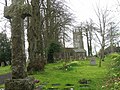 St Michael's Church - geograph.org.uk - 5373979.jpg 640 × 480; 112 KB
-
 St. Cherries - geograph.org.uk - 1552879.jpg 640 × 480; 66 KB
-
 Staddlestone adjoining the north side of the church tower - geograph.org.uk - 6505038.jpg 2,945 × 2,945; 4.66 MB
-
 Stile west of Spreyton - geograph.org.uk - 1624803.jpg 480 × 640; 126 KB
-
 Temporary fencing at Spreyton - geograph.org.uk - 4243752.jpg 1,600 × 1,200; 1.45 MB
-
 The A30 westbound near Hollycombe Farm - geograph.org.uk - 3511544.jpg 1,024 × 768; 198 KB
-
 The Barton, looking towards the church tower - geograph.org.uk - 6505037.jpg 4,032 × 3,024; 3.69 MB
-
 The downstream side of Cullaford Bridge on the River Yeo - geograph.org.uk - 5345260.jpg 6,000 × 4,000; 5.73 MB
-
 The downstream side of Thorn Bridge on the River Yeo - geograph.org.uk - 5345193.jpg 6,000 × 4,000; 5.23 MB
-
 The edge of Highfield, near Spreyton - geograph.org.uk - 4243742.jpg 1,600 × 1,598; 1.62 MB
-

-

-
 The source of the River Yeo - geograph.org.uk - 5345281.jpg 6,000 × 4,000; 6.68 MB
-
 The upstream side of Cullaford Bridge on the River Yeo - geograph.org.uk - 5345261.jpg 6,000 × 4,000; 4.43 MB
-
 The upstream side of Thorn Bridge on the River Yeo - geograph.org.uk - 5345197.jpg 6,000 × 4,000; 4.92 MB
-
 The valley of the River Troney - geograph.org.uk - 3299141.jpg 1,024 × 768; 561 KB
-
 Thorn Bridge - geograph.org.uk - 4243714.jpg 1,600 × 1,201; 1.61 MB
-
 Thorn Bridge Ford - geograph.org.uk - 5924439.jpg 4,032 × 3,024; 3.45 MB
-
 Towards the Yeo valley - geograph.org.uk - 1896374.jpg 640 × 480; 101 KB
-
 Track at St Cherries - geograph.org.uk - 1552856.jpg 480 × 640; 141 KB
-
 Track shared with stream, Coxmoor - geograph.org.uk - 2239824.jpg 525 × 640; 155 KB
-
 Track to ford, Nethercott - geograph.org.uk - 1619436.jpg 640 × 480; 134 KB
-
 Track to Nethercott - geograph.org.uk - 1624839.jpg 483 × 640; 113 KB
-
 Track to South Nethercott - geograph.org.uk - 1624829.jpg 640 × 480; 133 KB
-
 Tracks beside Northbeer Lane - geograph.org.uk - 2238360.jpg 640 × 423; 84 KB
-
 Trees at Brandis Corner - geograph.org.uk - 2238624.jpg 640 × 480; 148 KB
-
 Trees on Northbeer Lane - geograph.org.uk - 2238132.jpg 640 × 433; 98 KB
-
 Troney valley - geograph.org.uk - 1553155.jpg 640 × 480; 110 KB
-
 Up the hill to East Begbeer - geograph.org.uk - 3437109.jpg 640 × 480; 134 KB
-
 Valley near Powlesland - geograph.org.uk - 1619505.jpg 640 × 480; 100 KB
-
 View at Brandis Corner - geograph.org.uk - 2238631.jpg 640 × 480; 137 KB
-
 View from No Man's Land - geograph.org.uk - 1895956.jpg 640 × 480; 106 KB
-
 Water on Combe Moor Lane - geograph.org.uk - 2238460.jpg 480 × 640; 113 KB
-
 Water on Combe Moor Lane - geograph.org.uk - 2238582.jpg 480 × 640; 120 KB
-
 West Devon , Country Lane - geograph.org.uk - 4666920.jpg 4,288 × 2,848; 6.35 MB
-
 West Devon , River Troney - geograph.org.uk - 4666915.jpg 4,288 × 2,848; 6.71 MB
-
 West Devon , River Troney - geograph.org.uk - 4666918.jpg 4,288 × 2,848; 6.4 MB
-
 Wet field above the Yeo - geograph.org.uk - 2239511.jpg 640 × 480; 137 KB
-
 Woodside track east of Spreyton - geograph.org.uk - 1552845.jpg 480 × 640; 126 KB
-
 Yeo valley - geograph.org.uk - 1896363.jpg 640 × 480; 107 KB


