Category:Sprongstraat 16, Zutphen
| Object location | | View all coordinates using: OpenStreetMap |
|---|
building in Zutphen, Netherlands  | |||||
| Upload media | |||||
| Instance of | |||||
|---|---|---|---|---|---|
| Location | Zutphen, Gelderland, Netherlands | ||||
| Street address |
| ||||
| Located on street |
| ||||
| Heritage designation |
| ||||
 | |||||
|
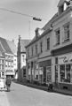
This is a category about rijksmonument number 41442
|
| Address |
|
Media in category "Sprongstraat 16, Zutphen"
The following 5 files are in this category, out of 5 total.
-
 Achtergevel - Zutphen - 20227741 - RCE.jpg 935 × 1,200; 199 KB
-
 En Beukestraat 65-67 - Zutphen - 20227735 - RCE.jpg 808 × 1,200; 167 KB
-
 Hoek Vaaltstraat 1 - Zutphen - 20227740 - RCE.jpg 804 × 1,200; 138 KB
-
 RM41442 Zutphen - Sprongstraat 16.jpg 1,944 × 2,592; 1.25 MB
-
 Zutphen, Netherlands - panoramio (22).jpg 1,375 × 2,048; 405 KB


.jpg)