Category:Stùc a' Chroin
975m high mountain in Perth and Kinross/Stirling, Scotland, UK  | |||||
| Upload media | |||||
| Instance of | |||||
|---|---|---|---|---|---|
| Location |
| ||||
| Mountain range | |||||
| Topographic prominence |
| ||||
| Elevation above sea level |
| ||||
| Parent peak | |||||
 | |||||
Stùc a' Chroin is a mountain located in the southern part of the Highlands of Scotland. It lies to the south of Ben Vorlich, which is itself bounded to the north by Loch Earn, and to the west by Loch Lubnaig.
Media in category "Stùc a' Chroin"
The following 49 files are in this category, out of 49 total.
-
 Allt an Dubh Choirein - geograph.org.uk - 191807.jpg 478 × 640; 137 KB
-
 Arivurichardich - geograph.org.uk - 130929.jpg 640 × 427; 91 KB
-
 Bales, Stirling - geograph.org.uk - 216392.jpg 640 × 478; 135 KB
-
 Bealach an Dubh Choirean - geograph.org.uk - 298033.jpg 427 × 640; 95 KB
-
 Ben Vorlich seen from Ben Vorlich - geograph.org.uk - 1040370.jpg 640 × 632; 65 KB
-
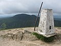 Ben Vorlich Trig Point - geograph.org.uk - 1395804.jpg 640 × 480; 75 KB
-
 Cairn on Stùc a' Chroin - geograph.org.uk - 1396778.jpg 640 × 480; 94 KB
-

-
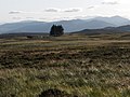
 Moorland on the east side of Glen Beich - geograph.org.uk - 714335.jpg 640 × 482; 147 KB
-

-
 Moss-side of Boquhapple - geograph.org.uk - 192715.jpg 640 × 478; 151 KB
-
 Newburgh-Vorlich.jpg 2,811 × 1,398; 216 KB
-
 North-northeast side of Stuc a Chroin.jpg 1,952 × 3,264; 1.6 MB
-
 Old fence post - geograph.org.uk - 263844.jpg 640 × 480; 113 KB
-
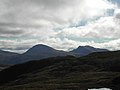
 Ridge of Stuc a' Chroin - geograph.org.uk - 951931.jpg 640 × 437; 62 KB
-
 Rough pasture in Glen Beich looking south - geograph.org.uk - 714304.jpg 640 × 482; 137 KB
-
 Stirling sunset - geograph.org.uk - 196169.jpg 640 × 326; 160 KB
-
 Stuc a Chroin - geograph.org.uk - 270368.jpg 640 × 420; 76 KB
-
 Stuc a Chroin from Ben Vorlich - geograph.org.uk - 270365.jpg 640 × 422; 76 KB
-
 Stuc a Chroin summit cairn - geograph.org.uk - 890824.jpg 640 × 480; 94 KB
-
 Stuc a Chroin trails.jpg 673 × 586; 90 KB
-
 Stuc a' Chroin - geograph.org.uk - 192705.jpg 478 × 640; 138 KB
-
 Stuc a' Chroin - geograph.org.uk - 755588.jpg 640 × 480; 60 KB
-
 Stuc a'Chroin - geograph.org.uk - 158035.jpg 640 × 480; 320 KB
-
 Stuc an Chroin summit. - geograph.org.uk - 138108.jpg 596 × 400; 50 KB
-
Stucachroin.ogg 5.0 s; 76 KB
-
 Stùc a' Chroin Summit Cairn - geograph.org.uk - 1396754.jpg 640 × 480; 91 KB
-
 Summit ridge, Stuc a' Chroin - geograph.org.uk - 1611947.jpg 640 × 480; 117 KB
-
 Summit Stuc a' Chroin - geograph.org.uk - 755594.jpg 640 × 480; 68 KB
-
 The ascent of Stuc a Chroin - geograph.org.uk - 890884.jpg 640 × 480; 65 KB
-
 The broad SE reidge of Stuc a Chroin - geograph.org.uk - 890828.jpg 640 × 480; 87 KB
-
 The top of Glen Anny - geograph.org.uk - 330940.jpg 640 × 480; 160 KB
-
 Top of Stuc a' Chroin - geograph.org.uk - 951927.jpg 640 × 435; 64 KB
-

-
 Ben Vorlich and Stuc a' Chroin - geograph.org.uk - 74765.jpg 640 × 480; 48 KB
-

-

-
 Moorland near Cnoc Beithe - geograph.org.uk - 216583.jpg 640 × 478; 121 KB
-
 North-west ridge, Stuc a' Chroin - geograph.org.uk - 192751.jpg 640 × 478; 160 KB
-
 Slopes of Stuc a' Chroin - geograph.org.uk - 191804.jpg 640 × 478; 138 KB
-
 Stiol nan Tarbh - geograph.org.uk - 191800.jpg 640 × 478; 110 KB
-
 Stiol nan Tarbh - geograph.org.uk - 192681.jpg 640 × 478; 112 KB
-
 Stuc a Chroin northern ridge - geograph.org.uk - 102481.jpg 640 × 480; 89 KB
-
 Stuc a'Chroin - geograph.org.uk - 32775.jpg 640 × 480; 65 KB
-
 Stuc an Chroin - geograph.org.uk - 128269.jpg 398 × 432; 24 KB
-
 The flat summit of Meall Odhar - geograph.org.uk - 117073.jpg 640 × 480; 100 KB
-

-
 The side of Aonach Gaineamhach - geograph.org.uk - 192687.jpg 640 × 478; 193 KB
-
 Vorlich View - geograph.org.uk - 270955.jpg 640 × 480; 90 KB


