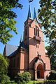
Category:St. Johannes (Niederwürschnitz)
| Object location | | View all coordinates using: OpenStreetMap |
|---|
| (Wikidata) |
 | |||||
| Upload media | |||||
| Instance of | |||||
|---|---|---|---|---|---|
| Location | Niederwürschnitz, Erzgebirgskreis, Saxony, Germany | ||||
| Street address |
| ||||
| Heritage designation | |||||
| Inception |
| ||||
 | |||||
Media in category "St. Johannes (Niederwürschnitz)"
The following 8 files are in this category, out of 8 total.
-
 St. Johannes Kirche in Niederwürschnitz. IMG 5575WI.jpg 3,456 × 5,184; 14.92 MB
-
 St. Johannes Kirche in Niederwürschnitz. IMG 5607WI.jpg 2,765 × 4,147; 10.46 MB
-
 St. Johannes Kirche in Niederwürschnitz. Sachsen. IMG 5486WI.jpg 2,765 × 4,147; 8.04 MB
-
 St. Johannes Kirche in Niederwürschnitz. Sachsen. IMG 5491WI.jpg 2,765 × 4,147; 8.05 MB
-
 St. Johannes Kirche in Niederwürschnitz. Sachsen.IMG 5514WI.jpg 2,765 × 3,803; 6.52 MB
-
 St. Johannes Kirche in Niederwürschnitz. SachsenIMG 5521WI.jpg 2,765 × 4,147; 7.65 MB
-
 St. Johannes Kirche in Niederwürschnitz.IMG 5609WI.jpg 2,765 × 4,147; 10.35 MB
-
 St. Johannis Niederwürschnitz (2).JPG 3,000 × 4,000; 2.26 MB


.JPG)