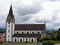
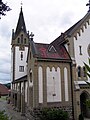
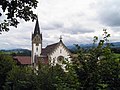
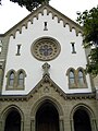
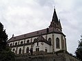
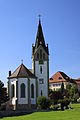
Category:St. Michael (Heitenried)
| Object location | | View all coordinates using: OpenStreetMap |
|---|
church building in Heitenried in the canton of Fribourg, Switzerland    | |||||
| Upload media | |||||
| Instance of | |||||
|---|---|---|---|---|---|
| Part of | |||||
| Location | Heitenried, Sense District, Canton of Fribourg, Switzerland | ||||
| Street address |
| ||||
| Heritage designation | |||||
 | |||||
Subcategories
This category has only the following subcategory.
I
Media in category "St. Michael (Heitenried)"
The following 22 files are in this category, out of 22 total.
-
 Heitenried Friedhofkreuz.jpg 2,592 × 3,888; 2.89 MB
-
 Heitenried Pfarrkirche Sankt Michael 01.jpg 4,608 × 3,456; 5.43 MB
-
 Heitenried Pfarrkirche Sankt Michael 10.jpg 4,896 × 3,264; 955 KB
-
 Heitenried Saint-Michel 2011-07-24 16 27 34 PICT3499.JPG 1,704 × 2,272; 1.5 MB
-
 Heitenried Saint-Michel 2011-07-24 16 29 34 PICT3501.JPG 2,272 × 1,704; 1.99 MB
-
 Heitenried Saint-Michel 2011-07-24 16 30 30 PICT3502.JPG 1,704 × 2,272; 2.16 MB
-
 Heitenried Saint-Michel 2011-07-24 16 31 20 PICT3503.JPG 2,272 × 1,704; 2.28 MB
-
 Heitenried Saint-Michel 2011-07-24 16 32 53 PICT3505.JPG 1,704 × 2,272; 2.28 MB
-
 Heitenried Saint-Michel 2011-07-24 16 38 23 PICT3514.JPG 1,704 × 2,272; 2.16 MB
-
 Heitenried Saint-Michel 2011-07-24 16 38 50 PICT3515.JPG 1,704 × 2,272; 1.98 MB
-
 Heitenried Saint-Michel 2011-07-24 16 39 24 PICT3516.JPG 2,272 × 1,704; 1.92 MB
-
 Heitenried Saint-Michel 2011-07-24 16 39 31 PICT3517.JPG 2,272 × 1,704; 2.02 MB
-
 Heitenried Saint-Michel 2011-07-24 16 40 14 PICT3518.JPG 2,272 × 1,704; 2.01 MB
-
 Heitenried Saint-Michel 2011-07-24 16 40 51 PICT3519.JPG 2,272 × 1,704; 2.11 MB
-
 Heitenried St. Michael (1).jpg 3,888 × 2,592; 3.13 MB
-
 Heitenried St. Michael (2).jpg 3,888 × 2,592; 2.9 MB
-
 Heitenried St. Michael (3).jpg 3,888 × 2,592; 3.37 MB
-
 Heitenried St. Michael (4).jpg 3,888 × 2,592; 2.7 MB
-
 Heitenried St. Michael (5).jpg 3,888 × 2,592; 2.11 MB
-
 Heitenried St. Michael (6).jpg 3,888 × 2,592; 3.34 MB
-
 Heitenried St. Michael (7).jpg 2,592 × 3,888; 3.11 MB
-
 St Michael Heitenried Sep 2010.jpg 3,168 × 4,752; 4.41 MB


.jpg)
.jpg)
.jpg)
.jpg)
.jpg)
.jpg)
.jpg)