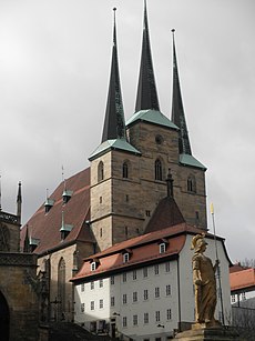
Category:St. Severi (Erfurt)
| Object location | | View all coordinates using: OpenStreetMap |
|---|
church in Thuringia, Germany | |||||
| Upload media | |||||
| Instance of | |||||
|---|---|---|---|---|---|
| Named after | |||||
| Dedicated to | |||||
| Location | Erfurt, Thuringia, Germany | ||||
| Architectural style | |||||
| Diocese | |||||
| Heritage designation | |||||
| Inception |
| ||||
| Religion or worldview | |||||
| official website | |||||
 | |||||
Subcategories
This category has the following 2 subcategories, out of 2 total.
E
I
Pages in category "St. Severi (Erfurt)"
This category contains only the following page.
Media in category "St. Severi (Erfurt)"
The following 32 files are in this category, out of 32 total.
-
Domen och Severi Kirche i Erfurt - TEK - TEKA0118318.tif 3,044 × 3,543; 20.59 MB
-
Motiv från Domplatz i Erfurt - TEK - TEKA0118544.tif 3,543 × 3,492; 23.63 MB
-
Bundesarchiv Bild 183-19902-0013, Erfurt, Severi-Kirche.jpg 800 × 582; 72 KB
-
Bundesarchiv Bild 183-77693-0001, Erfurt, Severi-Kirche.jpg 545 × 800; 41 KB
-
19870529110NR Erfurt Katholisches Priesterseminar.jpg 3,659 × 3,348; 4.64 MB
-
Severikirche Erfurt.JPG 1,114 × 1,482; 343 KB
-
Dom von Erfurt.JPG 3,072 × 2,304; 1.8 MB
-
Am Domplatz in Erfurt...2H1A4451WI.jpg 3,363 × 3,435; 3.31 MB
-
Ansichten Deutschland Bokelmann 014.jpg 4,136 × 3,114; 6.5 MB
-
De Reiselexikon (Schramm) 1 269.jpg 443 × 785; 97 KB
-
Erfurt - KMB - 16001000156166.jpg 533 × 780; 82 KB
-
Erfurt - View from Petersberg - 2.jpg 3,648 × 5,472; 6.54 MB
-
Erfurt Winter Schnee 202.jpg 4,846 × 2,660; 6.21 MB
-
Erfurt, Blick auf Severikirche vom Petersberg.JPG 4,000 × 3,000; 2.93 MB
-
Erfurt, Severikirche, Ausstattung-002.jpg 3,264 × 4,928; 12.47 MB
-
Erfurt, Severikirche, von Aussen-006.jpg 4,928 × 3,264; 11.17 MB
-
Erfurt. Domberg und St.Severi - geo.hlipp.de - 7801.jpg 640 × 480; 67 KB
-
Johannes Driesch Erfurt mit Dom und St, Severi 1929.jpg 1,029 × 677; 99 KB
-
Katholikentag Erfurt 22.jpg 3,404 × 5,106; 3.17 MB
-
Neubauten im Brühl Erfurt.JPG 1,600 × 1,200; 451 KB
-
Serverikirche, Anischt von Nordosten Erfurt 20211003 0001.jpg 3,728 × 5,603; 21.78 MB
-
Severi church from WNW at night.jpg 3,882 × 3,882; 8.66 MB
-
Severikirche Erfurt 20211003 0021.jpg 3,787 × 5,692; 21.18 MB
-
Severikirche Erfurt 20211003 0022.jpg 3,910 × 5,876; 16.36 MB
-
Severikirche Erfurt 20211003 0023.jpg 6,048 × 4,024; 21.96 MB
-
Severikirche Erfurt 20211003 0024.jpg 5,805 × 3,862; 20.16 MB
-
Severikirche, vom Brühl Erfurt 20211003 0017.jpg 3,547 × 5,332; 23.49 MB
-
Severikirche, vom Brühl Erfurt 20211003 0018.jpg 5,726 × 3,810; 21.75 MB
-
St. Severi und Dom von der Cyriaksburg Erfurt 20200904 127.jpg 4,169 × 2,774; 8.82 MB
-
St. Severin Church in Erfurt.jpg 2,736 × 3,648; 3.26 MB
-
St. Severin Church.jpg 3,648 × 2,736; 3.37 MB


