Category:St. Urban (Wantewitz)
| Object location | | View all coordinates using: OpenStreetMap |
|---|
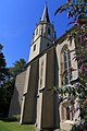
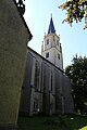
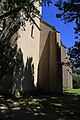
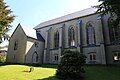
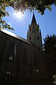
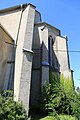
church building in Priestewitz, Saxony, Germany   | |||||
| Upload media | |||||
| Instance of | |||||
|---|---|---|---|---|---|
| Named after | |||||
| Location | Wantewitz, Priestewitz, Meissen District, Saxony, Germany | ||||
| Street address |
| ||||
| Heritage designation | |||||
| Inception |
| ||||
 | |||||
Subcategories
This category has only the following subcategory.
I
Media in category "St. Urban (Wantewitz)"
The following 19 files are in this category, out of 19 total.
-
 2019 Wantewitz 1.+2. Weltkrieg.jpg 5,166 × 2,926; 3.63 MB
-
 2019 Wantewitz Kirche Pano.jpg 5,118 × 4,742; 22.65 MB
-
 2019 Wantewitz Kirche.jpg 5,212 × 2,972; 2.44 MB
-
 Kirche Wantewitz August 2017 (1).jpg 3,648 × 5,472; 5.13 MB
-
 Kirche Wantewitz August 2017 (10).jpg 3,648 × 5,472; 5.05 MB
-
 Kirche Wantewitz August 2017 (2).jpg 3,648 × 5,472; 4.86 MB
-
 Kirche Wantewitz August 2017 (3).jpg 3,648 × 5,472; 4.66 MB
-
 Kirche Wantewitz August 2017 (4).jpg 3,648 × 5,472; 5.07 MB
-
 Kirche Wantewitz August 2017 (5).jpg 5,472 × 3,648; 4.65 MB
-
 Kirche Wantewitz August 2017 (6).jpg 3,648 × 5,472; 4.53 MB
-
 Kirche Wantewitz August 2017 (7).jpg 3,648 × 5,472; 5.11 MB
-
 Kirche Wantewitz August 2017 (8).jpg 3,648 × 5,472; 4.84 MB
-
 Kirche Wantewitz August 2017 (9).jpg 3,648 × 5,472; 5.03 MB
-
 Litho - Wantewitz - St Urban.jpg 1,231 × 1,600; 589 KB
-
 Sankt-Urban-Kirche Wantewitz-1.jpg 2,345 × 3,535; 4.71 MB
-
 Sankt-Urban-Kirche Wantewitz-2.jpg 2,275 × 3,240; 3.73 MB
-
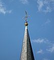 Sankt-Urban-Kirche Wantewitz-Turmspitze.jpg 2,410 × 2,670; 2.87 MB
-
 Sankt-Urban-Kirche Wantewitz.jpg 1,183 × 1,428; 1,022 KB
-
 WantewitzKirche5.JPG 3,423 × 2,560; 1.7 MB


.jpg)
.jpg)
.jpg)
.jpg)
.jpg)
.jpg)
.jpg)
.jpg)
.jpg)
.jpg)


