Category:St Andrew's Church, Aikton
| Object location | | View all coordinates using: OpenStreetMap |
|---|
Grade I listed church in the United Kingdom  | |||||
| Upload media | |||||
| Instance of | |||||
|---|---|---|---|---|---|
| Dedicated to | |||||
| Location | Aikton, Allerdale, Cumbria, North West England, England | ||||
| Architectural style | |||||
| Diocese | |||||
| Heritage designation |
| ||||
| Inception |
| ||||
| Religion or worldview | |||||
| official website | |||||
 | |||||
This is a category about listed building number 1327139. |
Media in category "St Andrew's Church, Aikton"
The following 3 files are in this category, out of 3 total.
-
 Aikton Church. - geograph.org.uk - 119914.jpg 640 × 471; 64 KB
-
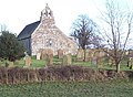
 Aikton St Andrew GeoUK5501755.jpg 1,250 × 834; 982 KB
-
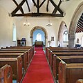 St Andrew's, Aikton - Interior.jpg 1,024 × 1,024; 134 KB

