Category:St Andrew's church, Gussage St Andrew
| Object location | | View all coordinates using: OpenStreetMap |
|---|
church in Gussage St Andrew, Dorset, UK  | |||||
| Upload media | |||||
| Instance of | |||||
|---|---|---|---|---|---|
| Dedicated to | |||||
| Location | Gussage St Andrew, Sixpenny Handley and Pentridge, Dorset, South West England, England | ||||
| Diocese | |||||
| Heritage designation |
| ||||
| Inception |
| ||||
| Religion or worldview | |||||
 | |||||
Media in category "St Andrew's church, Gussage St Andrew"
The following 6 files are in this category, out of 6 total.
-
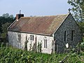 Ancient Church at Gussage St Andrew - geograph.org.uk - 260696.jpg 640 × 480; 110 KB
-
 Church door at Gussage St Andrew - geograph.org.uk - 260700.jpg 480 × 640; 80 KB
-
 Gussage St Andrew, "tower" - geograph.org.uk - 3593218.jpg 640 × 480; 90 KB
-
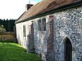
 Gussage St. Andrew, church of St. Andrew - geograph.org.uk - 506478.jpg 640 × 429; 110 KB
-
 St Andrews Church, Gussage St Andrew - geograph.org.uk - 1014420.jpg 640 × 480; 118 KB
-
 St Andrews Church, Gussage St Andrew - geograph.org.uk - 1014430.jpg 640 × 480; 123 KB


