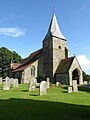
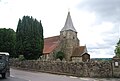
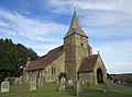
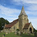
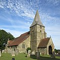
Category:St Bartholomew's Church, Burwash
church building in Burwash, Rother, East Sussex, England, UK _(June_2015)_(3).JPG) | |||||
| Upload media | |||||
| Instance of | |||||
|---|---|---|---|---|---|
| Location | Burwash, Rother, East Sussex, South East England, England | ||||
| Diocese | |||||
| Heritage designation |
| ||||
| Religion or worldview | |||||
 | |||||
Subcategories
This category has the following 2 subcategories, out of 2 total.
S
Media in category "St Bartholomew's Church, Burwash"
The following 47 files are in this category, out of 47 total.
-
 18th century gravestone, Burwash, Sussex.jpg 1,600 × 1,200; 474 KB
-
 Burwash Church - geograph.org.uk - 2454432.jpg 2,256 × 1,496; 859 KB
-
 Burwash Church - geograph.org.uk - 4289851.jpg 640 × 480; 36 KB
-
 Burwash church - geograph.org.uk - 5091709.jpg 1,024 × 768; 216 KB
-
 Burwash church - geograph.org.uk - 5091712.jpg 600 × 800; 98 KB
-
 Burwash church - geograph.org.uk - 5091715.jpg 768 × 1,024; 212 KB
-
 Burwash church - geograph.org.uk - 5091717.jpg 800 × 600; 110 KB
-

-
 Burwash churchyard 01.jpg 5,184 × 3,888; 4.15 MB
-
 Burwash churchyard 02.jpg 5,184 × 3,888; 4.37 MB
-

-
 Parish Church of St Bartholomew - geograph.org.uk - 3654087.jpg 640 × 430; 69 KB
-
 Parish Church of St Bartholomew - geograph.org.uk - 3654093.jpg 640 × 430; 65 KB
-
 Parish Church of St Bartholomew - geograph.org.uk - 3654238.jpg 640 × 430; 60 KB
-
 St Bartholomew's Church, Burwash - geograph.org.uk - 2635246.jpg 2,256 × 1,496; 2.14 MB
-
 St Bartholomew's church, Burwash - geograph.org.uk - 4905025.jpg 4,896 × 3,672; 6.57 MB
-
 St Bartholomew's Church, Burwash - geograph.org.uk - 798180.jpg 640 × 480; 133 KB
-
 St Bartholomew's Church, High Street, Burwash (NHLE Code 1044041) (June 2015) (1).JPG 3,400 × 3,600; 2.86 MB
-
 St Bartholomew's Church, High Street, Burwash (NHLE Code 1044041) (June 2015) (10).JPG 3,400 × 4,600; 2.88 MB
-
 St Bartholomew's Church, High Street, Burwash (NHLE Code 1044041) (June 2015) (11).JPG 4,600 × 3,400; 3.3 MB
-
 St Bartholomew's Church, High Street, Burwash (NHLE Code 1044041) (June 2015) (12).JPG 3,200 × 3,200; 2.21 MB
-
 St Bartholomew's Church, High Street, Burwash (NHLE Code 1044041) (June 2015) (13).JPG 4,600 × 3,000; 3.03 MB
-
 St Bartholomew's Church, High Street, Burwash (NHLE Code 1044041) (June 2015) (2).JPG 3,400 × 3,400; 2.7 MB
-
 St Bartholomew's Church, High Street, Burwash (NHLE Code 1044041) (June 2015) (3).JPG 3,400 × 3,800; 2.96 MB
-
 St Bartholomew's Church, High Street, Burwash (NHLE Code 1044041) (June 2015) (4).JPG 4,600 × 3,400; 3.58 MB
-
 St Bartholomew's Church, High Street, Burwash (NHLE Code 1044041) (June 2015) (5).JPG 4,600 × 3,400; 3.18 MB
-
 St Bartholomew's Church, High Street, Burwash (NHLE Code 1044041) (June 2015) (6).JPG 4,600 × 3,400; 2.99 MB
-
 St Bartholomew's Church, High Street, Burwash (NHLE Code 1044041) (June 2015) (7).JPG 4,600 × 3,200; 2.73 MB
-
 St Bartholomew's Church, High Street, Burwash (NHLE Code 1044041) (June 2015) (8).JPG 4,600 × 3,400; 2.37 MB
-
 St Bartholomew's Church, High Street, Burwash (NHLE Code 1044041) (June 2015) (9).JPG 4,600 × 3,400; 2.98 MB
-

-
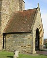 St Bartholomew's Church, High Street, Burwash (NHLE Code 1044041) (June 2015) (Porch).JPG 3,400 × 4,200; 3.52 MB
-
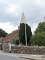
 St Bartholomew's Church, High Street, Burwash (NHLE Code 1044041) (June 2015) (Spire).JPG 3,400 × 4,600; 3.35 MB
-

-

-
 St Bartholomew, Burwash - geograph.org.uk - 2520236.jpg 768 × 1,024; 194 KB
-
 St Bartholomew, Burwash, churchyard (a) - geograph.org.uk - 5480714.jpg 640 × 480; 110 KB
-

-

-

-

-

-
 St Bartholomew, Burwash, entrance - geograph.org.uk - 5479759.jpg 480 × 640; 71 KB
-
 St Bartholomew, Burwash, spire - geograph.org.uk - 5455416.jpg 640 × 480; 78 KB
-
 St Bartholomew, Burwash.jpg 1,970 × 1,477; 705 KB
-
 St. Bartholomew's Church, Burwash - geograph.org.uk - 1943175.jpg 640 × 466; 43 KB
-
 War Memorial at Burwash - geograph.org.uk - 1578340.jpg 640 × 480; 75 KB


_(June_2015)_(1).JPG)
_(June_2015)_(10).JPG)
_(June_2015)_(11).JPG)
_(June_2015)_(12).JPG)
_(June_2015)_(13).JPG)
_(June_2015)_(2).JPG)
_(June_2015)_(4).JPG)
_(June_2015)_(5).JPG)
_(June_2015)_(6).JPG)
_(June_2015)_(7).JPG)
_(June_2015)_(8).JPG)
_(June_2015)_(9).JPG)
_(June_2015)_(Churchyard).JPG)
_(June_2015)_(Porch).JPG)
_(June_2015)_(Spire).JPG)
_(June_2015)_(Window).JPG)


_-_geograph.org.uk_-_5480714.jpg)
_-_geograph.org.uk_-_5480717.jpg)
_-_geograph.org.uk_-_5480718.jpg)
_-_geograph.org.uk_-_5480719.jpg)
_-_geograph.org.uk_-_5480728.jpg)
_-_geograph.org.uk_-_5480730.jpg)


