Category:St Breock
village and civil parish in Cornwall, UK  Eglwys Sant Breock | |||||
| Upload media | |||||
| Instance of | |||||
|---|---|---|---|---|---|
| Location | Cornwall, South West England, England | ||||
 | |||||
English: St Breock is a village and a civil parish in north Cornwall, United Kingdom. (Its Cornish name is Lansant or Nansent: the spelling St Breoke was also formerly in use.)
Subcategories
This category has the following 5 subcategories, out of 5 total.
Media in category "St Breock"
The following 200 files are in this category, out of 265 total.
(previous page) (next page)-

-
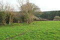
 A forest track in Hustyn Wood - geograph.org.uk - 4855036.jpg 640 × 427; 84 KB
-
 A Grand Day Out, 2006. - geograph.org.uk - 309364.jpg 640 × 480; 140 KB
-
-
-
-
 Access woodland, Hustyn Wood - geograph.org.uk - 5431797.jpg 2,048 × 3,072; 1.6 MB
-
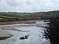
 Across the Camel Estuary - geograph.org.uk - 4510793.jpg 2,429 × 1,620; 1.3 MB
-
 Across the Camel estuary - geograph.org.uk - 5395491.jpg 3,072 × 1,373; 605 KB
-
 Across the Camel estuary - geograph.org.uk - 5395658.jpg 2,951 × 1,428; 660 KB
-
 Approaching Burlawn - geograph.org.uk - 5431042.jpg 3,072 × 1,952; 1.24 MB
-
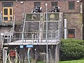 Archimedes screw pump at Wadebridge sewage works - geograph.org.uk - 2832347.jpg 3,648 × 2,736; 2.52 MB
-
 Bend in the lane, Trigtahwheel - geograph.org.uk - 5430846.jpg 3,056 × 1,835; 1.23 MB
-
 Birds at Pinkson Creek - geograph.org.uk - 5398278.jpg 2,048 × 1,536; 745 KB
-
 Bridge and stream, Hustyn Wood - geograph.org.uk - 5431618.jpg 3,072 × 2,048; 1.36 MB
-
 Bridge over Camel Trail - geograph.org.uk - 2868480.jpg 800 × 600; 456 KB
-
 Bridge over River Camel at Grogley Moor - geograph.org.uk - 2849098.jpg 800 × 600; 557 KB
-
 Bridge over stream from Carhart - geograph.org.uk - 2868488.jpg 800 × 600; 371 KB
-
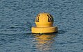 Buoy, Camel estuary - geograph.org.uk - 5398791.jpg 965 × 600; 137 KB
-
 Buoys and floats, Camel estuary - geograph.org.uk - 5398801.jpg 2,048 × 1,536; 636 KB
-
 Camel and Camel Trail - geograph.org.uk - 5419780.jpg 3,072 × 2,048; 1.39 MB
-
 Camel estuary - geograph.org.uk - 5262026.jpg 3,072 × 2,048; 1.26 MB
-
 Camel estuary - geograph.org.uk - 5395477.jpg 2,048 × 1,424; 712 KB
-
 Camel estuary - geograph.org.uk - 5395583.jpg 3,072 × 2,048; 918 KB
-
 Camel estuary - geograph.org.uk - 5395655.jpg 1,924 × 919; 345 KB
-
 Camel estuary - geograph.org.uk - 5398782.jpg 3,072 × 2,048; 984 KB
-
 Camel Estuary - geograph.org.uk - 5710827.jpg 2,976 × 1,681; 757 KB
-
 Camel estuary west of Tregunna House - geograph.org.uk - 5395574.jpg 3,072 × 2,048; 1.29 MB
-
 Camel Quarry - geograph.org.uk - 5398121.jpg 3,072 × 2,048; 1.36 MB
-

-
 Camel Trail - geograph.org.uk - 5196675.jpg 1,600 × 1,067; 732 KB
-
 Camel Trail - geograph.org.uk - 5196713.jpg 1,600 × 1,067; 825 KB
-
 Camel Trail - geograph.org.uk - 5196719.jpg 1,600 × 1,067; 563 KB
-
 Camel Trail - geograph.org.uk - 5196739.jpg 1,600 × 1,067; 373 KB
-
 Camel Trail - geograph.org.uk - 5196749.jpg 1,600 × 900; 409 KB
-
 Camel Trail - geograph.org.uk - 5395145.jpg 3,072 × 2,048; 1.56 MB
-
 Camel Trail - geograph.org.uk - 5395493.jpg 2,928 × 1,863; 1.49 MB
-
 Camel Trail - geograph.org.uk - 5419687.jpg 3,072 × 2,048; 1.77 MB
-
 Camel Trail at Camel Quarry - geograph.org.uk - 5395682.jpg 3,072 × 2,048; 1.48 MB
-
 Camel Trail at Camel Quarry - geograph.org.uk - 5398044.jpg 3,021 × 1,649; 1.1 MB
-
 Camel Trail at Camel Quarry - geograph.org.uk - 5398119.jpg 3,060 × 1,919; 1.33 MB
-
 Camel Trail at Pinkson Creek - geograph.org.uk - 5398866.jpg 2,185 × 1,195; 644 KB
-
 Camel Trail in Treraven Woods - geograph.org.uk - 2849074.jpg 800 × 600; 484 KB
-
 Camel valley - geograph.org.uk - 5419759.jpg 3,072 × 2,048; 1.61 MB
-
 Canada geese on the Camel - geograph.org.uk - 5395482.jpg 1,915 × 1,050; 415 KB
-
 Canada geese over the Camel - geograph.org.uk - 5261960.jpg 1,328 × 1,262; 131 KB
-
 Collapsing bank, Pawton Mill - geograph.org.uk - 6058134.jpg 2,195 × 2,812; 1.29 MB
-
 Confluence, Pennard - geograph.org.uk - 6057803.jpg 2,848 × 4,288; 2.14 MB
-
 Coniferous forest at Hustyn - geograph.org.uk - 4855034.jpg 427 × 640; 110 KB
-
 Coniferous woodland, Hustyn Wood - geograph.org.uk - 5431644.jpg 2,048 × 3,072; 1.83 MB
-
 Cornwall , Countryside Scenery - geograph.org.uk - 5467650.jpg 6,000 × 4,000; 7.66 MB
-
 Cottage and phone box, Burlawn - geograph.org.uk - 5430941.jpg 3,062 × 1,841; 1.42 MB
-
 Cows in a field - geograph.org.uk - 4177170.jpg 640 × 480; 132 KB
-
 Derry's Wood across the River Camel - geograph.org.uk - 2849037.jpg 600 × 800; 484 KB
-
 Dog, Trelyll Farm - geograph.org.uk - 6065687.jpg 4,186 × 2,776; 2.06 MB
-
 Downhill to the Camel Estuary - geograph.org.uk - 204495.jpg 640 × 427; 132 KB
-
 Duchy Designs at Hawksfield - geograph.org.uk - 5721774.jpg 2,794 × 1,450; 376 KB
-
 Elm Terrace, Burlawn - geograph.org.uk - 5430920.jpg 3,072 × 2,048; 1.01 MB
-
 End of the track, Hustyn Wood - geograph.org.uk - 5431783.jpg 3,072 × 2,048; 1.42 MB
-
-
 Factory building, Polmorla valley - geograph.org.uk - 6066469.jpg 4,211 × 2,443; 1.58 MB
-
 Farmland near Trelyll Farm - geograph.org.uk - 6064937.jpg 4,288 × 2,550; 1.56 MB
-
 Farmland near Trelyll Farm - geograph.org.uk - 6064982.jpg 4,288 × 2,848; 1.43 MB
-
 Farmland near Trelyll Farm - geograph.org.uk - 6064990.jpg 4,288 × 2,848; 1.46 MB
-
 Field above Mill Pool Wood - geograph.org.uk - 5431483.jpg 3,056 × 1,662; 954 KB
-
 Field access track near Trelyll Farm - geograph.org.uk - 6065700.jpg 3,974 × 2,825; 1.28 MB
-
 Field by Hawke's Wood - geograph.org.uk - 5432838.jpg 2,194 × 1,544; 807 KB
-
 Field by Hawke's Wood - geograph.org.uk - 5432845.jpg 2,048 × 1,536; 1.04 MB
-
 Field gate on St Breock Downs - geograph.org.uk - 3915739.jpg 640 × 480; 66 KB
-
 Field gateway at Highfurze - geograph.org.uk - 4855049.jpg 640 × 427; 80 KB
-
 Field near the County Showground - geograph.org.uk - 6065908.jpg 4,288 × 2,848; 2.23 MB
-
 Field, Burlawn - geograph.org.uk - 5431038.jpg 3,072 × 2,048; 1.47 MB
-
 Field, West Hill - geograph.org.uk - 5268203.jpg 2,852 × 1,839; 963 KB
-
 Footbridge over ford at Hustyn Mill - geograph.org.uk - 727597.jpg 640 × 480; 123 KB
-
 Footbridges in Hustyn Wood - geograph.org.uk - 5431582.jpg 2,048 × 3,072; 1.53 MB
-
 Footpath in Hustyn Wood - geograph.org.uk - 5266737.jpg 3,072 × 2,048; 1.62 MB
-
 Footpath signs and house near Burlawn - geograph.org.uk - 4177174.jpg 640 × 480; 154 KB
-
 Ford at Burlawn - geograph.org.uk - 5139429.jpg 6,000 × 4,000; 6.72 MB
-
 Fork in land near Pennard - geograph.org.uk - 6053590.jpg 3,864 × 2,324; 1.85 MB
-
 Former railway bridge over River Camel - geograph.org.uk - 5420355.jpg 1,574 × 1,852; 916 KB
-
-
 Foundry, Polmorla valley - geograph.org.uk - 6066448.jpg 4,288 × 2,602; 1.77 MB
-
 Foundry, Polmorla valley - geograph.org.uk - 6066506.jpg 4,279 × 2,671; 1.6 MB
-
 Foundry, Polmorla valley - geograph.org.uk - 6066521.jpg 4,288 × 2,848; 2 MB
-
 Foundry, Polmorla valley - geograph.org.uk - 6066539.jpg 4,288 × 2,848; 1.08 MB
-
 Foundry, Polmorla valley - geograph.org.uk - 6066549.jpg 4,288 × 2,848; 2.06 MB
-
 Gate and puddle by Tredruston Road - geograph.org.uk - 6065931.jpg 4,288 × 2,848; 1.62 MB
-
 Gate between fields, Burlawn - geograph.org.uk - 5431478.jpg 3,072 × 2,048; 1.52 MB
-
 Grass triangle near Tredruston Farm (geograph 6057556).jpg 4,288 × 2,848; 1.78 MB
-
 Green Tunnel - geograph.org.uk - 4510702.jpg 1,594 × 2,391; 1.59 MB
-
 Gulls by the Camel - geograph.org.uk - 5395197.jpg 1,812 × 1,386; 475 KB
-
 Hals Grave junction - geograph.org.uk - 2868448.jpg 800 × 600; 317 KB
-
 Hens, Pawton Mill - geograph.org.uk - 6065975.jpg 4,288 × 2,546; 2.06 MB
-
 Hide, Camel Trail - geograph.org.uk - 5395504.jpg 3,072 × 2,048; 1.24 MB
-
 House at Pawton Mill - geograph.org.uk - 6058073.jpg 4,151 × 2,695; 1.51 MB
-
 House at Whitecross - geograph.org.uk - 5721743.jpg 4,195 × 2,420; 2.57 MB
-
 House on St Breock Downs - geograph.org.uk - 4177169.jpg 640 × 480; 157 KB
-
 Houses at Trevanson - geograph.org.uk - 3495959.jpg 800 × 600; 126 KB
-
 Hustyn Farm lane - geograph.org.uk - 847068.jpg 640 × 453; 169 KB
-
 Hut, 10 Acre Wood - geograph.org.uk - 6066359.jpg 4,288 × 2,848; 2.17 MB
-
 In Mill Pool Wood - geograph.org.uk - 5431539.jpg 3,072 × 2,048; 1.55 MB
-
 Junction by Pennard Villas - geograph.org.uk - 6057854.jpg 4,271 × 2,507; 2.42 MB
-
 Junction near Burlawn - geograph.org.uk - 4177172.jpg 640 × 480; 139 KB
-
 Junction near Tredruston Farm - geograph.org.uk - 6057549.jpg 3,528 × 2,316; 1.59 MB
-
 Lane along Polmorla valley - geograph.org.uk - 6066048.jpg 4,288 × 2,848; 2.41 MB
-
 Lane along Polmorla valley - geograph.org.uk - 6066090.jpg 2,526 × 3,159; 1.61 MB
-
 Lane along Polmorla valley - geograph.org.uk - 6066152.jpg 4,288 × 2,848; 2.95 MB
-
 Lane along Polmorla valley - geograph.org.uk - 6066229.jpg 2,518 × 3,404; 1.79 MB
-
 Lane and track, Burlawn - geograph.org.uk - 5431010.jpg 3,072 × 2,048; 1.28 MB
-
 Lane at Pawton Mill - geograph.org.uk - 6058019.jpg 4,197 × 2,736; 1.6 MB
-
 Lane at Pawton Mill - geograph.org.uk - 6058138.jpg 4,277 × 2,647; 2.04 MB
-
 Lane between Bishop's Wood and Hustyn Wood - geograph.org.uk - 5819138.jpg 1,024 × 768; 338 KB
-
 Lane past Trelyll Farm - geograph.org.uk - 6065015.jpg 4,288 × 2,848; 1.33 MB
-
 Lane to Hay - geograph.org.uk - 6053598.jpg 4,018 × 2,376; 1.71 MB
-
 Lane to Pennard - geograph.org.uk - 6057690.jpg 4,288 × 2,848; 2.21 MB
-
 Lane to Polmorla - geograph.org.uk - 6053479.jpg 4,015 × 2,415; 1.64 MB
-
 Lane to Polmorla valley - geograph.org.uk - 6057718.jpg 3,869 × 2,087; 1.95 MB
-
 Lane to Polmorla valley - geograph.org.uk - 6057729.jpg 2,848 × 3,580; 2.18 MB
-
 Lane to Polmorla valley - geograph.org.uk - 6057742.jpg 2,848 × 4,288; 2.09 MB
-
 Lane to Treneague - geograph.org.uk - 5262756.jpg 2,048 × 3,072; 1.51 MB
-
 Lane to Wadebridge - geograph.org.uk - 5430778.jpg 677 × 835; 130 KB
-
 Lorry on a lane near Burlawn - geograph.org.uk - 4177175.jpg 640 × 480; 164 KB
-
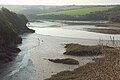
 Low tide on the Camel Estuary - geograph.org.uk - 5196727.jpg 1,600 × 1,067; 269 KB
-
 Marshy land by the River Camel - geograph.org.uk - 2849070.jpg 800 × 600; 405 KB
-
 Mobile (tricycle-drawn) Snack Bar - geograph.org.uk - 4511087.jpg 2,687 × 1,791; 1.39 MB
-

-
 North Cornwall , St Breock Wind Farm - geograph.org.uk - 2493205.jpg 4,224 × 2,748; 3.05 MB
-
 Old and new on the skyline of St Breock - geograph.org.uk - 2851677.jpg 800 × 600; 255 KB
-
-

-

-
 On the Camel Trail heading to Padstow - geograph.org.uk - 4177318.jpg 640 × 480; 139 KB
-
 On the Camel Trail heading to Padstow - geograph.org.uk - 4177325.jpg 640 × 480; 206 KB
-
 On the Camel Trail heading to Wadebridge - geograph.org.uk - 4177332.jpg 640 × 480; 185 KB
-
 Path junction, Hustyn Wood - geograph.org.uk - 5431818.jpg 2,048 × 3,072; 2.1 MB
-
 Path to Hustyn Mill - geograph.org.uk - 5431123.jpg 3,072 × 2,048; 1.51 MB
-
 Path to Hustyn Mill - geograph.org.uk - 5431502.jpg 2,048 × 3,072; 1.88 MB
-
 Path, Hustyn Wood - geograph.org.uk - 5431897.jpg 2,048 × 3,072; 1.35 MB
-
 Pawton Mill - geograph.org.uk - 6058127.jpg 4,288 × 2,848; 2.08 MB
-
 Pawton Mill - geograph.org.uk - 6058143.jpg 3,086 × 1,970; 1.1 MB
-
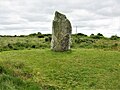
 Pawton Quoit - geograph.org.uk - 794.jpg 640 × 480; 179 KB
-
 Pengelly Cross - geograph.org.uk - 5430914.jpg 3,072 × 2,048; 1.17 MB
-
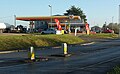 Petrol station, West Hill - geograph.org.uk - 5268221.jpg 1,900 × 1,173; 409 KB
-
 Pinkson Creek - geograph.org.uk - 2868498.jpg 800 × 600; 346 KB
-
 Pinkson Creek - geograph.org.uk - 4511103.jpg 3,318 × 2,212; 2.1 MB
-
 Pinkson Creek - geograph.org.uk - 5398759.jpg 2,670 × 1,770; 1.04 MB
-
 Pinkson Creek seen from the Camel Trail - geograph.org.uk - 4177338.jpg 640 × 480; 138 KB
-
 Polbrock Bridge over River Camel - geograph.org.uk - 2848991.jpg 600 × 800; 563 KB
-
 Polmorla - geograph.org.uk - 5432855.jpg 2,048 × 1,536; 613 KB
-
 Polmorla Brook - geograph.org.uk - 6057810.jpg 4,003 × 2,752; 1.83 MB
-
 Polmorla Brook - geograph.org.uk - 6066241.jpg 2,829 × 2,984; 2.17 MB
-
 Polmorla Brook - geograph.org.uk - 6066418.jpg 4,024 × 2,810; 2.25 MB
-
 Pool by the Camel Trail - geograph.org.uk - 5264489.jpg 3,072 × 2,048; 1.48 MB
-
 Postbox, Burlawn - geograph.org.uk - 5430927.jpg 1,853 × 2,866; 950 KB
-
 Public footpath leading to Trevorder - geograph.org.uk - 4855047.jpg 640 × 427; 126 KB
-
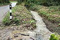
 Puddles alongside the Grogley Rd - geograph.org.uk - 2098805.jpg 640 × 447; 83 KB
-
 Redshank, Camel estuary - geograph.org.uk - 5261966.jpg 867 × 659; 106 KB
-
 River Camel - geograph.org.uk - 5196641.jpg 1,600 × 1,067; 729 KB
-
 River Camel - geograph.org.uk - 5419710.jpg 3,072 × 2,048; 1.4 MB
-
 River Camel - geograph.org.uk - 5419786.jpg 2,048 × 3,072; 1.45 MB
-
 River Camel - geograph.org.uk - 5419808.jpg 3,072 × 2,048; 1.49 MB
-
 River Camel - geograph.org.uk - 5419872.jpg 3,072 × 2,048; 1.47 MB
-
 River Camel - geograph.org.uk - 5419899.jpg 3,072 × 2,048; 1.5 MB
-
 River Camel at the confluence of the Amble - geograph.org.uk - 5395410.jpg 3,072 × 2,048; 1.05 MB
-
 River Camel estuary - geograph.org.uk - 5394931.jpg 3,072 × 2,048; 1.16 MB
-
 River Camel estuary - geograph.org.uk - 5395497.jpg 2,988 × 1,787; 786 KB
-
 River cliff by the Camel Trail - geograph.org.uk - 5395397.jpg 3,072 × 2,048; 1.51 MB
-
 Rivulet, Camel estuary - geograph.org.uk - 5673448.jpg 4,288 × 2,848; 1.11 MB
-
 Road Bridge over the Camel - geograph.org.uk - 2098817.jpg 640 × 407; 106 KB
-
 Road Junction by the bridge - geograph.org.uk - 2098793.jpg 640 × 427; 86 KB
-

-
 Roundabout by Royal Cornwall Showground - geograph.org.uk - 5268214.jpg 3,072 × 2,048; 1.04 MB
-
 Sculpture, Hawksfield - geograph.org.uk - 5721812.jpg 1,934 × 1,164; 105 KB
-
 Sheep in a field - geograph.org.uk - 4177168.jpg 640 × 480; 164 KB
-
 Signpost, Pennard - geograph.org.uk - 6057867.jpg 1,855 × 2,651; 906 KB
-
 Signs at Hal's Grave - geograph.org.uk - 5721793.jpg 3,578 × 1,928; 777 KB
-

-
 Snowdrops by the Polmorla Brook - geograph.org.uk - 6066379.jpg 4,288 × 2,848; 2.82 MB
-
 St Breock Beacon - geograph.org.uk - 3275895.jpg 2,560 × 1,920; 3.16 MB
-
 St Breock Downs - geograph.org.uk - 2849186.jpg 800 × 600; 289 KB
-
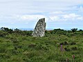 St Breock Downs Monolith - geograph.org.uk - 6203865.jpg 1,024 × 768; 169 KB
-
 St Breock Downs Monolith - geograph.org.uk - 6203869.jpg 1,024 × 768; 231 KB
-
 St Breock, St Breock Downs - geograph.org.uk - 47191.jpg 640 × 433; 124 KB
-
 Stream below Mill Pool Wood - geograph.org.uk - 5431517.jpg 3,072 × 2,048; 1.75 MB
-
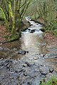
 Stream in Hustyn Wood - geograph.org.uk - 727602.jpg 640 × 480; 163 KB
-
 Stream, Hustyn Wood - geograph.org.uk - 5431621.jpg 2,048 × 3,072; 1.48 MB
-
 Stream, Pennard - geograph.org.uk - 6057748.jpg 4,159 × 2,764; 2.1 MB
-
 Stream, Pennard - geograph.org.uk - 6057789.jpg 4,288 × 2,848; 2.77 MB
-
 Tesco store and car-park, Wadebridge - geograph.org.uk - 5761648.jpg 1,600 × 1,200; 683 KB
-
 Tesco, Wadebridge - geograph.org.uk - 4518704.jpg 3,304 × 2,203; 2.05 MB
-
 The A39 - geograph.org.uk - 4189127.jpg 4,000 × 2,664; 5.72 MB
-
 The A39 - geograph.org.uk - 4189139.jpg 4,000 × 2,664; 5.8 MB
-
 The A39 - geograph.org.uk - 4189150.jpg 4,000 × 2,664; 5.09 MB
-
 The A39 - geograph.org.uk - 4189155.jpg 4,000 × 2,664; 5.8 MB
-
 The A39 - geograph.org.uk - 4197493.jpg 4,000 × 2,664; 4.35 MB
-
 The A39 - geograph.org.uk - 4197508.jpg 4,000 × 2,664; 3.99 MB
-
 The A39 - geograph.org.uk - 4197514.jpg 4,000 × 2,664; 4.38 MB
-
 The A39 - geograph.org.uk - 4197518.jpg 4,000 × 2,664; 3.68 MB
-
 The A39 from Trevanson Road - geograph.org.uk - 3495962.jpg 800 × 600; 123 KB
-
 The abandoned Camel quarries - geograph.org.uk - 2868492.jpg 600 × 800; 353 KB


.jpg)


.jpg)


_Snack_Bar_-_geograph.org.uk_-_4511087.jpg)


.jpg)


