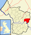
Category:St George West (ward)
electoral ward of the unitary authority of Bristol | |||||
| Upload media | |||||
| Instance of |
| ||||
|---|---|---|---|---|---|
| Location | City of Bristol, South West England, England | ||||
 | |||||
Media in category "St George West (ward)"
The following 67 files are in this category, out of 67 total.
-
'Brizzle Born Bakery', St George - geograph.org.uk - 6871785.jpg 1,024 × 768; 146 KB
-
'Cherry Orchards' chapel conversion - geograph.org.uk - 6872793.jpg 1,024 × 760; 161 KB
-
'Pre-fabs' on Plummers Hill - geograph.org.uk - 6872834.jpg 1,024 × 768; 220 KB
-
'The Pied Horse' - geograph.org.uk - 6871798.jpg 1,024 × 768; 157 KB
-
'Wackum Inn', Bristol - geograph.org.uk - 6872841.jpg 1,024 × 758; 161 KB
-
A lot of 'Bubbles'^ - geograph.org.uk - 6755263.jpg 4,623 × 3,055; 4.35 MB
-
Advisory notice - geograph.org.uk - 6757413.jpg 3,595 × 3,135; 3 MB
-
Aerator - geograph.org.uk - 6755048.jpg 1,811 × 1,706; 1,003 KB
-
At the Lake - geograph.org.uk - 6491838.jpg 4,111 × 2,884; 5.75 MB
-
Benchmark on former Hauliers Arms pub - geograph.org.uk - 5664521.jpg 1,024 × 683; 215 KB
-
Bethel Road - geograph.org.uk - 5579393.jpg 6,000 × 4,000; 4.69 MB
-
Bristol harbour entrance lock, Brislington - geograph.org.uk - 6870751.jpg 1,024 × 768; 226 KB
-
Bristol stgeorge.png 702 × 780; 148 KB
-
Bristol stgeorgewest.png 702 × 780; 152 KB
-
Footbridge, St Anne's - geograph.org.uk - 6870777.jpg 1,024 × 768; 165 KB
-
Former public house, Hauliers Arms, Pilemarsh - geograph.org.uk - 5664546.jpg 1,024 × 683; 136 KB
-
Green Croft at the junction of Speedwell Road - geograph.org.uk - 6174353.jpg 1,900 × 1,265; 1.09 MB
-
Houses on Clouds Hill Road, Bristol - geograph.org.uk - 6173232.jpg 1,920 × 1,280; 907 KB
-
Houses on Whitehall Road - geograph.org.uk - 6174178.jpg 1,920 × 1,280; 1.01 MB
-
In the Wheel Park - geograph.org.uk - 6491822.jpg 2,193 × 1,550; 1.4 MB
-
Kennet ^ Avon Canal Walk - geograph.org.uk - 6052529.jpg 640 × 480; 95 KB
-
Mural, on Church Road, Bristol - geograph.org.uk - 6872823.jpg 1,024 × 768; 180 KB
-
Nothing like a good book^ - geograph.org.uk - 6492493.jpg 900 × 631; 307 KB
-
Ordnance Survey Cut Mark - geograph.org.uk - 6905127.jpg 1,024 × 669; 327 KB
-
Ordnance Survey Cut Mark - geograph.org.uk - 6905129.jpg 1,024 × 716; 186 KB
-
Ordnance Survey Cut Mark - geograph.org.uk - 6905137.jpg 1,024 × 617; 178 KB
-
Ordnance Survey Cut Mark - geograph.org.uk - 6905140.jpg 1,024 × 744; 179 KB
-
Ordnance Survey Cut Mark - geograph.org.uk - 6905141.jpg 1,024 × 750; 203 KB
-
Ordnance Survey Cut Mark - geograph.org.uk - 6905144.jpg 1,024 × 812; 228 KB
-
Ordnance Survey Cut Mark - geograph.org.uk - 6905147.jpg 1,006 × 1,024; 337 KB
-
Ordnance Survey Cut Mark - geograph.org.uk - 6905150.jpg 1,024 × 586; 147 KB
-
Ordnance Survey Pivot - geograph.org.uk - 6905135.jpg 1,024 × 647; 296 KB
-
Ordnance Survey Rivet - geograph.org.uk - 6905132.jpg 1,024 × 581; 232 KB
-
Ornamental Avenue - geograph.org.uk - 6491825.jpg 3,594 × 2,525; 5.8 MB
-
Out of nowhere^ - geograph.org.uk - 6755042.jpg 4,753 × 3,177; 4.07 MB
-
Overlooking the Park - geograph.org.uk - 6755046.jpg 4,480 × 2,930; 3.53 MB
-
Park Notice - geograph.org.uk - 6491819.jpg 2,928 × 4,430; 3.63 MB
-
Park View, Bristol - geograph.org.uk - 6170893.jpg 1,920 × 1,280; 867 KB
-
Parking for books - geograph.org.uk - 6755043.jpg 4,362 × 3,107; 3.61 MB
-
Recreation Ground - geograph.org.uk - 6490293.jpg 4,503 × 3,057; 5.59 MB
-
Richmond Road - geograph.org.uk - 5579464.jpg 6,000 × 4,000; 5.24 MB
-
Shops on Church Road, Redfield - geograph.org.uk - 6171922.jpg 1,892 × 1,236; 1.19 MB
-
Sikh Temple on Summerhill Road - geograph.org.uk - 6872797.jpg 1,024 × 783; 177 KB
-
Speedwell Road, Crofts End - geograph.org.uk - 6174349.jpg 1,868 × 1,196; 1.06 MB
-
Sri Guru Singh Gurdwara, Bristol - geograph.org.uk - 6171919.jpg 1,906 × 1,260; 1.54 MB
-
St George Library, Bristol.jpg 5,579 × 3,719; 4.9 MB
-
St George West Bristol UK ward map.svg 1,138 × 1,266; 709 KB
-
St George's Park - geograph.org.uk - 5579403.jpg 5,760 × 3,840; 7.4 MB
-
St John's church - geograph.org.uk - 6758547.jpg 4,226 × 3,038; 3.74 MB
-
Summerhill Academy - geograph.org.uk - 6872827.jpg 1,024 × 768; 249 KB
-
Summerhill Road - geograph.org.uk - 5579381.jpg 6,000 × 4,000; 4.74 MB
-
Summerhill Road - geograph.org.uk - 5579398.jpg 6,000 × 4,000; 6.27 MB
-
Tennis Courts - geograph.org.uk - 6492020.jpg 2,416 × 1,769; 2.4 MB
-
Testing the water - geograph.org.uk - 6787657.jpg 2,117 × 2,471; 1.44 MB
-
The A431 Summerhill Road.jpg 600 × 400; 184 KB
-
The Fire Engine and Church Road - geograph.org.uk - 5579472.jpg 6,000 × 4,000; 4.32 MB
-
The Fountain Cafe, on Church Road - geograph.org.uk - 6872818.jpg 1,024 × 785; 163 KB
-
Tower block on Bethel Road - geograph.org.uk - 6871803.jpg 1,024 × 745; 171 KB
-
Wackum Inn, Whitehall Road, Bristol - geograph.org.uk - 5829104.jpg 640 × 495; 144 KB
-
What's in a name^ - geograph.org.uk - 6758559.jpg 4,467 × 3,264; 4.6 MB
-
Wheels in the Park - geograph.org.uk - 6755050.jpg 4,098 × 3,264; 5.27 MB
-
Whitehall Road.jpg 500 × 333; 172 KB
-
^100A Blackswarth Road, Grindell Road - geograph.org.uk - 5664479.jpg 1,024 × 679; 112 KB


