Category:St Laurence's church, Affpuddle
| Object location | | View all coordinates using: OpenStreetMap |
|---|
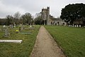
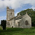
church in Affpuddle, Dorset, England, UK  | |||||
| Upload media | |||||
| Instance of | |||||
|---|---|---|---|---|---|
| Dedicated to | |||||
| Location | Affpuddle, Affpuddle and Turnerspuddle, Dorset, South West England, England | ||||
| Diocese | |||||
| Heritage designation |
| ||||
| Inception |
| ||||
| Religion or worldview | |||||
 | |||||
Subcategories
This category has the following 2 subcategories, out of 2 total.
Media in category "St Laurence's church, Affpuddle"
The following 29 files are in this category, out of 29 total.
-
 SY8093 Affpuddle - geograph.org.uk - 373.jpg 640 × 427; 37 KB
-
 Affpuddle Church - geograph.org.uk - 905955.jpg 640 × 441; 49 KB
-
 Affpuddle Church - geograph.org.uk - 905956.jpg 640 × 487; 97 KB
-
 Affpuddle Church - geograph.org.uk - 905957.jpg 501 × 640; 65 KB
-

-
 Affpuddle, St. Laurence's - geograph.org.uk - 5680976.jpg 1,024 × 750; 176 KB
-
 Affpuddle-02-St Laurentius-Friedhof-2004-gje.jpg 3,072 × 2,048; 2 MB
-
 Affpuddle-04-St Laurentius-2004-gje.jpg 2,040 × 2,004; 1.11 MB
-
 Affpuddle-06-St Laurentius-Friedhof-2004-gje.jpg 2,672 × 2,036; 1.48 MB
-
 Bench Mark, St Laurence's Church - geograph.org.uk - 2316647.jpg 480 × 640; 83 KB
-
 Church, Affpuddle - geograph.org.uk - 5416263.jpg 640 × 480; 133 KB
-
 Church, Affpuddle - geograph.org.uk - 5419663.jpg 640 × 480; 143 KB
-
 Detail, St Laurence's Churchyard - geograph.org.uk - 2316682.jpg 480 × 640; 85 KB
-
 Dreamy days in Dorset 4, Affpuddle - geograph.org.uk - 3125270.jpg 640 × 480; 77 KB
-
 Gate, St Laurence's Church, Affpuddle - geograph.org.uk - 1175017.jpg 480 × 640; 193 KB
-
 Parish church of St Laurence - Affpuddle - geograph.org.uk - 811533.jpg 640 × 427; 372 KB
-
 Porch, St Laurence's Church, Affpuddle - geograph.org.uk - 1175023.jpg 480 × 640; 191 KB
-
 St Laurence's Church, Affpuddle - geograph.org.uk - 1174864.jpg 640 × 480; 145 KB
-
 St Laurence's Church, Affpuddle - geograph.org.uk - 1174922.jpg 640 × 480; 118 KB
-
 St Laurence's Church, Affpuddle - geograph.org.uk - 1924668.jpg 800 × 600; 101 KB
-
 St Laurence's Church, Affpuddle - geograph.org.uk - 2316577.jpg 640 × 480; 71 KB
-
 St Laurence, Affpuddle (29986620073).jpg 3,676 × 2,594; 2.09 MB
-
 St Laurence, Affpuddle (30532400621).jpg 3,726 × 2,551; 1.82 MB
-
 St Laurence, Affpuddle (30584298996).jpg 4,545 × 3,173; 2.82 MB
-

-

-

-
 St Laurence, Affpupddle - geograph.org.uk - 3272379.jpg 1,000 × 686; 232 KB
-
 St Lawrence, Affpuddle.JPG 4,115 × 2,587; 6.18 MB


.jpg)
.jpg)
.jpg)
_-_geograph.org.uk_-_3162716.jpg)
_-_geograph.org.uk_-_3162718.jpg)
_-_geograph.org.uk_-_3162731.jpg)
