Category:St Margarets and All Saints church, Wyton, Cambridgeshire
| Object location | | View all coordinates using: OpenStreetMap |
|---|
West end see Google streetview
Grade I listed church, Huntingdonshire, United Kingdom _Churchyard_(geograph_3660760).jpg) | |||||
| Upload media | |||||
| Instance of | |||||
|---|---|---|---|---|---|
| Location | Houghton and Wyton, Huntingdonshire, Cambridgeshire, East of England, England | ||||
| Heritage designation |
| ||||
| Inception |
| ||||
 | |||||
Media in category "St Margarets and All Saints church, Wyton, Cambridgeshire"
The following 4 files are in this category, out of 4 total.
-
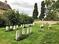 Burial ground in Houghton & Wyton (geograph 6586827).jpg 4,032 × 3,024; 4.29 MB
-
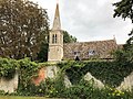 Former church on Rectory Lane, Wyton, Cambridgeshire (geograph 6586829).jpg 4,032 × 3,024; 4.55 MB
-
 Wyton (St Margarets and All Saints) Churchyard (geograph 3660760).jpg 2,000 × 1,333; 715 KB
-
 Wyton All Saints close SSW.jpg 1,756 × 1,534; 310 KB
.jpg)
.jpg)
