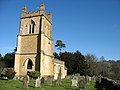
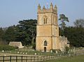
Category:St Mary's church, Temple Guiting
| Object location | | View all coordinates using: OpenStreetMap |
|---|
Grade I listed church in Cotswold, United Kingdom  | |||||
| Upload media | |||||
| Instance of | |||||
|---|---|---|---|---|---|
| Location | Temple Guiting, Cotswold, Gloucestershire, South West England, England | ||||
| Diocese | |||||
| Heritage designation |
| ||||
| Inception |
| ||||
| Religion or worldview | |||||
 | |||||
Subcategories
This category has only the following subcategory.
Media in category "St Mary's church, Temple Guiting"
The following 14 files are in this category, out of 14 total.
-
 Church of St Mary (geograph 1961094).jpg 4,000 × 3,000; 2.63 MB
-
 Church of St Mary (geograph 2221135).jpg 1,024 × 768; 230 KB
-
 Church of St Mary, Temple Guiting (geograph 1961072).jpg 4,000 × 3,000; 3.31 MB
-
 St Mary's churchyard and the rectory - geograph.org.uk - 2221123.jpg 1,024 × 768; 345 KB
-
 St Mary, Temple Guiting (geograph 4813040).jpg 1,624 × 1,060; 1.43 MB
-
 St Marys church, Temple Guiting (geograph 3336360).jpg 2,592 × 1,944; 1.5 MB
-
 Temple Guiting church (geograph 5764396).jpg 680 × 1,024; 290 KB
-
 Temple Guiting Church (geograph 6602838).jpg 1,024 × 837; 199 KB
-
 Temple Guiting Church - geograph.org.uk - 1164871.jpg 426 × 640; 33 KB
-
 Temple Guiting Church - geograph.org.uk - 1164874.jpg 640 × 426; 54 KB
-
 Temple Guiting church - geograph.org.uk - 5494.jpg 640 × 475; 65 KB
-
 Temple Guiting Church. - panoramio.jpg 2,586 × 1,866; 1.08 MB
-
 The tower of Temple Guiting church (geograph 5764206).jpg 680 × 1,024; 265 KB
-
 Tower of Temple Guiting Church - geograph.org.uk - 1164880.jpg 426 × 640; 40 KB
.jpg)
.jpg)
.jpg)

.jpg)
.jpg)
.jpg)
.jpg)


.jpg)
