Category:St Mary in the Marsh
village and civil parish near New Romney in Kent, England  | |||||
| Upload media | |||||
| Instance of | |||||
|---|---|---|---|---|---|
| Location | Folkestone and Hythe, Kent, South East England, England | ||||
 | |||||
Subcategories
This category has the following 2 subcategories, out of 2 total.
H
- Hope Church of All Saints (4 F)
Media in category "St Mary in the Marsh"
The following 200 files are in this category, out of 716 total.
(previous page) (next page)-
 A narrow private, potholed road - geograph.org.uk - 4814650.jpg 640 × 426; 82 KB
-
 A259 - geograph.org.uk - 4819709.jpg 594 × 640; 60 KB
-

-

-
 All Saints Church Remains - geograph.org.uk - 4751240.jpg 640 × 480; 69 KB
-
 All Saints Hall - geograph.org.uk - 1995575.jpg 800 × 600; 146 KB
-
 Alley off Jefferstone Lane - geograph.org.uk - 4814675.jpg 640 × 426; 80 KB
-
 Approach to St Mary's Church at St Mary in the Marsh - geograph.org.uk - 5571432.jpg 4,000 × 3,000; 4.95 MB
-
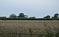
 Arable field - geograph.org.uk - 4804223.jpg 640 × 426; 59 KB
-
 Arable land by St Mary - geograph.org.uk - 4799060.jpg 640 × 388; 53 KB
-
 Arable land by St Mary's Rd - geograph.org.uk - 4798952.jpg 640 × 383; 40 KB
-
 Arable land near St Mary - geograph.org.uk - 4798973.jpg 640 × 426; 51 KB
-
 Arable land, St Mary - geograph.org.uk - 4798989.jpg 640 × 426; 48 KB
-
 Arable stubble - geograph.org.uk - 4804211.jpg 640 × 389; 49 KB
-
 Ashford Road - geograph.org.uk - 2112669.jpg 640 × 480; 69 KB
-
 Ashford Road towards Ivychurch - geograph.org.uk - 6350049.jpg 5,456 × 3,632; 2.02 MB
-
 Ashford Road towards Ivychurch - geograph.org.uk - 6350050.jpg 5,456 × 3,632; 1.88 MB
-
 Ashford Road towards Ivychurch - geograph.org.uk - 6350052.jpg 5,456 × 3,632; 1.68 MB
-
 Ashford Road towards Ivychurch - geograph.org.uk - 6350070.jpg 5,456 × 3,632; 1.83 MB
-
 Ashford Road towards Ivychurch - geograph.org.uk - 6350083.jpg 5,456 × 3,632; 2.06 MB
-
 Ashford Road towards Ivychurch - geograph.org.uk - 6350087.jpg 5,456 × 3,632; 1.64 MB
-
 Ashford Road, Hope - geograph.org.uk - 2673619.jpg 4,000 × 3,000; 3.95 MB
-
 Ayeker on Ashford Road - geograph.org.uk - 6350054.jpg 5,456 × 3,632; 2.1 MB
-
 Bailiff's Sergeant Public House, St. Mary's Bay - geograph.org.uk - 1947623.jpg 3,072 × 2,304; 1.35 MB
-
 Bailiffs Sergeant - geograph.org.uk - 4814682.jpg 640 × 426; 56 KB
-

-
 Bailiffs Sergeant sign - geograph.org.uk - 1969901.jpg 768 × 1,024; 184 KB
-
 Bailiffs Sergeant, 30 Jefferstone Lane - geograph.org.uk - 1879567.jpg 1,024 × 738; 204 KB
-
 Bailiffs Sergeant, 30 Jefferstone Lane - geograph.org.uk - 1879686.jpg 1,024 × 767; 190 KB
-
 Bailiffs Sergeant, St Mary's Bay - geograph.org.uk - 1969894.jpg 1,024 × 683; 165 KB
-
 Bailiffs Sergeant, St. Mary's Bay - geograph.org.uk - 2025808.jpg 3,488 × 2,616; 2.2 MB
-
 Bailiffs Sergeant, St. Mary's Bay - geograph.org.uk - 4636437.jpg 2,272 × 1,704; 712 KB
-
 Barn on Ashford Road - geograph.org.uk - 6350055.jpg 5,456 × 3,632; 1.72 MB
-
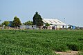
 Barn, Romney Marsh - geograph.org.uk - 4252673.jpg 640 × 480; 96 KB
-
 Barn, The Ayeker - geograph.org.uk - 5126187.jpg 640 × 426; 85 KB
-
 Barns - geograph.org.uk - 5126163.jpg 640 × 426; 54 KB
-
 Beach and Sea Wall, St Mary's Bay - geograph.org.uk - 3244750.jpg 2,256 × 1,496; 917 KB
-
 Beach at St Mary's Bay - geograph.org.uk - 2435781.jpg 640 × 320; 65 KB
-
 Beach near St Mary's Bay - geograph.org.uk - 3271668.jpg 2,000 × 1,325; 1.94 MB
-
 Beach near St. Mary's Bay - geograph.org.uk - 4636413.jpg 2,272 × 1,704; 915 KB
-
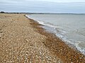 Beach, St. Mary's Bay - geograph.org.uk - 5315399.jpg 640 × 480; 175 KB
-
 Beachside Stores ^ Costcutters - geograph.org.uk - 4814693.jpg 640 × 426; 71 KB
-
 Bend in a lane - geograph.org.uk - 4809989.jpg 640 × 426; 69 KB
-
 Bend in the lane - geograph.org.uk - 4804222.jpg 640 × 426; 66 KB
-
 Bend on the way to New Romney - geograph.org.uk - 5126169.jpg 640 × 426; 51 KB
-
 Bend, Jefferstone Lane - geograph.org.uk - 4810099.jpg 640 × 426; 91 KB
-
 Blossom by the road to New Romney - geograph.org.uk - 5126170.jpg 640 × 426; 66 KB
-
 Bramley Way - geograph.org.uk - 5455846.jpg 3,264 × 2,448; 3.64 MB
-
 Bramley Way - geograph.org.uk - 5615472.jpg 3,264 × 2,448; 1.88 MB
-
 Bramley Way off Cockreed Lane - geograph.org.uk - 5454516.jpg 3,264 × 2,448; 1.76 MB
-
 Briars Road, St. Mary's Bay - geograph.org.uk - 4636433.jpg 2,272 × 1,704; 756 KB
-
 Brick bridge over New Sewer - geograph.org.uk - 5315426.jpg 640 × 480; 134 KB
-
 Bridge over New Sewer - geograph.org.uk - 1858179.jpg 1,024 × 768; 277 KB
-
 Bridge over New Sewer - geograph.org.uk - 2228504.jpg 3,072 × 2,304; 2.33 MB
-
 Bridge over New Sewer - geograph.org.uk - 4252711.jpg 640 × 480; 127 KB
-
 Bridge over Sheaty Sewer - geograph.org.uk - 4804185.jpg 640 × 426; 56 KB
-
 Brodnyx - geograph.org.uk - 4810024.jpg 640 × 426; 94 KB
-
 Brodnyx Cottage - geograph.org.uk - 4810121.jpg 640 × 426; 99 KB
-
 Brodynex Farm - geograph.org.uk - 2673854.jpg 4,000 × 3,000; 3.92 MB
-
 Building site, Cockreed Lane - geograph.org.uk - 5674097.jpg 3,264 × 2,448; 2.33 MB
-
 Building site, Cockreed Lane - geograph.org.uk - 5982794.jpg 3,195 × 2,448; 2.19 MB
-
 Building site, Cockreed Lane - geograph.org.uk - 5982803.jpg 3,264 × 2,448; 2.26 MB
-
 Building site, Cockreed Lane - geograph.org.uk - 5982838.jpg 3,264 × 2,448; 3.87 MB
-
 Building site, Cockreed Lane - geograph.org.uk - 6117032.jpg 3,264 × 2,448; 3.79 MB
-
 Building site, Dymchurch Road (A259) - geograph.org.uk - 5984555.jpg 3,264 × 2,448; 1.64 MB
-
 Building site, Dymchurch Road (A259) - geograph.org.uk - 6257791.jpg 3,264 × 2,448; 2.02 MB
-
 Building site, Dymchurch Road (A259) - geograph.org.uk - 6257799.jpg 3,264 × 2,448; 3.79 MB
-
 Building site, Dymchurch Road (A259) - geograph.org.uk - 6346158.jpg 3,264 × 2,448; 1.83 MB
-
 Building site, Dymchurch Road - geograph.org.uk - 6379539.jpg 3,202 × 2,314; 1.32 MB
-
 Buildings on Nesbit Lane, St Mary's Bay - geograph.org.uk - 3569678.jpg 1,024 × 768; 154 KB
-
 Bus on St Marys Road - geograph.org.uk - 1997229.jpg 1,024 × 768; 210 KB
-

-

-
 Bus stop, A259 - geograph.org.uk - 4814708.jpg 640 × 426; 49 KB
-
 Buttercup meadow - geograph.org.uk - 5126214.jpg 640 × 426; 108 KB
-

-
 Cereal stubble - geograph.org.uk - 4804401.jpg 640 × 426; 54 KB
-
 Cereal stubble - geograph.org.uk - 4810046.jpg 640 × 402; 54 KB
-
 Chittenden's Lane - geograph.org.uk - 2152094.jpg 3,072 × 2,304; 2.15 MB
-
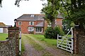
 Church Land Farm - geograph.org.uk - 5125782.jpg 640 × 426; 77 KB
-
 Church Land Farm - geograph.org.uk - 5125785.jpg 640 × 426; 56 KB
-
 Church Land Farm - geograph.org.uk - 5125786.jpg 640 × 426; 68 KB
-
 Church of St Mary in the Marsh - from the north - geograph.org.uk - 5837673.jpg 1,024 × 813; 127 KB
-
 Church of St Mary in the Marsh - geograph.org.uk - 5837448.jpg 1,024 × 772; 182 KB
-
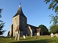
 Church of St Mary the Virgin - geograph.org.uk - 4804205.jpg 640 × 426; 52 KB
-
 Clobsden Sewer (looking towards Blackmanstone Bridge) - geograph.org.uk - 2173395.jpg 3,072 × 2,304; 1.93 MB
-
 Clobsden Sewer - geograph.org.uk - 4792463.jpg 640 × 426; 96 KB
-
 Clobsden Sewer - geograph.org.uk - 4792464.jpg 640 × 426; 93 KB
-
 Clobsden Sewer - looking towards Swallowtail Bridge - geograph.org.uk - 2173398.jpg 3,072 × 2,304; 2.34 MB
-
 Clobsden Sewer north of St Mary's Bay - geograph.org.uk - 5486848.jpg 1,024 × 768; 105 KB
-
 Clover field near Jefferstone Lane - geograph.org.uk - 2048983.jpg 1,280 × 960; 618 KB
-
 Coast Drive, St. Mary's Bay - geograph.org.uk - 4636422.jpg 2,272 × 1,704; 861 KB
-
 Cobsden Close, St. Mary's Bay - geograph.org.uk - 4636687.jpg 2,272 × 1,704; 793 KB
-
 Cobsden Road, St. Mary's Bay - geograph.org.uk - 4636695.jpg 2,272 × 1,704; 804 KB
-
 Cockreed Lane - geograph.org.uk - 5454512.jpg 3,264 × 2,448; 2.15 MB
-
 Cockreed Lane - geograph.org.uk - 5863822.jpg 3,051 × 2,448; 1.98 MB
-
 Cockreed Lane - geograph.org.uk - 5865485.jpg 3,264 × 2,448; 1.69 MB
-
 Cockreed Lane and footpath - geograph.org.uk - 2153235.jpg 3,072 × 2,304; 2.66 MB
-
 Cockreed Lane, New Romney - geograph.org.uk - 4649159.jpg 2,272 × 1,704; 789 KB
-
 Communications Mast, near St Mary's Bay - geograph.org.uk - 3244748.jpg 1,536 × 1,194; 914 KB
-
 Contractors’ site, Cockreed Lane - geograph.org.uk - 5455965.jpg 3,264 × 2,448; 1.78 MB
-
 Contractors’ site, Cockreed Lane - geograph.org.uk - 5457184.jpg 3,264 × 2,448; 1.67 MB
-
 Crossing New Sewer on Collins Bridge - geograph.org.uk - 5779051.jpg 5,027 × 3,770; 5.15 MB
-
-
 Derelict buildings, Brickyard Poultry Farm, Cockreed Lane - geograph.org.uk - 4647064.jpg 3,264 × 2,448; 3.83 MB
-
 Disused buildings near Hope - geograph.org.uk - 2673628.jpg 4,000 × 3,000; 4.05 MB
-
 Dorland, Cockreed Lane - geograph.org.uk - 4701092.jpg 3,264 × 2,448; 2.93 MB
-
 Dorland, Cockreed Lane - geograph.org.uk - 5982853.jpg 3,264 × 2,448; 1.82 MB
-
 Drain at Five Vents Bridge - geograph.org.uk - 2573876.jpg 2,256 × 1,496; 912 KB
-
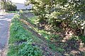
 Drainage Channel - geograph.org.uk - 1858160.jpg 1,024 × 500; 130 KB
-
 Drainage Channel beside St. Mary's Road - geograph.org.uk - 2173324.jpg 3,072 × 2,304; 1.96 MB
-
 Drainage channel towards Slinches Farm - geograph.org.uk - 2153324.jpg 3,072 × 2,304; 2.09 MB
-
 Drainage ditch near Hope All Saints Church - geograph.org.uk - 2673601.jpg 4,000 × 3,000; 4.11 MB
-
 Drainage ditch near St Mary's Bay - geograph.org.uk - 2049015.jpg 960 × 1,280; 583 KB
-
 Drainage ditch on Romney Marsh - geograph.org.uk - 2673604.jpg 4,000 × 3,000; 4.12 MB
-
 Dymchurch Rd, A259 - geograph.org.uk - 4814706.jpg 640 × 426; 74 KB
-
 Dymchurch Rd, A259 - geograph.org.uk - 4819706.jpg 640 × 426; 60 KB
-
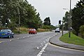
 Dymchurch Road (A259) - geograph.org.uk - 1994399.jpg 800 × 589; 104 KB
-
 Dymchurch Road, St. Mary's Bay - geograph.org.uk - 4636719.jpg 2,272 × 1,704; 496 KB
-
 East Road coastline - geograph.org.uk - 6384540.jpg 1,832 × 3,264; 625 KB
-
 Elizabeth II postbox, Teelin Close - geograph.org.uk - 1994782.jpg 736 × 1,024; 185 KB
-
 Entering St Mary in the Marsh - geograph.org.uk - 4798998.jpg 640 × 426; 73 KB
-
 Entrance to Caravan Park - geograph.org.uk - 4814657.jpg 640 × 426; 54 KB
-
 Evening at St Mary in the Marsh - geograph.org.uk - 5845628.jpg 770 × 1,024; 169 KB
-
 Fallow field - geograph.org.uk - 4810050.jpg 640 × 426; 63 KB
-
 Fallow field - geograph.org.uk - 4810061.jpg 640 × 426; 57 KB
-
 Farm access track - geograph.org.uk - 5125783.jpg 640 × 426; 60 KB
-
 Farm building - geograph.org.uk - 5126164.jpg 640 × 426; 69 KB
-
 Farm track and cornfield near Winford bridge - geograph.org.uk - 2574708.jpg 2,256 × 1,496; 908 KB
-
 Farm track near Beechcroft Farm - geograph.org.uk - 2228512.jpg 3,072 × 2,304; 2.18 MB
-
 Farmland alongside Pickneybush Lane - geograph.org.uk - 2055798.jpg 1,280 × 960; 611 KB
-
 Farmland by Jefferstone Lane - geograph.org.uk - 4810063.jpg 640 × 340; 36 KB
-
 Farmland near St Mary in the Marsh - geograph.org.uk - 2055816.jpg 1,280 × 960; 644 KB
-
 Farmland near St Mary in the Marsh - geograph.org.uk - 2057265.jpg 1,280 × 960; 638 KB
-
 Farmland near St Mary in the Marsh - geograph.org.uk - 2574003.jpg 2,256 × 1,496; 908 KB
-
 Farmland south west of St Mary in the Marsh - geograph.org.uk - 5836568.jpg 1,024 × 800; 331 KB
-
 Farmland with treasure hunter - geograph.org.uk - 2574696.jpg 2,256 × 1,496; 916 KB
-
 Farmland, Romney Marsh - geograph.org.uk - 5117958.jpg 640 × 426; 70 KB
-
 Farmland, Romney Marsh - geograph.org.uk - 5117982.jpg 640 × 426; 89 KB
-
 Farmland, Romney Marsh - geograph.org.uk - 5118136.jpg 640 × 350; 39 KB
-
 Field - geograph.org.uk - 5126223.jpg 640 × 426; 49 KB
-
 Field and Lane near St Mary in the Marsh - geograph.org.uk - 2574687.jpg 2,256 × 1,496; 897 KB
-
 Field beside St.Mary's Road - geograph.org.uk - 2173309.jpg 3,072 × 1,728; 1 MB
-
 Field by Jefferstone Lane - geograph.org.uk - 4810018.jpg 640 × 426; 65 KB
-
 Field by Jefferstone Lane - geograph.org.uk - 4814648.jpg 640 × 426; 71 KB
-
 Field edge on Romney Marsh - geograph.org.uk - 2048947.jpg 1,280 × 960; 629 KB
-
 Field near Beachcroft Farm - geograph.org.uk - 1858177.jpg 1,024 × 683; 226 KB
-
 Field near Honeychild Manor - geograph.org.uk - 2152117.jpg 3,072 × 1,728; 1.35 MB
-
 Field north of St Mary's Bay (1) - geograph.org.uk - 5486844.jpg 1,024 × 768; 97 KB
-
 Field north of St Mary's Bay (2) - geograph.org.uk - 5486847.jpg 1,024 × 768; 133 KB
-
 Field of broad beans, Romney Marsh - geograph.org.uk - 3554492.jpg 640 × 480; 87 KB
-
 Field of Stubble - geograph.org.uk - 4810093.jpg 640 × 426; 68 KB
-
 Field of Stubble - geograph.org.uk - 4810116.jpg 640 × 426; 63 KB
-
 Field on the edge of St Mary's Bay - geograph.org.uk - 4814656.jpg 640 × 426; 57 KB
-
 Field recently stripped of grass turf - geograph.org.uk - 427995.jpg 640 × 480; 63 KB
-
 Field, edge of New Romney - geograph.org.uk - 5126233.jpg 640 × 426; 66 KB
-
 Fields near Tonbridge Farm - geograph.org.uk - 2573940.jpg 2,256 × 1,496; 912 KB
-

-
 Finger post at Stone Bridge - geograph.org.uk - 6350035.jpg 5,456 × 3,632; 3.3 MB
-
 Finger post on Ashford Road - geograph.org.uk - 6350068.jpg 5,456 × 3,632; 1.82 MB
-
 Finger post on Ashford Road - geograph.org.uk - 6350072.jpg 5,456 × 3,632; 3.12 MB
-
 Five Vents Bridge - geograph.org.uk - 2573885.jpg 2,256 × 1,496; 934 KB
-
 Flat arable landscape - geograph.org.uk - 4798962.jpg 640 × 329; 35 KB
-
 Flat farmland - geograph.org.uk - 4810133.jpg 640 × 426; 55 KB
-
 Flat farmland - geograph.org.uk - 4814639.jpg 640 × 426; 64 KB
-
 Flat field - geograph.org.uk - 4810112.jpg 640 × 426; 44 KB
-
 Flat field of stubble - geograph.org.uk - 4804416.jpg 640 × 392; 41 KB
-
 Flat field of stubble - geograph.org.uk - 4810081.jpg 640 × 426; 68 KB
-
 Flat field, Romney Marsh - geograph.org.uk - 5125789.jpg 640 × 345; 23 KB
-
 Flat field, Romney Marsh - geograph.org.uk - 5126156.jpg 640 × 426; 48 KB
-
 Foord Electrical Centre - geograph.org.uk - 4814680.jpg 640 × 426; 43 KB
-

-
 Footbridge near St Mary in the Marsh - geograph.org.uk - 2153328.jpg 3,072 × 2,304; 2.08 MB
-
 Footbridge over Clobsden Sewer - geograph.org.uk - 2173375.jpg 3,072 × 2,304; 2.26 MB
-
 Footbridge over the Jefferstone Sewer - geograph.org.uk - 2173186.jpg 3,072 × 2,304; 1.85 MB
-
 Footbridge over the New Sewer (2) - geograph.org.uk - 2153312.jpg 3,072 × 2,304; 3.1 MB
-
 Footbridge over the New Sewer - geograph.org.uk - 2152151.jpg 3,072 × 2,304; 2.19 MB
-
 Footbridge over the New Sewer - geograph.org.uk - 2153295.jpg 3,072 × 2,304; 2.17 MB
-
 Footbridge over the Wallingham Sewer - geograph.org.uk - 2153242.jpg 3,072 × 2,304; 2.12 MB
-
 Footbridge over Wallingham Sewer - geograph.org.uk - 2153185.jpg 3,072 × 2,304; 2.1 MB
-
 Footbridge, Clobsden Sewer - geograph.org.uk - 4792452.jpg 640 × 426; 73 KB
-
 Footpath alongside the New Sewer - geograph.org.uk - 2057354.jpg 1,280 × 960; 625 KB
-

-
 Footpath beside Wallingham Sewer - geograph.org.uk - 2153259.jpg 3,072 × 2,304; 2.28 MB
-
 Footpath by Haffenden Farm - geograph.org.uk - 2055811.jpg 1,280 × 960; 632 KB
-
 Footpath crosses St.Mary's Road - geograph.org.uk - 2173293.jpg 3,072 × 2,304; 2.33 MB
-
 Footpath from St Mary's Road - geograph.org.uk - 2673884.jpg 4,000 × 3,000; 4.2 MB
-
 Footpath HM112 on Ashford Road - geograph.org.uk - 6350080.jpg 5,456 × 3,632; 3.1 MB
-
 Footpath junction beside the New Sewer - geograph.org.uk - 2153290.jpg 3,072 × 2,304; 2.32 MB
-
 Footpath junction near the Wallingham Sewer - geograph.org.uk - 2153254.jpg 3,072 × 2,304; 2.17 MB
-
 Footpath near New Romney - geograph.org.uk - 2673877.jpg 4,000 × 3,000; 4.07 MB
-
 Footpath near Stone Bridge - geograph.org.uk - 5126238.jpg 640 × 426; 82 KB
-
 Footpath near Stone Bridge - geograph.org.uk - 5126241.jpg 640 × 426; 138 KB
-
 Footpath off Jefferstone Lane - geograph.org.uk - 4814645.jpg 640 × 426; 82 KB
-
 Footpath on Pickneybush Lane - geograph.org.uk - 2153441.jpg 3,072 × 2,304; 1.58 MB
-
 Footpath out on to Romney Marsh - geograph.org.uk - 2049028.jpg 1,280 × 960; 638 KB
-
 Footpath sign near School Farm - geograph.org.uk - 4804219.jpg 640 × 426; 56 KB
-
 Footpath through crops - geograph.org.uk - 5118004.jpg 640 × 426; 77 KB
-
 Footpath to Dymchurch - geograph.org.uk - 2173287.jpg 3,072 × 2,304; 2.08 MB
-
 Footpath towards Hope Farm - geograph.org.uk - 2153181.jpg 3,072 × 2,304; 2.28 MB


_-_geograph.org.uk_-_5984555.jpg)
_-_geograph.org.uk_-_6257791.jpg)
_-_geograph.org.uk_-_6257799.jpg)
_-_geograph.org.uk_-_6346158.jpg)


_-_geograph.org.uk_-_1881090.jpg)
_-_geograph.org.uk_-_1994148.jpg)


_-_geograph.org.uk_-_1994173.jpg)


_-_geograph.org.uk_-_2173395.jpg)


_-_geograph.org.uk_-_1994399.jpg)


_-_geograph.org.uk_-_5486844.jpg)
_-_geograph.org.uk_-_5486847.jpg)


_-_geograph.org.uk_-_2153312.jpg)


