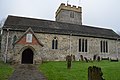
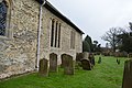
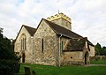
Category:St Nicholas, Charlwood
This is a category about listed building number 1248610. |
| Object location | | View all coordinates using: OpenStreetMap |
|---|
parish church of Charlwood, Surrey, England, UK  | |||||
| Upload media | |||||
| Instance of | |||||
|---|---|---|---|---|---|
| Dedicated to | |||||
| Location | Charlwood, Mole Valley, Surrey, South East England, England | ||||
| Architectural style | |||||
| Diocese | |||||
| Heritage designation |
| ||||
| Religion or worldview | |||||
| official website | |||||
 | |||||
Subcategories
This category has the following 4 subcategories, out of 4 total.
C
- Charlwood War Memorial (3 F)
S
Media in category "St Nicholas, Charlwood"
The following 34 files are in this category, out of 34 total.
-

-
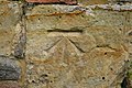 Benchmark, Church of St Nicholas - geograph.org.uk - 4323101.jpg 640 × 426; 96 KB
-
 Sundial on church at Charlwood - geograph.org.uk - 24499.jpg 640 × 480; 132 KB
-
 Charlwood - St Nicholas - geograph.org.uk - 5255237.jpg 2,560 × 1,920; 2.88 MB
-
 Charlwood, Church of St Nicholas - geograph.org.uk - 847279.jpg 640 × 480; 85 KB
-
 Charlwood, St Nicholas - geograph.org.uk - 6368047.jpg 4,608 × 3,456; 4 MB
-
 Charlwood, St. Nicholas's Church - geograph.org.uk - 4543438.jpg 4,608 × 3,456; 6.27 MB
-
 Chest tomb, Church of St Nicholas - geograph.org.uk - 4323021.jpg 640 × 426; 95 KB
-
 Church of St Nicholas - geograph.org.uk - 4323014.jpg 640 × 426; 72 KB
-
 Church of St Nicholas - geograph.org.uk - 4323036.jpg 640 × 426; 75 KB
-
 Church of St Nicholas - geograph.org.uk - 4323047.jpg 640 × 426; 72 KB
-
 Church of St Nicholas - geograph.org.uk - 4323065.jpg 640 × 426; 73 KB
-
 Church of St Nicholas - geograph.org.uk - 4323106.jpg 640 × 426; 84 KB
-
 Church of St Nicholas - geograph.org.uk - 4323115.jpg 640 × 426; 71 KB
-
 Lych Gate, St Nicholas' Church, Charlewood - geograph.org.uk - 2008191.jpg 3,072 × 2,304; 3.67 MB
-
 Lychgate at St Nicholas' Church, Rectory Lane, Charlwood (NHLE Code 1277824) (May 2012).JPG 2,400 × 1,800; 1.33 MB
-
 St Nicholas church, Charlwood (geograph 2274468).jpg 3,264 × 2,448; 2.53 MB
-
 St Nicholas' Church, Charlewood - geograph.org.uk - 2008172.jpg 3,072 × 2,304; 3.21 MB
-
 St Nicholas' Church, Charlwood (View of SE Side).JPG 2,400 × 1,852; 1.13 MB
-
 St Nicholas' Church, Rectory Lane, Charlwood (NHLE Code 1248610) (May 2012) (1).JPG 2,500 × 1,700; 1.15 MB
-
 St Nicholas' Church, Rectory Lane, Charlwood (NHLE Code 1248610) (May 2012) (3).JPG 2,400 × 1,800; 1.24 MB
-
 St Nicholas' Church, Rectory Lane, Charlwood (NHLE Code 1248610) (May 2012) (4).JPG 2,592 × 1,944; 1.65 MB
-
 St Nicholas' Church, Rectory Lane, Charlwood (NHLE Code 1248610) (May 2012) (5).JPG 2,592 × 1,944; 1.57 MB
-
 St Nicholas' Church, Rectory Lane, Charlwood (NHLE Code 1248610) (May 2012) (6).JPG 2,592 × 1,944; 1.68 MB
-
 St Nicholas' Church, Rectory Lane, Charlwood (NHLE Code 1248610).JPG 2,400 × 1,800; 1.32 MB
-
 St Nicholas, Charlwood - geograph.org.uk - 1752301.jpg 2,560 × 1,920; 1.88 MB
-
 St Nicholas, Charlwood, churchyard (iv) - geograph.org.uk - 3617964.jpg 640 × 480; 106 KB
-
 St Nicholas, Charlwood, Surrey - geograph.org.uk - 2106542.jpg 1,000 × 623; 136 KB
-
 St Nicholas, Charlwood, Surrey - geograph.org.uk - 2106547.jpg 1,000 × 661; 195 KB
-
 St Nicholas, Charlwood, Surrey - geograph.org.uk - 2106580.jpg 1,000 × 707; 155 KB
-
 St Nicholas, Charlwood, Surrey - Porch window - geograph.org.uk - 2106574.jpg 1,000 × 825; 187 KB
-
 St Nicholas, Charlwood, Surrey - Porch window - geograph.org.uk - 2106576.jpg 1,000 × 666; 205 KB
-
 Sun dial, Church of St Nicholas - geograph.org.uk - 4323094.jpg 426 × 640; 81 KB
-
 Sussex Border Path (2) - geograph.org.uk - 6104203.jpg 4,608 × 3,456; 4.96 MB


_(May_2012).JPG)
.jpg)

.JPG)
_(May_2012)_(1).JPG)
_(May_2012)_(3).JPG)
_(May_2012)_(4).JPG)
_(May_2012)_(5).JPG)
_(May_2012)_(6).JPG)
.JPG)

_-_geograph.org.uk_-_3617964.jpg)


_-_geograph.org.uk_-_6104203.jpg)