Category:St Nicholas and Bonvilston
English: St Nicholas and Bonvilston is a community in the principal area of the Vale of Glamorgan, in Wales.
community in Vale of Glamorgan, Wales   | |||||
| Upload media | |||||
| Pronunciation audio | |||||
|---|---|---|---|---|---|
| Instance of | |||||
| Location | Vale of Glamorgan, Wales | ||||
| Population |
| ||||
| Area |
| ||||
| official website | |||||
 | |||||
Subcategories
This category has the following 4 subcategories, out of 4 total.
Media in category "St Nicholas and Bonvilston"
The following 179 files are in this category, out of 179 total.
-
 1917 Potting shed, bothy, Dyffryn Gardens - geograph.org.uk - 5532274.jpg 5,184 × 3,456; 6.27 MB
-
 A wintry scene near St Nicholas - geograph.org.uk - 3302995.jpg 4,000 × 3,000; 4.17 MB
-
 A4226 near Redland - geograph.org.uk - 5886724.jpg 1,024 × 783; 114 KB
-

-
 A48 at The Red Lion, Bonvilston - geograph.org.uk - 5886704.jpg 1,024 × 764; 179 KB
-
 Across the fields near Tinkinswood - geograph.org.uk - 3302989.jpg 4,000 × 3,000; 2.68 MB
-

-

-
 Blackland Farm - geograph.org.uk - 5263101.jpg 3,264 × 2,448; 1.87 MB
-
 Bonvilston Village Hall - geograph.org.uk - 4765009.jpg 3,264 × 2,448; 1.78 MB
-
 Bus shelter by A48 in Greenway - geograph.org.uk - 5820996.jpg 1,600 × 1,064; 524 KB
-
 Bus shelter by A48 in St Nicholas - geograph.org.uk - 5820974.jpg 1,600 × 1,199; 734 KB
-

-
 Church cottage - geograph.org.uk - 4764990.jpg 3,264 × 2,448; 1.19 MB
-

-
 Coed y Graig - geograph.org.uk - 5966879.jpg 3,264 × 2,448; 1.81 MB
-
 Conifer on oval lawn, on north side of Dyffryn House - geograph.org.uk - 5530837.jpg 5,179 × 3,451; 3.93 MB
-
 Cottage - St.Nicholas - geograph.org.uk - 4782722.jpg 3,264 × 2,448; 1.94 MB
-
 Cottrell Lodge west of St Nicholas - geograph.org.uk - 2781397.jpg 640 × 560; 88 KB
-
 Country Lane Passing Place - geograph.org.uk - 2779274.jpg 2,200 × 1,633; 4.8 MB
-
 Court Farm, Bonvilston - geograph.org.uk - 2781442.jpg 640 × 470; 118 KB
-

-
 Crossways Junction - geograph.org.uk - 2775619.jpg 2,000 × 721; 1.52 MB
-
 Derelict Farm Buildings, Bonvilston - geograph.org.uk - 3359539.jpg 2,288 × 1,712; 740 KB
-
 Driveway on the edge of Dyffryn Gardens - geograph.org.uk - 5895161.jpg 5,184 × 3,456; 7.63 MB
-
 Duffryn House - south elevation - geograph.org.uk - 5532575.jpg 5,179 × 3,451; 4.29 MB
-
 Dyffryn Gardens - geograph.org.uk - 4985871.jpg 1,280 × 851; 595 KB
-
 Dyffryn Gardens - geograph.org.uk - 4985885.jpg 1,280 × 851; 563 KB
-
 Dyffryn Gardens - geograph.org.uk - 4985910.jpg 1,280 × 851; 500 KB
-
 Dyffryn House - geograph.org.uk - 4985780.jpg 1,280 × 851; 433 KB
-
 Dyffryn House - geograph.org.uk - 5111930.jpg 2,285 × 3,047; 1.62 MB
-
 Dyffryn Lane south of St Nicholas - geograph.org.uk - 5820961.jpg 1,600 × 1,280; 967 KB
-
 East wing, Dyffryn House - geograph.org.uk - 5056010.jpg 5,179 × 3,451; 4.36 MB
-
 Eastern boundary of Bonvilston - geograph.org.uk - 2781423.jpg 640 × 398; 68 KB
-
 Eastern boundary of St Nicholas - geograph.org.uk - 2781088.jpg 640 × 479; 75 KB
-

-

-

-
 Entrance to Bonvilston Reading Room - geograph.org.uk - 2783081.jpg 640 × 481; 85 KB
-
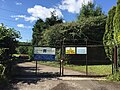
 Entrance to Caeglas Activity Centre - geograph.org.uk - 2187649.jpg 640 × 480; 101 KB
-
 Entrance to churchyard, Bonvilston - geograph.org.uk - 2224580.jpg 3,000 × 4,000; 4.45 MB
-

-
 Entrance to The Downs hamlet - geograph.org.uk - 2162110.jpg 640 × 481; 105 KB
-
 Entrance to Tinkinswood Farm - geograph.org.uk - 2244628.jpg 4,000 × 3,000; 2.4 MB
-
 Fallen tree-stump, much weathered - geograph.org.uk - 2242103.jpg 4,000 × 3,000; 3.34 MB
-
 Farm Gate with Footpath Access - geograph.org.uk - 5475991.jpg 3,264 × 2,448; 3.08 MB
-
 Field near Tinkinswood burial chamber (4784).jpg 4,288 × 2,848; 6.94 MB
-
 Field next to Dyfrryn Gardens - geograph.org.uk - 5895145.jpg 5,179 × 3,451; 4.1 MB
-
 Fields south of St Nicholas - geograph.org.uk - 2191926.jpg 640 × 480; 78 KB
-
 Flower borders by Dyffryn House - geograph.org.uk - 5901933.jpg 1,024 × 768; 1.33 MB
-

-
-
 Footpath in Coed Nant-bran - geograph.org.uk - 3302872.jpg 4,000 × 3,000; 3.62 MB
-
 Footpath near Dyffryn - geograph.org.uk - 3302962.jpg 4,000 × 3,000; 2.95 MB
-
 Footpath near St Nicholas - geograph.org.uk - 3303012.jpg 4,000 × 3,000; 2.98 MB
-
 Ger-y-llan, St Nicholas - geograph.org.uk - 2781224.jpg 640 × 392; 91 KB
-
 Gourd tunnel, Australasian garden, Dyffryn Gardens - geograph.org.uk - 5532151.jpg 5,179 × 3,451; 5.73 MB
-

-

-
 Greenway Farm near Bonvilston - geograph.org.uk - 2783702.jpg 640 × 471; 83 KB
-

-
 Herbaceous border, Dyffryn Gardens - geograph.org.uk - 5057029.jpg 5,179 × 3,451; 4.12 MB
-
 House, Dyffryn Gardens - geograph.org.uk - 5532212.jpg 5,179 × 3,451; 3.93 MB
-
 Ivy and mushrooms - geograph.org.uk - 5966885.jpg 3,264 × 2,448; 2.36 MB
-
 Lane between St Nicholas and Homri - geograph.org.uk - 2280888.jpg 640 × 480; 124 KB
-
 Lane east of Hensol Forest - geograph.org.uk - 3785420.jpg 640 × 480; 98 KB
-
 Lane in St Nicholas - geograph.org.uk - 3303021.jpg 3,000 × 4,000; 3.97 MB
-
 Lane near Dog Hill Farm - geograph.org.uk - 3837452.jpg 2,400 × 1,596; 5.45 MB
-
 Lane near Greenway Farm - geograph.org.uk - 3785421.jpg 640 × 480; 90 KB
-
 Lane south of Lower Greenway - geograph.org.uk - 5753155.jpg 640 × 480; 94 KB
-
 Large tree near Dyffryn - geograph.org.uk - 3302959.jpg 4,000 × 3,000; 3.78 MB
-
 Lime trees, West Garden, Dyffryn Gardens - geograph.org.uk - 5894998.jpg 5,179 × 3,451; 4.88 MB
-
 Low-headroom footpath near St Nicholas - geograph.org.uk - 3302865.jpg 4,000 × 3,000; 4.25 MB
-
 Lower Greenway Farm - geograph.org.uk - 4765899.jpg 3,264 × 2,448; 2.23 MB
-
 Maes-y-ffynon semis, Bonvilston - geograph.org.uk - 2781482.jpg 640 × 464; 75 KB
-
 Merrick Cottages, St Nicholas, Vale of Glamorgan - geograph.org.uk - 2179816.jpg 4,000 × 3,000; 1.89 MB
-

-

-

-

-

-
 Number 2 The Old Forge, Bonvilston - geograph.org.uk - 2781537.jpg 640 × 572; 90 KB
-
 Observatory, Dyffryn Gardens - geograph.org.uk - 5532249.jpg 5,184 × 3,456; 7.1 MB
-

-
 Old Shed, Brook Lane - geograph.org.uk - 3854130.jpg 2,400 × 1,794; 6.09 MB
-
 Old woodland near Duffryn - geograph.org.uk - 5966894.jpg 3,264 × 2,448; 3.52 MB
-
 On fields near Dyffryn - geograph.org.uk - 3302971.jpg 4,000 × 3,000; 3.41 MB
-
 On the path to St Nicholas - geograph.org.uk - 3303001.jpg 4,000 × 3,000; 3.16 MB
-
 Ordnance Survey 1GL Bolt - geograph.org.uk - 4901458.jpg 480 × 640; 125 KB
-
 Ordnance Survey Cut Mark - geograph.org.uk - 4901272.jpg 480 × 640; 117 KB
-

-
 Pathway through the autumn of our lives - geograph.org.uk - 4764987.jpg 2,448 × 3,264; 3.42 MB
-
 Paved Court, Dyffryn Gardens - geograph.org.uk - 5057063.jpg 5,179 × 3,451; 5.66 MB
-

-
 Plasnewydd, Bonvilston - geograph.org.uk - 2783002.jpg 640 × 555; 112 KB
-
 Porkers under a parasol, Dyffryn Gardens^ - geograph.org.uk - 5057002.jpg 5,179 × 3,451; 5.12 MB
-
 Power Line - geograph.org.uk - 3854142.jpg 2,400 × 1,818; 5.38 MB
-
 Property under Construction - geograph.org.uk - 5274086.jpg 3,264 × 2,448; 3.45 MB
-

-
 Pylon near Tinkinswood burial chamber - geograph.org.uk - 2117219.jpg 640 × 480; 173 KB
-
 Rambling near St Nicholas - geograph.org.uk - 3302854.jpg 4,000 × 3,000; 2.51 MB
-
 Red Lion Cottages, Bonvilston - geograph.org.uk - 2781556.jpg 640 × 355; 55 KB
-
 Redland Farm - geograph.org.uk - 4764964.jpg 3,264 × 2,448; 1.64 MB
-
 Redway Road, Bonvilston - geograph.org.uk - 2783219.jpg 640 × 496; 75 KB
-
 River Waycock at Dyffryn - geograph.org.uk - 2212807.jpg 640 × 480; 113 KB
-

-
 Road to Llancarfan from Bonvilston - geograph.org.uk - 2783147.jpg 640 × 499; 72 KB
-

-
 Rockery, Dyffryn Gardens - geograph.org.uk - 5530856.jpg 5,179 × 3,451; 4.66 MB
-
 Row of cottages - geograph.org.uk - 4765014.jpg 3,264 × 2,448; 1.77 MB
-
 Sheep near St Nicholas - geograph.org.uk - 3302858.jpg 4,000 × 3,000; 2.98 MB
-
 Sheepcourt Cottage, Bonvilston - geograph.org.uk - 2781434.jpg 640 × 437; 74 KB
-
 Single track road to Pendoylan - geograph.org.uk - 2781413.jpg 601 × 640; 80 KB
-
 Sinuous dry rill, Dyffryn Gardens - geograph.org.uk - 5893640.jpg 5,179 × 3,451; 5.9 MB
-

-
 Snow scene, St Nicholas, Vale of Glamorgan - geograph.org.uk - 2179849.jpg 4,000 × 3,000; 2 MB
-
 Snow-covered fields, St Nicholas, Vale of Glamorgan - geograph.org.uk - 2179828.jpg 4,000 × 3,000; 2.75 MB
-
 Soar Chapel, Trehill - geograph.org.uk - 4782727.jpg 3,264 × 2,448; 1.95 MB
-
 South Front of Dyffryn House (2) - geograph.org.uk - 4113413.jpg 3,072 × 2,304; 1.78 MB
-

-
 St Nicholas semis - geograph.org.uk - 2781208.jpg 640 × 503; 62 KB
-
 St Nicholas, St Nicholas - geograph.org.uk - 6372727.jpg 4,000 × 3,000; 5.13 MB
-
 St Nicholas, St. Nicholas - geograph.org.uk - 5041780.jpg 1,024 × 760; 189 KB
-
 St Nicholas, thatched cottages - geograph.org.uk - 5041785.jpg 1,024 × 768; 177 KB
-
 St Nicholas, war memorial - geograph.org.uk - 5041763.jpg 1,024 × 759; 192 KB
-
 Staircase, Dyffryn House - geograph.org.uk - 6046844.jpg 4,407 × 2,976; 617 KB
-
 Steps in rockery, Dyffryn Gardens - geograph.org.uk - 5899936.jpg 5,179 × 3,451; 6.31 MB
-
 Stile and Footpath - geograph.org.uk - 3836912.jpg 2,400 × 1,593; 4.39 MB
-
 Stile and Footpath, St.Nicholas - geograph.org.uk - 2808284.jpg 2,200 × 1,650; 3.9 MB
-
 Stile and Gate off Brook Lane - geograph.org.uk - 3854149.jpg 2,400 × 1,528; 4.71 MB
-
 Stile on the footpath between St Nicholas and St Lythans - geograph.org.uk - 2242095.jpg 4,000 × 3,000; 2.24 MB
-
 Stone stile, St Nicholas - geograph.org.uk - 2244650.jpg 3,296 × 2,472; 1.84 MB
-
 Succulent design, Dyffryn Gardens - geograph.org.uk - 5901674.jpg 1,024 × 768; 1.58 MB
-
 Sycamore Cross, Bonvilston - geograph.org.uk - 4764953.jpg 3,154 × 2,365; 1.04 MB
-
 Telephone exchange near Bonvilston - geograph.org.uk - 2783571.jpg 640 × 466; 89 KB
-
 The Aubrey Arms near Bonvilston - geograph.org.uk - 2783697.jpg 640 × 546; 101 KB
-
 The Coach House, St Nicholas - geograph.org.uk - 2781187.jpg 640 × 480; 74 KB
-
 The Old Barn, Bonvilston - geograph.org.uk - 2781514.jpg 640 × 421; 60 KB
-
 The Old Laundry, Bonvilston - geograph.org.uk - 2783187.jpg 640 × 618; 93 KB
-

-
 The Old Schoolhouse, St Nicholas - geograph.org.uk - 2781247.jpg 638 × 640; 107 KB
-
 The Retreat, St Nicholas - geograph.org.uk - 2781393.jpg 640 × 565; 87 KB
-
 The road to Liege Manor and Tyn-y-coed - geograph.org.uk - 5820989.jpg 1,600 × 1,200; 781 KB
-
 The road to St Georges-super-Ely - geograph.org.uk - 2161706.jpg 640 × 637; 137 KB
-
 The rockery at Dyffryn Gardens - geograph.org.uk - 5820002.jpg 1,200 × 1,600; 873 KB
-
 The Smithy, St Nicholas - geograph.org.uk - 2781389.jpg 640 × 544; 111 KB
-
 Theatre Garden, Dyffryn Gardens - geograph.org.uk - 5058134.jpg 5,184 × 3,456; 5.34 MB
-
 Tiles, Dyffryn House - geograph.org.uk - 6046846.jpg 4,241 × 2,116; 643 KB
-
 Tinkinswood - geograph.org.uk - 3302978.jpg 4,000 × 3,000; 3.33 MB
-
 Tinkinswood Burial Chamber - geograph.org.uk - 2244639.jpg 3,296 × 2,472; 1.91 MB
-
 Track towards Homri - geograph.org.uk - 2281895.jpg 640 × 480; 91 KB
-
 Tree and pylons, St Nicholas - geograph.org.uk - 2242084.jpg 4,000 × 3,000; 2.54 MB
-
 Tree near Tinkinswood - geograph.org.uk - 2244626.jpg 2,982 × 3,213; 2.97 MB
-
 Tree presented to Bonvilston in 1954 - geograph.org.uk - 2783233.jpg 640 × 493; 104 KB
-
 Trehill Cottage, St Nicholas - geograph.org.uk - 2781392.jpg 640 × 558; 79 KB
-
 Tuag at Lwyneliddon - Towards St Lythans - geograph.org.uk - 5818600.jpg 1,024 × 768; 244 KB
-
 Tuag at Sain Nicolas - Towards St Nicholas - geograph.org.uk - 5818571.jpg 1,024 × 768; 236 KB
-
 Tuag at Tinkinswood - Towards Tinkinswood - geograph.org.uk - 5818579.jpg 1,024 × 768; 204 KB
-
 Tudor Lodge - geograph.org.uk - 4764994.jpg 2,413 × 1,585; 779 KB
-
 Tudor Lodge, Bonvilston - geograph.org.uk - 2783118.jpg 640 × 486; 86 KB
-
 Ty'n-y-coed Farmhouse - geograph.org.uk - 2779290.jpg 2,200 × 1,657; 4.02 MB
-
 View north from the lane between St Nicholas and Homri - geograph.org.uk - 2280891.jpg 4,000 × 3,000; 3.34 MB
-
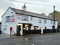 Village Shop - geograph.org.uk - 4764972.jpg 3,264 × 2,448; 1.25 MB
-
 Wales Vale of Glamorgan Community St Nicholas and Bonvilston map.svg 512 × 322; 401 KB
-
 War Memorial - geograph.org.uk - 4782735.jpg 2,448 × 3,264; 1.97 MB
-
 Water Treatment Works - geograph.org.uk - 5475957.jpg 3,264 × 2,448; 3.61 MB
-
 Water Treatment Works Entrance, St.Nicholas - geograph.org.uk - 2808263.jpg 2,200 × 1,650; 3.56 MB
-
 Well Lane, north of St Nicholas, Vale of Glamorgan - geograph.org.uk - 2179856.jpg 4,000 × 3,000; 2.92 MB
-
 Well Lane, St Nicholas, Vale of Glamorgan - geograph.org.uk - 2179822.jpg 4,000 × 3,000; 4.32 MB
-
 Well Lane, St Nicholas, Vale of Glamorgan - geograph.org.uk - 2179844.jpg 4,000 × 3,000; 4.15 MB
-
 Western boundary of Bonvilston - geograph.org.uk - 2783360.jpg 640 × 535; 95 KB
-
 Western boundary of St Nicholas - geograph.org.uk - 2781394.jpg 640 × 487; 88 KB
-
 Window - Dyffryn House - geograph.org.uk - 4985929.jpg 863 × 1,280; 532 KB
-
 Wintry scene in St Nicholas - geograph.org.uk - 3303018.jpg 4,000 × 3,000; 3.64 MB
-
 Wintry scene near Dyffryn - geograph.org.uk - 3302966.jpg 4,000 × 3,000; 2.13 MB
-
 Wintry tree near St Nicholas - geograph.org.uk - 3303006.jpg 4,000 × 3,000; 5.03 MB
-
 Wintry trees near St Nicholas - geograph.org.uk - 3302864.jpg 4,000 × 3,000; 5.37 MB
-
 Woodlands Lodge, Bonvilston - geograph.org.uk - 2782986.jpg 640 × 522; 95 KB
-
 Zoar Church - geograph.org.uk - 4765887.jpg 3,264 × 2,448; 1.96 MB


.jpg)


_to_live_-_geograph.org.uk_-_3398622.jpg)


_-_geograph.org.uk_-_4113413.jpg)


