Category:St Paul's House
| Object location | | View all coordinates using: OpenStreetMap |
|---|
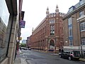
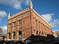
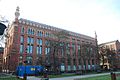
building in Leeds, West Yorkshire, England, UK  | |||||
| Upload media | |||||
| Instance of | |||||
|---|---|---|---|---|---|
| Location | Leeds, West Yorkshire, Yorkshire and the Humber, England | ||||
| Heritage designation |
| ||||
 | |||||
Media in category "St Paul's House"
The following 46 files are in this category, out of 46 total.
-

-
 Decoration on the top of St Paul's House.jpg 2,736 × 3,648; 1.08 MB
-

-

-
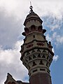
 Minarets St Paul House Leeds.jpg 3,872 × 2,592; 2.48 MB
-
 Park Square . - geograph.org.uk - 408792.jpg 640 × 480; 103 KB
-
 St Paul's House (18779859269).jpg 1,598 × 3,072; 3.72 MB
-
 St Paul's House - Minaret (5853715548).jpg 1,755 × 3,169; 2.69 MB
-
 St Paul's House - Pillars (5853170689).jpg 2,432 × 4,196; 6.21 MB
-
 St Paul's House blue plaque.jpg 3,648 × 2,736; 2.19 MB
-
 St Paul's House Leeds 9 April 2018.jpg 3,072 × 2,304; 3.24 MB
-
 St Paul's House plaque, Leeds 19 March 2018.jpg 2,505 × 1,988; 3.06 MB
-
 St Paul's House, Leeds (2428054327).jpg 2,318 × 1,888; 5.75 MB
-
 St Paul's House, Leeds (2428857598).jpg 2,318 × 1,888; 3.01 MB
-
 St Paul's House, Leeds - geograph.org.uk - 4520945.jpg 640 × 480; 76 KB
-
 St Paul's House, Leeds 19 March 2018.jpg 3,072 × 2,304; 3.04 MB
-
 St Paul's House, Leeds, front - geograph.org.uk - 5042854.jpg 800 × 800; 264 KB
-
 St Paul's House, Leeds, rear - geograph.org.uk - 5042858.jpg 1,024 × 768; 276 KB
-
 St Paul's House, Leeds.jpg 3,648 × 2,736; 1.96 MB
-
 St Paul's House, Park Square, Leeds (7th January 2020).jpg 5,152 × 3,864; 6.51 MB
-
 St Paul's House, Park Square, Leeds - geograph.org.uk - 2572367.jpg 4,320 × 3,240; 4.56 MB
-
 St Paul's House, St Paul's Street, Leeds - geograph.org.uk - 2737334.jpg 458 × 640; 179 KB
-

-
 St Pauls House Leeds 24 March 2017 1.jpg 1,792 × 2,952; 2.7 MB
-
 St Pauls House Leeds 24 March 2017 2c.jpg 2,724 × 1,834; 1.72 MB
-
 St Pauls House Leeds 24 March 2017 3.jpg 2,448 × 3,264; 2.73 MB
-
 St Pauls House Leeds 24 March 2017 4.jpg 2,448 × 3,264; 2.44 MB
-
 St Pauls House Leeds 24 March 2017 5.jpg 2,448 × 3,264; 2.75 MB
-
 St Pauls House Leeds Old Entrance.jpg 1,536 × 2,048; 672 KB
-
 St Pauls House, Leeds 1.jpg 3,872 × 2,592; 2.19 MB
-
 St Pauls House, Leeds 2.jpg 3,872 × 2,592; 2.09 MB
-
 St Pauls House, Leeds, 28082016, jcw1967, OPE (1) (28663381823).jpg 2,661 × 4,011; 8.75 MB
-
 St Pauls House, Leeds, 28082016, jcw1967, OPE (2) (29250184656).jpg 3,983 × 2,611; 8.43 MB
-
 St Pauls House, Leeds, 28082016, jcw1967, OPE (3) (29205359601).jpg 2,448 × 3,264; 6.19 MB
-
 St Pauls House, Leeds, 28082016, jcw1967, OPE (4) (28661408434).jpg 2,448 × 3,264; 6.57 MB
-
 St Pauls House, Leeds, 28082016, jcw1967, OPE (5) (28663206243).jpg 3,264 × 2,448; 5.53 MB
-
 St Pauls House, Leeds, 28082016, jcw1967, OPE (6) (29250021086).jpg 3,264 × 2,448; 7.12 MB
-
 St Pauls House, Leeds, 28082016, jcw1967, OPE (7) (29175520802).jpg 2,448 × 3,264; 6.52 MB
-
 St Pauls House, Leeds, 28082016, jcw1967, OPE (8) (29249936586).jpg 3,264 × 2,448; 6.87 MB
-
 St Pauls House, Leeds, 28082016, jcw1967, OPE (9) (29175444322).jpg 2,448 × 3,264; 5.76 MB
-
 St Paul’s House, Leeds - geograph.org.uk - 3537011.jpg 655 × 1,024; 116 KB
-
 St. Paul's House, Leeds (23rd December 2018).jpg 5,152 × 3,864; 6.17 MB
-
 St. Paul's House, Leeds (4th April 2018).jpg 5,152 × 3,864; 6.85 MB
-
 St. Paul's House, Park Square, Leeds (12th April 2014) 001.JPG 4,608 × 3,456; 6.28 MB
-
 St. Paul's House, Park Square, Leeds (12th April 2014) 002.JPG 4,608 × 3,456; 6.35 MB
-
 StPaulsHouseLeeds.jpg 640 × 480; 88 KB

_-_geograph.org.uk_-_2737340.jpg)
_-_geograph.org.uk_-_2737344.jpg)


.jpg)
.jpg)
.jpg)


.jpg)
.jpg)


.jpg)


_(28663381823).jpg)
_(29250184656).jpg)
_(29205359601).jpg)
_(28661408434).jpg)
_(28663206243).jpg)
_(29250021086).jpg)
_(29175520802).jpg)
_(29249936586).jpg)
_(29175444322).jpg)

.jpg)
.jpg)
_001.JPG)
_002.JPG)
