Category:St Peter's, Tandridge
| Object location | | View all coordinates using: OpenStreetMap |
|---|
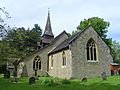
Grade I listed church, Tandridge, United Kingdom .JPG) | |||||
| Upload media | |||||
| Instance of | |||||
|---|---|---|---|---|---|
| Dedicated to | |||||
| Location | Tandridge, Surrey, South East England, England | ||||
| Diocese | |||||
| Has part(s) |
| ||||
| Heritage designation |
| ||||
| Inception |
| ||||
| Religion or worldview | |||||
 | |||||
Subcategories
This category has only the following subcategory.
S
Media in category "St Peter's, Tandridge"
The following 21 files are in this category, out of 21 total.
-
 St Peter's Church, Tandridge - geograph.org.uk - 4957719.jpg 3,264 × 2,448; 2.9 MB
-
 St Peter's Church, Tandridge Lane, Tandridge (NHLE Code 1189811) (June 2013) (1).JPG 2,500 × 1,800; 887 KB
-
 St Peter's Church, Tandridge Lane, Tandridge (NHLE Code 1189811) (June 2013) (2).JPG 2,400 × 1,800; 825 KB
-
 St Peter's Church, Tandridge Lane, Tandridge (NHLE Code 1189811) (June 2013) (3).JPG 2,500 × 1,900; 938 KB
-
 St Peter's Church, Tandridge Lane, Tandridge (NHLE Code 1189811) (June 2013) (4).JPG 2,400 × 1,800; 1.17 MB
-
 St Peter's Church, Tandridge Lane, Tandridge (NHLE Code 1189811) (June 2013) (5).JPG 2,200 × 1,800; 1.7 MB
-
 St Peter's Church, Tandridge Lane, Tandridge (NHLE Code 1189811) (June 2013) (6).JPG 2,400 × 1,800; 842 KB
-
 St Peter's Church, Tandridge Lane, Tandridge (NHLE Code 1189811) (June 2013) (7).jpg 2,400 × 1,600; 1.61 MB
-
 St Peter's Church, Tandridge Lane, Tandridge (NHLE Code 1189811) (June 2013) (8).JPG 2,592 × 1,944; 1.15 MB
-

-
 St Peter's Church, Tandridge Lane, Tandridge (NHLE Code 1189811) (June 2013) (Spire).JPG 1,500 × 2,500; 770 KB
-

-

-

-
 St Peter's Church, Tandridge Lane, Tandridge (NHLE Code 1189811).JPG 2,400 × 1,800; 848 KB
-
 St Peter's church, west end - geograph.org.uk - 2931191.jpg 480 × 640; 112 KB
-
 St Peter's, Tandridge - geograph.org.uk - 47421.jpg 640 × 480; 131 KB
-
 St Peter, Tandridge, eastern aspect - geograph.org.uk - 5242998.jpg 480 × 640; 73 KB
-
 St Peter, Tandridge, southern aspect - geograph.org.uk - 5243003.jpg 640 × 480; 81 KB
-
 St. Peter's Church, Tandridge - geograph.org.uk - 2205557.jpg 1,106 × 712; 452 KB
-


_(June_2013)_(1).JPG)
_(June_2013)_(2).JPG)
_(June_2013)_(3).JPG)
_(June_2013)_(4).JPG)
_(June_2013)_(5).JPG)
_(June_2013)_(6).JPG)
_(June_2013)_(7).jpg)
_(June_2013)_(8).JPG)
_(June_2013)_(Entrance_Porch).JPG)
_(June_2013)_(Spire).JPG)
_(June_2013)_(Window)_(1).JPG)
_(June_2013)_(Window)_(2).JPG)
_(June_2013)_(Window)_(3).JPG)


