Category:St Saviour Church, Richmond Hill, Leeds
| Object location | | View all coordinates using: OpenStreetMap |
|---|
Grade I listed church in Leeds, West Yorkshire, England, UK  | |||||
| Upload media | |||||
| Instance of | |||||
|---|---|---|---|---|---|
| Dedicated to | |||||
| Location | Leeds, West Yorkshire, Yorkshire and the Humber, England | ||||
| Architectural style | |||||
| Diocese | |||||
| Heritage designation |
| ||||
| Inception |
| ||||
| Religion or worldview | |||||
 | |||||
Subcategories
This category has the following 2 subcategories, out of 2 total.
Media in category "St Saviour Church, Richmond Hill, Leeds"
The following 54 files are in this category, out of 54 total.
-

-
 Aire near Rose Wharf - geograph.org.uk - 1310689.jpg 640 × 480; 93 KB
-
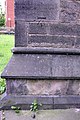 Benchmark on buttress of St Saviours Church - geograph.org.uk - 3765357.jpg 683 × 1,024; 249 KB
-
 Interior of St Saviour's church, Richmond Hill - geograph.org.uk - 6268057.jpg 1,024 × 768; 125 KB
-
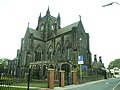 St Saviour , Ellerby Road, Leeds - geograph.org.uk - 1508682.jpg 640 × 480; 72 KB
-
 St Saviour Richmond Hill.jpg 2,039 × 1,614; 1.29 MB
-
 St Saviour, Leeds - Doorway - geograph.org.uk - 1107433.jpg 425 × 640; 90 KB
-
 St Saviour, Leeds - Doorway - geograph.org.uk - 1107434.jpg 425 × 640; 89 KB
-
 St Saviour , Ellerby Road, Leeds - geograph.org.uk - 4883775.jpg 2,048 × 1,135; 282 KB
-
 St Saviour , Ellerby Road, Leeds - geograph.org.uk - 4883777.jpg 2,048 × 1,137; 278 KB
-
 St Saviour , Ellerby Road, Leeds - geograph.org.uk - 4883781.jpg 2,048 × 1,135; 351 KB
-
 St Saviour , Ellerby Road, Leeds - geograph.org.uk - 4883784.jpg 2,048 × 1,137; 351 KB
-
 St Saviour , Ellerby Road, Leeds - geograph.org.uk - 4883788.jpg 2,048 × 1,136; 337 KB
-
 St Saviour , Ellerby Road, Leeds - geograph.org.uk - 4883810.jpg 2,048 × 1,137; 314 KB
-
 St Saviour , Ellerby Road, Leeds - geograph.org.uk - 4883811.jpg 2,048 × 1,137; 432 KB
-
 St Saviour , Ellerby Road, Leeds - geograph.org.uk - 4883812.jpg 2,048 × 1,137; 359 KB
-
 St Saviour , Ellerby Road, Leeds - geograph.org.uk - 4883814.jpg 2,048 × 1,135; 404 KB
-
 St Saviour , Ellerby Road, Leeds - geograph.org.uk - 4883816.jpg 2,048 × 1,141; 266 KB
-
 St Saviour , Ellerby Road, Leeds - geograph.org.uk - 4883819.jpg 2,048 × 1,137; 362 KB
-
 St Saviour , Ellerby Road, Leeds - geograph.org.uk - 4883822.jpg 2,048 × 1,139; 412 KB
-
 St Saviour , Ellerby Road, Leeds - geograph.org.uk - 4883824.jpg 2,048 × 1,135; 434 KB
-
 St Saviour , Ellerby Road, Leeds - geograph.org.uk - 4883827.jpg 2,048 × 1,139; 412 KB
-
 St Saviour , Ellerby Road, Leeds - geograph.org.uk - 4883831.jpg 2,048 × 1,135; 337 KB
-
 St Saviour , Ellerby Road, Leeds - geograph.org.uk - 4883834.jpg 2,048 × 1,135; 260 KB
-
 St Saviour , Ellerby Road, Leeds - geograph.org.uk - 4883841.jpg 1,865 × 2,048; 491 KB
-
 St Saviour , Ellerby Road, Leeds - geograph.org.uk - 4883843.jpg 2,048 × 1,138; 189 KB
-
 St Saviour , Ellerby Road, Leeds - geograph.org.uk - 4883852.jpg 2,048 × 1,138; 243 KB
-
 St Saviour , Ellerby Road, Leeds - geograph.org.uk - 4883855.jpg 2,048 × 1,180; 369 KB
-
 St Saviour , Ellerby Road, Leeds - geograph.org.uk - 4883857.jpg 2,048 × 1,112; 371 KB
-
 St Saviour , Ellerby Road, Leeds - geograph.org.uk - 4883859.jpg 2,048 × 1,111; 358 KB
-
 St Saviour 5 November 2016.jpg 3,183 × 1,996; 3.61 MB
-

-
 St Saviour Church, Richmond Hill, Leeds (26th October 2024) 001.jpg 6,000 × 4,000; 6.11 MB
-
 St Saviour Church, Richmond Hill, Leeds (26th October 2024) 002.jpg 6,000 × 4,000; 6.42 MB
-
 St Saviour Church, Richmond Hill, Leeds (26th October 2024) 003.jpg 6,000 × 4,000; 6.13 MB
-
 St Saviour Church, Richmond Hill, Leeds (26th October 2024) 004.jpg 6,000 × 4,000; 6.1 MB
-
 St Saviour Church, Richmond Hill, Leeds (26th October 2024) 005.jpg 4,000 × 6,000; 5.86 MB
-
 St Saviour Church, Richmond Hill, Leeds (26th October 2024) 006.jpg 4,000 × 6,000; 7.41 MB
-
 St Saviour Church, Richmond Hill, Leeds (26th October 2024) 007.jpg 6,000 × 4,000; 6.36 MB
-
 St Saviour Church, Richmond Hill, Leeds (26th October 2024) 008.jpg 6,000 × 4,000; 6.51 MB
-
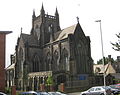
 St Saviour's Church - Ellerby Road - geograph.org.uk - 3484434.jpg 640 × 480; 80 KB
-
 St Saviour's Church - Ellerby Road - geograph.org.uk - 745547.jpg 640 × 410; 41 KB
-

-
 St Saviour, Ellerby Lane, Leeds 1 (3396187704).jpg 1,842 × 1,868; 2.17 MB
-
 St Saviour, Ellerby Road, Leeds 2 (3392417997).jpg 2,560 × 2,458; 4.9 MB
-
 St Saviour, Ellerby Road, Leeds 3 (3393225566).jpg 2,514 × 1,856; 3.83 MB
-
 St Saviour, Leeds (6136965977).jpg 2,485 × 3,727; 7.66 MB
-
 St Saviour, Leeds - geograph.org.uk - 1107450 (cropped).jpg 425 × 577; 66 KB
-
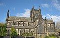
 St Saviour, Leeds - geograph.org.uk - 1107450.jpg 425 × 640; 70 KB
-
 St Saviour, Leeds - geograph.org.uk - 1107451 (cropped).jpg 363 × 363; 41 KB
-
 St Saviour, Leeds - geograph.org.uk - 1107451.jpg 425 × 640; 77 KB
-
 St Saviour, Richmond Hill (21814919310).jpg 3,056 × 2,423; 4.91 MB
-
 St Saviours Church, Ellerby Road - geograph.org.uk - 3765370.jpg 1,024 × 683; 156 KB
-
 West end of St Saviour's church, Richmond Hill - geograph.org.uk - 6268054.jpg 768 × 1,024; 174 KB
.jpg)


_001.jpg)
_002.jpg)
_003.jpg)
_004.jpg)
_005.jpg)
_006.jpg)
_007.jpg)
_008.jpg)


.jpg)
.jpg)
.jpg)
.jpg)
.jpg)

.jpg)

.jpg)

