Category:Stadelhof (Paderborn)
Deutsch: Areal Am Stadelhof 8/Badengasse/Giersmauer 13–15; ehemaliger Hof der Familie von Stapel; VHS Paderborn
| Object location | | View all coordinates using: OpenStreetMap |
|---|
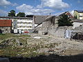
This is the category for an archaeological site.
It is on the list of cultural monuments of Paderborn, no. 59.
It is on the list of cultural monuments of Paderborn, no. 59.
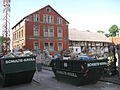
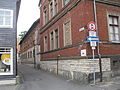
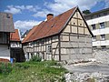
This is the category for an architectural monument.
It is on the list of cultural monuments of Paderborn, no. 88, 290, 352.
It is on the list of cultural monuments of Paderborn, no. 88, 290, 352.
Media in category "Stadelhof (Paderborn)"
The following 22 files are in this category, out of 22 total.
-
 Paderborn-Am Stadelhof 8-2.jpg 2,736 × 3,648; 2.57 MB
-
 Paderborn-Am Stadelhof 8-3.jpg 3,648 × 2,736; 2.98 MB
-
 Paderborn-Am Stadelhof 8-4.jpg 3,648 × 2,736; 3.35 MB
-
 Paderborn-Am Stadelhof 8-5.jpg 2,736 × 3,648; 2.94 MB
-
 Paderborn-Am Stadelhof 8.jpg 3,648 × 2,736; 2.32 MB
-
 Paderborn-Badengasse 2014 - 1.jpg 3,648 × 2,736; 1.98 MB
-
 Paderborn-Badengasse 2014 - 2.jpg 3,648 × 2,736; 2.69 MB
-
 Paderborn-Badengasse-2.jpg 3,648 × 2,736; 2.85 MB
-
 Paderborn-Badengasse-3.jpg 3,648 × 2,736; 2.4 MB
-
 Paderborn-Fensterspolie Stadelhof.jpg 3,648 × 2,736; 2.96 MB
-
 Paderborn-Giersmauer 13-15 (2014) - 2.jpg 3,648 × 2,736; 2.12 MB
-
 Paderborn-Giersmauer 13-15 (2014).jpg 2,988 × 2,292; 1.45 MB
-
 Paderborn-Giersmauer 13-15 - 2.jpg 3,648 × 2,736; 3.35 MB
-
 Paderborn-Giersmauer 13-15.jpg 3,276 × 2,080; 1.05 MB
-
 Paderborn-Giersmauer 13-Spolie-1.jpg 3,648 × 2,736; 3.43 MB
-
 Paderborn-Giersmauer 13-Spolie-2.jpg 2,736 × 3,648; 3.06 MB
-
 Paderborn-Stadelhof - 2.jpg 2,736 × 3,648; 2.11 MB
-
 Paderborn-Stadelhof - 3.jpg 3,648 × 2,736; 2.43 MB
-
 Paderborn-Stadelhof Fundamente eines Fachwerkhauses.jpg 3,648 × 2,736; 3.27 MB
-
 Paderborn-Stadelhof Informationstafel.jpg 3,648 × 2,736; 2.13 MB
-
 Paderborn-Stadelhof-Spolien.jpg 3,648 × 2,736; 2.98 MB
-
 Paderborn-Stadelhof.jpg 3,648 × 2,736; 2.17 MB


_-_2.jpg)
.jpg)


