Category:Stadhuis Vianen
| Object location | | View all coordinates using: OpenStreetMap |
|---|
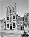
Nederlands: Afbeeldingen van het Stadhuis (of Raadhuis), Voorstraat 30, 4132 AS Vianen. Gelegen in het centrum van Vianen, Utrecht in de provincie Utrecht in het midden van Nederland
English: Pictures of the town hall, Voorstraat 30, 4132 AS Vianen. In Vianen in the province Utrecht in the middle of the Netherlands
|
This is a category about rijksmonument number 36311
|
 | |||||
| Upload media | |||||
| Instance of | |||||
|---|---|---|---|---|---|
| Location | Vianen, Vijfheerenlanden, Utrecht, Netherlands | ||||
| Street address |
| ||||
| Located on street |
| ||||
| Heritage designation |
| ||||
 | |||||
Subcategories
This category has the following 2 subcategories, out of 2 total.
I
- Interior of Stadhuis Vianen (3 F)
Media in category "Stadhuis Vianen"
The following 41 files are in this category, out of 41 total.
-
 Achtergevel in de Kerkstraat - Vianen - 20241786 - RCE.jpg 1,200 × 957; 221 KB
-
 Bovenlicht - Vianen - 20241778 - RCE.jpg 795 × 1,200; 230 KB
-
 Detail zijgevel - Vianen - 20241754 - RCE.jpg 954 × 1,200; 310 KB
-
 Exterieur - Vianen - 20241748 - RCE.jpg 885 × 1,200; 197 KB
-
 Exterieur - Vianen - 20241749 - RCE.jpg 888 × 1,200; 246 KB
-
 Exterieur OVERZICHT - Vianen - 20304611 - RCE.jpg 1,200 × 1,194; 275 KB
-
 Exterieur OVERZICHT - Vianen - 20308486 - RCE.jpg 1,195 × 1,200; 279 KB
-
 Exterieur OVERZICHT VOORGEVEL - Vianen - 20287022 - RCE.jpg 1,200 × 1,200; 264 KB
-
 Exterieur voormalige franse kerk - Vianen - 20241757 - RCE.jpg 1,200 × 953; 247 KB
-
 Gedeelte linkerzijgevel - Vianen - 20241787 - RCE.jpg 956 × 1,200; 228 KB
-
 Gedeelte van de noord zijgevel - Vianen - 20241756 - RCE.jpg 968 × 1,200; 291 KB
-
 Gedeelte voorgevel - Vianen - 20241777 - RCE.jpg 806 × 1,200; 228 KB
-
 Het stadhuis van Vianen Raad huis te Vianen (titel op object), RP-T-1888-A-1736.jpg 5,256 × 4,116; 2.21 MB
-
 Linkerzijgevel en achtergevel - Vianen - 20241784 - RCE.jpg 1,200 × 955; 242 KB
-
 Onderbouw voorgevel - Vianen - 20241753 - RCE.jpg 1,200 × 950; 257 KB
-
 Overzicht - Vianen - 20241780 - RCE.jpg 1,200 × 950; 215 KB
-
 Overzicht voorgevel en linker zijgevel - Vianen - 20241776 - RCE.jpg 894 × 1,200; 186 KB
-
 Raampartij - Vianen - 20241779 - RCE.jpg 807 × 1,200; 204 KB
-
 Rechterzij en achtergevel - Vianen - 20241785 - RCE.jpg 1,200 × 949; 267 KB
-
 Stadhuis van Vianen (provincie Utrecht).JPG 3,456 × 5,184; 7.64 MB
-
 Stadhuis Vianen DSCF8604.jpg 2,816 × 1,864; 2.43 MB
-
 Stadhuis Vianen DSCF8605.jpg 2,816 × 1,864; 2.72 MB
-
 Stadhuis Vianen DSCF8606.jpg 1,864 × 2,816; 2.46 MB
-
 Stadhuis Vianen DSCF8610.jpg 1,864 × 2,816; 2.61 MB
-
 Stadhuis Vianen DSCF8649.jpg 1,864 × 2,816; 2.62 MB
-
 Stadhuis Vianen DSCF8652.jpg 2,816 × 1,864; 2.45 MB
-
 Stadhuis Vianen DSCF8653.jpg 2,816 × 1,864; 2.71 MB
-
 Vianen - Voorstraat 30 - Stadhuis - Rijksmonument 36311.JPG 1,728 × 2,304; 1.21 MB
-
 Vianen 103.JPG 3,264 × 2,448; 1.94 MB
-
 Vianen RM Voorstraat 30 (1).jpg 2,460 × 4,007; 3.28 MB
-
 Vianen RM Voorstraat 30 (2).jpg 2,557 × 4,035; 3.39 MB
-
 Vianen stadhuis 2006.jpg 480 × 640; 261 KB
-
 Voorgevel - Vianen - 20241750 - RCE.jpg 961 × 1,200; 259 KB
-
 Voorgevel - Vianen - 20241751 - RCE.jpg 951 × 1,200; 253 KB
-
 Voorgevel - Vianen - 20241752 - RCE.jpg 955 × 1,200; 245 KB
-
 Voorgevel - Vianen - 20241781 - RCE.jpg 946 × 1,200; 269 KB
-
 Voorgevel - Vianen - 20241782 - RCE.jpg 954 × 1,200; 240 KB
-
 Voorgevel gemeentesecretarie - Vianen - 20241783 - RCE.jpg 952 × 1,200; 322 KB
-
 Voorgevel met ingangspartij - Vianen - 20241775 - RCE.jpg 1,200 × 954; 206 KB
-
 Voorstraat, Vianen DSCF8603.jpg 2,816 × 1,864; 2.53 MB
-
 Zijgevel naar het westen - Vianen - 20241755 - RCE.jpg 938 × 1,200; 281 KB


,_RP-T-1888-A-1736.jpg)


.JPG)


.jpg)
.jpg)


