Category:Stadskorenpakhuis, Schoonhoven
|
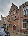
This is a category about rijksmonument number 33483
|
| Address |
|
| Object location | | View all coordinates using: OpenStreetMap |
|---|
 | |||||
| Upload media | |||||
| Instance of | |||||
|---|---|---|---|---|---|
| Location | Schoonhoven, Krimpenerwaard, South Holland, Netherlands | ||||
| Street address |
| ||||
| Located on street | |||||
| Heritage designation |
| ||||
 | |||||
Media in category "Stadskorenpakhuis, Schoonhoven"
The following 14 files are in this category, out of 14 total.
-
 Exterieur - Schoonhoven - 20198212 - RCE.jpg 894 × 1,200; 262 KB
-
 Exterieur - Schoonhoven - 20198213 - RCE.jpg 1,200 × 898; 295 KB
-
 Exterieur - Schoonhoven - 20198214 - RCE.jpg 885 × 1,200; 295 KB
-
 Ingang - Schoonhoven - 20198432 - RCE.jpg 877 × 1,200; 252 KB
-
 Overzicht gevelwand - Schoonhoven - 20319225 - RCE.jpg 756 × 1,200; 232 KB
-
 Overzicht voorgevel - Schoonhoven - 20368586 - RCE.jpg 926 × 1,200; 279 KB
-
 Ramen - Schoonhoven - 20198433 - RCE.jpg 869 × 1,200; 255 KB
-
 RM33483 Schoonhoven - Koestraat 72 (foto 1).jpg 1,944 × 2,592; 1.79 MB
-
 RM33483 Schoonhoven - Koestraat 72 (foto 2).jpg 2,592 × 1,944; 2.03 MB
-
 Stadskorenpakhuis Schoonhoven1.jpg 1,740 × 1,279; 342 KB
-
 Voorgevel - Schoonhoven - 20198431 - RCE.jpg 878 × 1,200; 202 KB
-

-

-


.jpg)
.jpg)


