Category:Stadtkirche Laufenburg
| Object location | | View all coordinates using: OpenStreetMap |
|---|
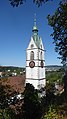
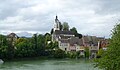
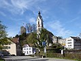
church building in Laufenburg in the canton of Aargau, Switzerland  | |||||
| Upload media | |||||
| Instance of | |||||
|---|---|---|---|---|---|
| Part of | |||||
| Named after | |||||
| Dedicated to | |||||
| Location | Laufenburg, Laufenburg District, Aargau, Switzerland | ||||
| Street address |
| ||||
| Heritage designation | |||||
 | |||||
Subcategories
This category has only the following subcategory.
I
Media in category "Stadtkirche Laufenburg"
The following 15 files are in this category, out of 15 total.
-
 2022-08-09 Stadtkirche Laufenburg (Aargau) 01.jpg 2,248 × 4,000; 3.76 MB
-
 2022-08-09 Stadtkirche Laufenburg (Aargau) 02.jpg 2,248 × 4,000; 3.9 MB
-
 Burg Laufenburg 1654.jpg 450 × 329; 50 KB
-
 Kirchturm Laufenbug.jpg 2,376 × 3,568; 5.21 MB
-
 Laufenburg aargau ansicht.jpg 2,048 × 1,536; 1.24 MB
-
 Laufenburg AG 2012-10-17 Mattes (26).JPG 3,648 × 2,736; 3.53 MB
-
 Laufenburg AG 2012-10-17 Mattes (34).JPG 1,944 × 2,592; 1.7 MB
-
 Laufenburg AG Blick auf Kirche und Burgruine.jpg 3,474 × 2,316; 4.89 MB
-
 Laufenburg AG Kirchturm.jpg 2,448 × 3,264; 2.72 MB
-
 Laufenburg CH - panoramio (1).jpg 7,221 × 4,060; 11.04 MB
-
 Laufenburg CH - panoramio.jpg 4,912 × 7,360; 8.15 MB
-
 Laufenburg Swiss side from Waldshut Landkreis 277.jpg 2,369 × 1,390; 1.78 MB
-
 Laufenburg-Pfarrkirche.jpg 1,333 × 2,051; 1.77 MB
-
 Ruine Laufeburg Uusguck.jpg 6,016 × 4,000; 6.3 MB
-
 Stadtkirche Laufenburg AG.jpg 1,510 × 1,126; 1.3 MB
_01.jpg)
_02.jpg)


.JPG)
.JPG)


.jpg)


