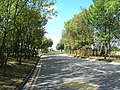
Category:Stainton, South Yorkshire
English: Stainton is a village and civil parish in the Metropolitan Borough of Doncaster in South Yorkshire, England. It has a population of 269.
Nederlands: Stainton is een dorp (village) en civil parish in het bestuurlijke gebied Doncaster, in het Engelse graafschap South Yorkshire. De civil parish telt
village and civil parish in Doncaster, South Yorkshire, UK  | |||||
| Upload media | |||||
| Instance of | |||||
|---|---|---|---|---|---|
| Location | Doncaster, South Yorkshire, Yorkshire and the Humber, England | ||||
| Population |
| ||||
 | |||||
Subcategories
This category has only the following subcategory.
S
Media in category "Stainton, South Yorkshire"
The following 99 files are in this category, out of 99 total.
-
 "The Three Tuns" public house in Stainton - geograph.org.uk - 5997658.jpg 5,003 × 3,453; 2.93 MB
-
 A Glimpse into Stainton Quarry - geograph.org.uk - 5424532.jpg 3,264 × 2,448; 3.53 MB
-
 A lane junction north of Stainton - geograph.org.uk - 5996733.jpg 5,183 × 3,887; 4.43 MB
-
 A private road to Holme Hall Quarry - geograph.org.uk - 3984643.jpg 1,600 × 1,064; 708 KB
-
 A view of Holme Hall Quarries at Stainton - geograph.org.uk - 5996677.jpg 5,184 × 3,888; 4.72 MB
-
 A631 near Carr House - geograph.org.uk - 2508563.jpg 640 × 480; 57 KB
-
 An unusual line of pylons - geograph.org.uk - 5988320.jpg 1,600 × 1,200; 240 KB
-
 Ant Wood - geograph.org.uk - 4675156.jpg 1,024 × 768; 176 KB
-
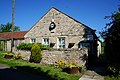
 Barn on School Lane, Stainton - geograph.org.uk - 3983522.jpg 1,600 × 1,064; 796 KB
-
 Barn on School Lane, Stainton - geograph.org.uk - 3983535.jpg 1,600 × 1,064; 767 KB
-
 Bridge over Ruddle Dike - geograph.org.uk - 3754416.jpg 1,600 × 1,200; 970 KB
-
 Bridge over Ruddle Dike - geograph.org.uk - 5424523.jpg 3,264 × 2,448; 2.81 MB
-
 Bridleway at Wilsic - geograph.org.uk - 4675129.jpg 1,024 × 768; 251 KB
-
 Bridleway leading to Lodge Farm - geograph.org.uk - 3981886.jpg 1,600 × 1,064; 670 KB
-
 Bridleway to Lodge Farm - geograph.org.uk - 238919.jpg 640 × 480; 79 KB
-
 Bridleway to Wilsic - geograph.org.uk - 4675147.jpg 1,024 × 768; 153 KB
-
 Buildings at Manor Farm, Stainton - geograph.org.uk - 3983539.jpg 1,600 × 1,064; 889 KB
-
 By Limekiln Lane looking towards Stainton - geograph.org.uk - 5996632.jpg 5,066 × 3,701; 3.98 MB
-
 Chapel Hole Lane (Byway) - geograph.org.uk - 5424537.jpg 3,264 × 2,448; 2.66 MB
-
 Church and Cross in Stainton - geograph.org.uk - 4780180.jpg 4,533 × 3,281; 3.46 MB
-
 Coal Mining Memorial Stone by Limekiln Lane - geograph.org.uk - 5996614.jpg 4,901 × 3,646; 4.3 MB
-
 Crop Field by Tickhill Back Lane - geograph.org.uk - 5448337.jpg 3,264 × 2,448; 4.1 MB
-
 Crop Fields near Wilsic Lodge Farm - geograph.org.uk - 5448346.jpg 3,264 × 2,448; 3.27 MB
-
 Denaby Wife Bridge - geograph.org.uk - 4780131.jpg 4,608 × 3,456; 3.5 MB
-
 Early morning on Cockhill Field Lane - geograph.org.uk - 821897.jpg 640 × 480; 54 KB
-
 Entrance to Holme Hall Quarry - geograph.org.uk - 3984611.jpg 1,600 × 1,064; 632 KB
-
 Farmland Adjoining Scotch Springs Lane - geograph.org.uk - 4780187.jpg 4,608 × 3,456; 3.61 MB
-
 Farmland of Hirst Lane - geograph.org.uk - 2553528.jpg 1,600 × 1,200; 335 KB
-
 Farmland off Cockhill Lane - geograph.org.uk - 2573678.jpg 1,600 × 1,200; 585 KB
-
 Farmland off Limekiln Lane - geograph.org.uk - 2553516.jpg 1,600 × 1,200; 373 KB
-
 Farmland off Limekiln Lane - geograph.org.uk - 2553519.jpg 1,600 × 1,200; 378 KB
-
 Farmland off Tickhill Back Lane - geograph.org.uk - 2553549.jpg 1,600 × 1,200; 511 KB
-
 Farmland, Lodge Farm - geograph.org.uk - 2553541.jpg 1,600 × 1,200; 300 KB
-
 Fields at Wilsic - geograph.org.uk - 2719549.jpg 640 × 426; 62 KB
-
 Footpath towards Fish Pond Lane - geograph.org.uk - 3754420.jpg 1,600 × 1,200; 574 KB
-
 Gas network sub-station (Stainton Loc. 318) - geograph.org.uk - 5996726.jpg 4,961 × 3,459; 3.37 MB
-
 Gate off Cockhill Field Lane - geograph.org.uk - 821903.jpg 640 × 383; 70 KB
-
 Gate that doesn't open off Stainton Lane - geograph.org.uk - 821906.jpg 640 × 480; 120 KB
-
 Glen Quarry - geograph.org.uk - 3984593.jpg 1,600 × 1,064; 781 KB
-
 Grazing land, Wilsic - geograph.org.uk - 2553630.jpg 1,600 × 1,200; 303 KB
-
 Hirst Lane towards Edlington - geograph.org.uk - 2553530.jpg 1,600 × 1,200; 304 KB
-
 Hirst Lane towards Edlington - geograph.org.uk - 2553535.jpg 1,600 × 1,200; 325 KB
-
 Junction of Limekiln Lane with the A631 - geograph.org.uk - 2553515.jpg 1,600 × 1,200; 293 KB
-
 Lambcote Grange and Surrounding Crop Fields - geograph.org.uk - 5420799.jpg 3,264 × 2,448; 3.18 MB
-
 Large Stone Cross at St Winifred's, Stainton - geograph.org.uk - 3983527.jpg 1,600 × 1,064; 702 KB
-
 Limekiln Lane - geograph.org.uk - 4714278.jpg 800 × 533; 106 KB
-
 Limekiln Lane towards Stainton - geograph.org.uk - 2553520.jpg 1,600 × 1,200; 404 KB
-
 Limekiln Lane, Stainton - geograph.org.uk - 2301732.jpg 800 × 600; 300 KB
-
 Limestone quarry. - geograph.org.uk - 6744348.jpg 1,024 × 641; 179 KB
-
 Lodge Farm - geograph.org.uk - 4675160.jpg 1,024 × 768; 173 KB
-
 Lodge Farm Cottages - geograph.org.uk - 4675165.jpg 1,024 × 768; 166 KB
-
 Lodge Farm, Wilsic - geograph.org.uk - 4112007.jpg 2,475 × 1,768; 1.31 MB
-
 Maltby signal box - geograph.org.uk - 4710526.jpg 800 × 533; 92 KB
-
 Marshalls Maltby Works on Hirst Lane - geograph.org.uk - 3981906.jpg 1,600 × 1,064; 835 KB
-
 Milestone, Wilsic.jpg 4,608 × 3,456; 3.69 MB
-
 Minor road towards Old Edlington - geograph.org.uk - 2573681.jpg 1,600 × 1,200; 695 KB
-
 Old Scotch Spring Lane, Stainton - geograph.org.uk - 3984622.jpg 1,600 × 1,064; 813 KB
-
 On Cock Hill Lane - geograph.org.uk - 5996742.jpg 5,184 × 3,888; 4.92 MB
-
 Ordnance Survey Cut Mark - geograph.org.uk - 4964797.jpg 640 × 480; 107 KB
-
 Potato field - geograph.org.uk - 4675140.jpg 1,024 × 768; 192 KB
-
 Pylons and the A631 Road - geograph.org.uk - 4780190.jpg 4,608 × 3,456; 3.83 MB
-
 Quarry off Hirst Lane - geograph.org.uk - 2553534.jpg 1,600 × 1,200; 359 KB
-
 Rail bridge serving Maltby colliery - geograph.org.uk - 660212.jpg 640 × 480; 124 KB
-
 Railway bridge over Limekiln Lane - geograph.org.uk - 2553526.jpg 1,600 × 1,200; 496 KB
-
 Road to quarry - geograph.org.uk - 2573638.jpg 1,600 × 1,200; 803 KB
-
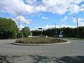 Roundabout on Stainton Lane - geograph.org.uk - 2573640.jpg 1,600 × 1,200; 498 KB
-
 Roundabout west of Stainton - geograph.org.uk - 5996656.jpg 5,047 × 3,675; 4.97 MB
-
 Ruddle Dike, Stainton - geograph.org.uk - 3983518.jpg 1,600 × 1,064; 857 KB
-
 School Lane, Stainton - geograph.org.uk - 3983540.jpg 1,600 × 1,064; 535 KB
-
 Scotch Spring Lane towards Stainton - geograph.org.uk - 2301723.jpg 800 × 600; 173 KB
-
 Scotch Springs Lane at Stainton - geograph.org.uk - 4780185.jpg 4,608 × 3,456; 3.52 MB
-
 St Winifred's Church at Stainton - geograph.org.uk - 4179025.jpg 640 × 374; 55 KB
-
 St Winifred's Church, Stainton - geograph.org.uk - 2553527.jpg 1,600 × 1,200; 406 KB
-
 St Winifred's Church, Stainton - geograph.org.uk - 3983531.jpg 1,600 × 1,064; 691 KB
-
 St Winifred's Church, Stainton - geograph.org.uk - 3983533.jpg 1,600 × 1,064; 574 KB
-
 St Winifrid's Church, Stainton - geograph.org.uk - 5996649.jpg 4,990 × 3,652; 3.63 MB
-
 Stainton church from Lime Kiln Lane - geograph.org.uk - 637017.jpg 640 × 345; 73 KB
-
 Stainton Hall.jpg 5,068 × 3,608; 3.84 MB
-
 Stainton Lane - geograph.org.uk - 5448336.jpg 3,264 × 2,448; 3.92 MB
-
 Stainton Lane heading north - geograph.org.uk - 2553543.jpg 1,600 × 1,200; 450 KB
-
 Stainton Lane towards Grange Lane - geograph.org.uk - 3984637.jpg 1,600 × 1,064; 673 KB
-
 Stainton Lane towards Grange Lane - geograph.org.uk - 3984648.jpg 1,600 × 1,064; 608 KB
-
 Sunset view near Maltby - geograph.org.uk - 1731359.jpg 1,280 × 959; 263 KB
-
 The old Ruddle Mill Austwood Lane - geograph.org.uk - 3224089.jpg 640 × 427; 113 KB
-
 The Three Tuns in Stainton - geograph.org.uk - 4780183.jpg 4,608 × 3,456; 3.71 MB
-
 The Three Tuns, Stainton - geograph.org.uk - 3984623.jpg 1,600 × 1,064; 855 KB
-
 The Three Tuns, Stainton - geograph.org.uk - 3984625.jpg 1,600 × 1,064; 737 KB
-
 The Three Tuns, Stainton - geograph.org.uk - 3984628.jpg 1,185 × 1,600; 538 KB
-
 The Village Hall, Stainton - geograph.org.uk - 3983523.jpg 1,600 × 1,064; 657 KB
-
 The Village of Stainton - geograph.org.uk - 3983516.jpg 1,600 × 1,064; 568 KB
-
 Tickhill Back Lane - geograph.org.uk - 2553550.jpg 1,600 × 1,200; 414 KB
-
 Tickhill Back Lane towards Tickhill - geograph.org.uk - 2301741.jpg 800 × 600; 267 KB
-
 Tickhill Back Lane towards Tickhill - geograph.org.uk - 2301749.jpg 800 × 600; 284 KB
-
 Willow Garth - geograph.org.uk - 4675187.jpg 1,024 × 768; 195 KB
-
 Wilsic - geograph.org.uk - 5137189.jpg 4,608 × 3,456; 3.92 MB
-
 Wilsic Home Farm - geograph.org.uk - 862636.jpg 640 × 480; 89 KB
-
 Wilsic Lane - geograph.org.uk - 2553632.jpg 1,600 × 1,200; 397 KB
-
 Path to Sandbeck - geograph.org.uk - 297224.jpg 640 × 480; 129 KB
-
 Stainton Woodhouse - geograph.org.uk - 84032.jpg 640 × 427; 53 KB


_-_geograph.org.uk_-_5424537.jpg)


_-_geograph.org.uk_-_5996726.jpg)


