Category:Stanley and Stanley Common
civil parish in Erewash district, Derbyshire, England | |||||
| Upload media | |||||
| Instance of | |||||
|---|---|---|---|---|---|
| Location | Erewash, Derbyshire, East Midlands, England | ||||
 | |||||
Subcategories
This category has the following 2 subcategories, out of 2 total.
S
- Stanley Common (10 F)
Media in category "Stanley and Stanley Common"
The following 74 files are in this category, out of 74 total.
-
 68 Station Road, Stanley - geograph.org.uk - 5475484.jpg 1,280 × 898; 283 KB
-
 A plethora of waymarks, Morley Lane - geograph.org.uk - 5474799.jpg 1,280 × 960; 299 KB
-

-
 Accommodation bridge, Stanley - geograph.org.uk - 5474827.jpg 1,280 × 960; 422 KB
-
 Allotment and concrete hut - geograph.org.uk - 5474784.jpg 1,280 × 960; 455 KB
-
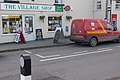
 At Stanley village post office - geograph.org.uk - 5475491.jpg 899 × 1,280; 296 KB
-
 Barbed wired gate with signs - geograph.org.uk - 3249375.jpg 3,648 × 2,736; 4.79 MB
-
 Belper Road, Smalley Common - geograph.org.uk - 6199869.jpg 800 × 600; 118 KB
-
 Bench mark, 68 Station Road, Stanley - geograph.org.uk - 5475490.jpg 1,280 × 1,280; 570 KB
-
 Bench mark, Home Farm, Stanley - geograph.org.uk - 5474769.jpg 1,280 × 1,280; 661 KB
-
 Bench mark, Stanley Farm - geograph.org.uk - 5474831.jpg 1,280 × 1,280; 679 KB
-
 Black Cat Garage, Stanley - geograph.org.uk - 5475478.jpg 1,280 × 877; 256 KB
-
 Bridge Cottage, Stanley - geograph.org.uk - 6197877.jpg 800 × 600; 122 KB
-
 Bus stop on Derby Road, Stanley Common - geograph.org.uk - 6197885.jpg 640 × 480; 109 KB
-
 Common Lane Bridge - geograph.org.uk - 5499191.jpg 1,280 × 960; 696 KB
-
 Common Lane, Stanley Common - geograph.org.uk - 6199876.jpg 800 × 600; 157 KB
-
 Commoners Lott - geograph.org.uk - 3250632.jpg 3,648 × 2,736; 4.75 MB
-
 Coronation Road, Stanley - geograph.org.uk - 5475475.jpg 1,280 × 960; 286 KB
-
 Cottage being repaired - geograph.org.uk - 3250607.jpg 3,648 × 2,736; 4.94 MB
-
 Crop field off Station Road, Stanley - geograph.org.uk - 6197559.jpg 800 × 600; 134 KB
-
 Decorate early to avoid disappointment - geograph.org.uk - 3250626.jpg 3,648 × 2,736; 4.46 MB
-

-
 Derbyshire UK parish map highlighting Stanley and Stanley Common.svg 888 × 1,308; 2.34 MB
-
 Farm land view - geograph.org.uk - 5752325.jpg 2,000 × 1,333; 2.51 MB
-
 Field footpath near Stanley - geograph.org.uk - 5474824.jpg 1,280 × 960; 371 KB
-
 Field near Home Farm - geograph.org.uk - 5474778.jpg 1,280 × 960; 254 KB
-
 Fields round Hayes Park Farm - geograph.org.uk - 3250612.jpg 3,648 × 2,736; 5.08 MB
-
 Footbridge over Stanley Brook - geograph.org.uk - 5499204.jpg 1,280 × 960; 685 KB
-
 Ford on Stanley Brook - geograph.org.uk - 5603321.jpg 4,032 × 3,024; 6.78 MB
-
 Ford, over Stanley Brook - geograph.org.uk - 582038.jpg 640 × 480; 150 KB
-
 Former railway building - geograph.org.uk - 3250014.jpg 3,648 × 2,736; 4.69 MB
-
 Former Stanley Colliery baths and canteen - geograph.org.uk - 5477257.jpg 1,280 × 886; 294 KB
-
-

-
 Grazing off Station Road, Stanley - geograph.org.uk - 6197864.jpg 800 × 562; 137 KB
-
 Greenery to the North of Locko Hall - geograph.org.uk - 3490400.jpg 4,000 × 3,000; 2.95 MB
-
 Herd of Cows on Morley Lane in Stanley - geograph.org.uk - 3490819.jpg 4,000 × 3,000; 2.64 MB
-
 Home Farm - geograph.org.uk - 3250334.jpg 3,648 × 2,736; 4.95 MB
-
 Home Farm - geograph.org.uk - 3250460.jpg 3,648 × 2,736; 5.3 MB
-
 Home Farm, Derby Road, Stanley - geograph.org.uk - 5474771.jpg 1,280 × 960; 325 KB
-
 House on Station Road, Stanley - geograph.org.uk - 6197572.jpg 800 × 600; 89 KB
-
 Houses on Belper Road - geograph.org.uk - 6199880.jpg 800 × 576; 107 KB
-

-
 Houses on Derby Road, Stanley Common - geograph.org.uk - 6197883.jpg 800 × 553; 82 KB
-
 Houses on Station Road, Stanley - geograph.org.uk - 6197873.jpg 800 × 499; 108 KB
-
 Looking west from Station Road bridge, Stanley - geograph.org.uk - 5477254.jpg 1,280 × 960; 308 KB
-
 Making hay near Stanley Common - geograph.org.uk - 5456820.jpg 1,280 × 960; 504 KB
-
 Manor Farm - geograph.org.uk - 5752319.jpg 2,000 × 1,333; 1.76 MB
-
 More than meets the eye - geograph.org.uk - 5475480.jpg 1,280 × 960; 380 KB
-
 Near Hill Farm, Stanley - geograph.org.uk - 5474767.jpg 1,280 × 960; 260 KB
-
 On Common Lane - geograph.org.uk - 3250618.jpg 2,736 × 3,648; 4.94 MB
-
 Pedestrians go left - geograph.org.uk - 5474825.jpg 1,280 × 960; 347 KB
-
 Prefabricated houses at Stanley Common - geograph.org.uk - 5456831.jpg 1,280 × 882; 291 KB
-
 Recreation Ground, Stanley Common - geograph.org.uk - 5456844.jpg 1,280 × 871; 276 KB
-
 Sign on Bridge Cottage, Stanley - geograph.org.uk - 6197881.jpg 618 × 800; 122 KB
-
 Site of railway bridge, Stanley - geograph.org.uk - 5474779.jpg 1,280 × 843; 295 KB
-
 Stanley and Stanley Common war memorial - geograph.org.uk - 5475451.jpg 960 × 1,280; 493 KB
-
 Stanley Brook Ford, Morley Lane - geograph.org.uk - 5474816.jpg 960 × 1,280; 437 KB
-
 Stanley Colliery offices - geograph.org.uk - 2672479.jpg 1,280 × 853; 291 KB
-
 Stanley Common - geograph.org.uk - 5752328.jpg 2,000 × 1,333; 2 MB
-
 Stanley Farm, Morley Lane - geograph.org.uk - 5474836.jpg 1,280 × 960; 245 KB
-
 Stanley Post Office - geograph.org.uk - 1049440.jpg 640 × 428; 88 KB
-
 Stanley village sign - geograph.org.uk - 5475476.jpg 960 × 1,280; 452 KB
-
 Station Road, Stanley - geograph.org.uk - 6197867.jpg 800 × 600; 102 KB
-
 The Crescent, with Silver Birch tree - geograph.org.uk - 3250621.jpg 3,648 × 2,736; 4.81 MB
-
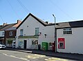 The Stanley Shop ^ Post Office - geograph.org.uk - 6197589.jpg 800 × 584; 77 KB
-
 The White Hart - geograph.org.uk - 5752324.jpg 2,000 × 1,333; 2.34 MB
-
 The White Hart, Stanley - geograph.org.uk - 6197876.jpg 640 × 386; 60 KB
-
 The White Post - geograph.org.uk - 3250635.jpg 3,648 × 2,736; 3.91 MB
-
 Trees framing the landscape - geograph.org.uk - 722573.jpg 640 × 414; 120 KB
-

-
 Village shop and cafe, Stanley - geograph.org.uk - 5475482.jpg 1,280 × 909; 301 KB
-
 War Memorial, Stanley - geograph.org.uk - 6197870.jpg 800 × 600; 100 KB
-
 Wesleyan Chapel - geograph.org.uk - 3250589.jpg 3,648 × 2,736; 4.36 MB


