Category:Stapleford, Hertfordshire
village and civil parish in Hertfordshire, UK  | |||||
| Upload media | |||||
| Instance of | |||||
|---|---|---|---|---|---|
| Location | East Hertfordshire, Hertfordshire, East of England, England | ||||
 | |||||
Subcategories
This category has the following 4 subcategories, out of 4 total.
S
- Stapleford railway station (2 F)
W
- Woodhall Arms, Stapleford (2 F)
Media in category "Stapleford, Hertfordshire"
The following 83 files are in this category, out of 83 total.
-
 A119 towards Stevenage - geograph.org.uk - 6225088.jpg 800 × 600; 83 KB
-
 A119 towards Stevenage - geograph.org.uk - 6225089.jpg 800 × 600; 83 KB
-
 Barley Croft, Waterford - geograph.org.uk - 3209517.jpg 2,048 × 1,536; 1.5 MB
-
 Bend on Church Lane, Stapleford - geograph.org.uk - 4669354.jpg 2,560 × 1,920; 2.16 MB
-
 Bend on Gobions Lane, Stapleford - geograph.org.uk - 4665372.jpg 2,560 × 1,920; 2.14 MB
-
 Bluebells in Row Wood - geograph.org.uk - 10392.jpg 480 × 640; 181 KB
-
 Bullsmill Lane - geograph.org.uk - 4664945.jpg 2,560 × 1,920; 1.58 MB
-
 Bullsmill Lane at the junction of High Road, Waterford - geograph.org.uk - 4540645.jpg 2,560 × 1,920; 1.99 MB
-
 Bullsmill Lane, Waterford - geograph.org.uk - 4670726.jpg 2,560 × 1,920; 2.01 MB
-
 Bullsmill Railway Bridge - geograph.org.uk - 134529.jpg 640 × 480; 119 KB
-
 Church Lane, Stapleford - geograph.org.uk - 4665440.jpg 2,560 × 1,920; 2.02 MB
-
 Church Lane, Stapleford - geograph.org.uk - 4669350.jpg 2,560 × 1,920; 2.04 MB
-
 Conservation Walks Marker - geograph.org.uk - 228969.jpg 471 × 640; 179 KB
-
 Cottage on Stony Hills - geograph.org.uk - 4665458.jpg 2,560 × 1,920; 2.03 MB
-
 Cottages on High Road, Stapleford - geograph.org.uk - 6225094.jpg 800 × 600; 121 KB
-
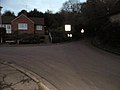
 Entering Stapleford - geograph.org.uk - 6225092.jpg 800 × 553; 114 KB
-
 Fallen tree next to River Bean, between Waterford and Stapleford 2020-08-26.jpg 3,024 × 4,032; 7.96 MB
-
 Farmland, Stapleford - geograph.org.uk - 6225087.jpg 640 × 480; 61 KB
-
 Field by Gobions Lane, Stapleford - geograph.org.uk - 4665402.jpg 2,560 × 1,920; 1.37 MB
-
 Field entrance by Gobions Road, Stapleford - geograph.org.uk - 4665407.jpg 2,560 × 1,920; 1.31 MB
-
 Fields by Bramfield Lane, Waterford - geograph.org.uk - 3209061.jpg 2,048 × 1,536; 1.47 MB
-
 Former pub, Waterford - geograph.org.uk - 4414932.jpg 4,320 × 3,240; 5.55 MB
-
 Gobions Lane, Bramfield - geograph.org.uk - 4669330.jpg 2,560 × 1,920; 1.03 MB
-
 Gobions Lane, Bramfield - geograph.org.uk - 4669335.jpg 2,560 × 1,920; 1.26 MB
-
 Gobions Lane, Stapleford - geograph.org.uk - 4665393.jpg 2,560 × 1,920; 1.34 MB
-
 GOC Watton-at-Stone to Stapleford 013 Stapleford Village Hall, Stapleford (32458431465).jpg 3,923 × 2,944; 3.26 MB
-
 Goldings Lane at the junction of Waterford High Street - geograph.org.uk - 4541173.jpg 2,440 × 1,748; 1.24 MB
-
 Great Gobions Farm - geograph.org.uk - 228964.jpg 640 × 480; 130 KB
-
 Great Gobions Farmhouse - geograph.org.uk - 4415030.jpg 4,320 × 3,240; 7.1 MB
-
 High Road at the junction of Gobions Lane, Stapleford - geograph.org.uk - 4664006.jpg 2,560 × 1,920; 1.51 MB
-
 High Road Stapleford - geograph.org.uk - 2836604.jpg 1,600 × 1,200; 569 KB
-
 High Road Waterford at the junction of Vicarage Lane - geograph.org.uk - 4670801.jpg 2,422 × 1,720; 1.14 MB
-
 High Road, near Waterford Hall Farm - geograph.org.uk - 6225086.jpg 800 × 600; 101 KB
-
 High Road, Stapleford - geograph.org.uk - 6225095.jpg 800 × 600; 114 KB
-
 Horsman Joinery - geograph.org.uk - 147130.jpg 640 × 480; 94 KB
-
 House on Bullsmill Lane - geograph.org.uk - 4664946.jpg 2,560 × 1,920; 1.38 MB
-
 House on Church Lane, Stapleford - geograph.org.uk - 4665419.jpg 2,560 × 1,920; 1.49 MB
-
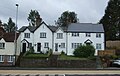
 Houses on High Road Stapleford - geograph.org.uk - 2836607.jpg 1,600 × 1,200; 566 KB
-
 Houses on High Road, Stapleford - geograph.org.uk - 6225096.jpg 800 × 510; 97 KB
-
 Houses on High Road, Waterford - geograph.org.uk - 6225084.jpg 640 × 408; 60 KB
-
 Houses on Vicarage Lane, Waterford - geograph.org.uk - 6225082.jpg 800 × 600; 103 KB
-
 Narrow road off Bullsmill Lane - geograph.org.uk - 3209487.jpg 2,048 × 1,536; 1.88 MB
-
 Path at the edge of Upper Stonyhills Wood - geograph.org.uk - 3986982.jpg 4,320 × 3,240; 5.2 MB
-
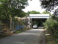
 Railway bridge at Stapleford - geograph.org.uk - 4414982.jpg 4,320 × 3,240; 4.82 MB
-
 Railway bridge over Bullsmill Lane - geograph.org.uk - 1221044.jpg 640 × 480; 93 KB
-
 Railway bridge over Bullsmill Lane - geograph.org.uk - 3479220.jpg 4,320 × 3,240; 3.45 MB
-
 Railway bridge over Gobions Lane - geograph.org.uk - 4414997.jpg 4,320 × 3,240; 6.57 MB
-
 Railway Bridge over Gobions Lane - geograph.org.uk - 4664005.jpg 1,568 × 2,340; 925 KB
-
 Railway bridge over the A119, Stapelford - geograph.org.uk - 6225093.jpg 800 × 600; 121 KB
-
 Railway towards London - geograph.org.uk - 6225081.jpg 800 × 600; 169 KB
-
 River Beane - geograph.org.uk - 4627350.jpg 480 × 640; 182 KB
-
 River Beane, Waterford Marsh - geograph.org.uk - 3339544.jpg 2,048 × 1,536; 807 KB
-
 Sacombe Road, Bullsmill - geograph.org.uk - 4674627.jpg 2,560 × 1,920; 981 KB
-
 Seventeenth century cottages in Waterford - geograph.org.uk - 4414802.jpg 4,320 × 3,240; 4.1 MB
-
 Sharp turn near Row Wood - geograph.org.uk - 4415059.jpg 4,320 × 3,240; 2.89 MB
-
 St Mary the Virgin, Stapleford - geograph.org.uk - 4287570.jpg 4,280 × 3,186; 4.37 MB
-
 St Michael and All Angels, Waterford - geograph.org.uk - 4287406.jpg 4,320 × 3,240; 3.56 MB
-
 St Michael and All Angels, Waterford - geograph.org.uk - 4287412.jpg 4,320 × 3,240; 3.7 MB
-
 Stapleford church - geograph.org.uk - 4627335.jpg 640 × 428; 117 KB
-
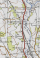 Stapleford Map.PNG 345 × 503; 418 KB
-
 Stapleford Primary School, Stapleford (29556775503).jpg 3,992 × 2,995; 3.79 MB
-
 Stapleford Primary School, Stapleford (29890060840).jpg 4,206 × 2,636; 3.91 MB
-
 Stapleford Railway Bridge - geograph.org.uk - 147135.jpg 640 × 480; 109 KB
-
 Stapleford, Church Lane - geograph.org.uk - 1525858.jpg 640 × 480; 126 KB
-

-
 Stubble field, Stapleford - geograph.org.uk - 6225090.jpg 800 × 559; 106 KB
-
 The A119 towards Stevenage - geograph.org.uk - 6225097.jpg 800 × 600; 76 KB
-
 The entrance to Great Farm on Gobions Lane - geograph.org.uk - 4665380.jpg 2,500 × 1,838; 1.78 MB
-
 The entrance to St Mary's Church, Stapleford - geograph.org.uk - 4665429.jpg 2,560 × 1,920; 1.89 MB
-
 The former Waterford Arms pub - geograph.org.uk - 4414915.jpg 4,320 × 3,240; 3.74 MB
-
 The Verney, Waterford - geograph.org.uk - 4414943.jpg 4,320 × 3,240; 5.6 MB
-
 Track from Gobions Farm towards Watton at Stone - geograph.org.uk - 4415046.jpg 4,320 × 3,240; 5.97 MB
-
 Track off Gobions Lane - geograph.org.uk - 4415002.jpg 4,320 × 3,240; 4.97 MB
-
 Trailers at Valentine Cottage - geograph.org.uk - 228988.jpg 480 × 640; 111 KB
-
 Valentine Cottage - geograph.org.uk - 228985.jpg 640 × 480; 112 KB
-
 Valentines Cottage on Gobions Lane - geograph.org.uk - 4415021.jpg 4,240 × 3,132; 4.47 MB
-
 Vicarage Lane at the junction of High Road, Waterford - geograph.org.uk - 3209054.jpg 2,048 × 1,536; 1.22 MB
-
 Vicarage Lane on the corner of Barley Croft, Waterford - geograph.org.uk - 3209527.jpg 2,048 × 1,536; 2.44 MB
-
 View by Church Lane, Stapleford - geograph.org.uk - 4669346.jpg 2,560 × 1,920; 2.15 MB
-
 View towards the railway line from Sacombe Road - geograph.org.uk - 3339549.jpg 2,048 × 1,536; 652 KB
-
 Warrenwood Industrial Estate - geograph.org.uk - 4414967.jpg 4,320 × 3,240; 3.5 MB
-
 Waterford Hall Farm - geograph.org.uk - 4287559.jpg 4,320 × 3,240; 4.93 MB
-
 Work in progress^ - geograph.org.uk - 228995.jpg 640 × 480; 143 KB


.jpg)


.jpg)
.jpg)


