Category:Steeg 4 (Norg)
| Object location | | View all coordinates using: OpenStreetMap |
|---|
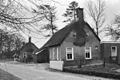
farmhouse in Noordenveld, Netherlands  | |||||
| Upload media | |||||
| Instance of | |||||
|---|---|---|---|---|---|
| Location | Norg, Drenthe, Netherlands | ||||
| Located on street |
| ||||
| Heritage designation |
| ||||
 | |||||
|
This is a category about rijksmonument number 30796
|
| Address |
|
Media in category "Steeg 4 (Norg)"
The following 3 files are in this category, out of 3 total.
-
 Aanzicht - Norg - 20170116 - RCE.jpg 1,200 × 804; 281 KB
-
 Overzicht - Norg - 20170115 - RCE.jpg 1,200 × 807; 285 KB
-
 Steeg.4.Norg.jpg 3,648 × 2,736; 1.66 MB

