Category:Steenweg 44, Utrecht
| Object location | | View all coordinates using: OpenStreetMap |
|---|
 | |||||
| Upload media | |||||
| Instance of | |||||
|---|---|---|---|---|---|
| Location | Utrecht, Netherlands | ||||
| Heritage designation |
| ||||
 | |||||
|
This is a category about rijksmonument number 514223
|
| Address |
|
Media in category "Steenweg 44, Utrecht"
The following 3 files are in this category, out of 3 total.
-
 Exterieur VOORGEVEL - Utrecht - 20306003 - RCE.jpg 948 × 1,200; 237 KB
-
 Lange Elisabethstraat Mariaplaats, 3511 Utrecht, Netherlands - panoramio (21).jpg 2,048 × 1,155; 511 KB
-
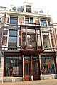 Steenweg 44.JPG 3,456 × 5,184; 7.4 MB

.jpg)